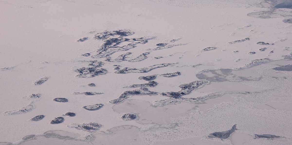
Kvarken Archipelago (UNESCO World Heritage)
Archipiélago de Kvarken
Ostrobothnia (Vaasa / Mustasaari / Korsnäs) · Finland
Photo: kallerna · CC BY-SA 4.0 · Wikimedia Commons
The world's premier natural laboratory for post-glacial isostatic rebound (transboundary UNESCO World Heritage site with Sweden's High Coast), where land rises from the Baltic Sea at 1 cm annually.
In Kvarken, the sea is turning into solid land before your very eyes. Glacial moraine ridges deposited during the Ice Age continue to emerge relentlessly from the shallow Baltic waters: undersea floor becomes dry ground, and stony shores evolve into dense boreal forest. Continental ice sheets retreated roughly 9,600 years ago, and the crust, depressed under miles of ice, rebounded at world-record speed in a process known as post-glacial isostatic rebound that continues unabated today. The archipelago off the Ostrobothnian coast constitutes Finland's first UNESCO World Natural Heritage site.
What makes it unique
Here the land rises nearly ten millimetres per year, and in some 2,000 years the seabed will emerge completely, dividing the Gulf of Bothnia into two.
The place
Nature
The landscape
The most striking figure to grasp is this: Kvarken has risen 285 m since the ice sheets vanished, representing one of the highest land uplift rates on Earth. What you see is an exceptionally shallow maritime landscape: while mainland shores are separated by 80 km across the Gulf of Bothnia, only 25 km separate the outermost Swedish and Finnish islands, and average water depths hover around just 25 m. On the Finnish side lies an intricate archipelago featuring large inhabited islands like Replot and Björkö alongside more than 5,600 smaller islets.
This continuous uplift leaves a distinctive geological signature: washboard-like De Geer moraine ridges, running in parallel swarms perpendicular to glacial ice flow. It also creates protected shallow bays: progressive land uplift isolates brackish inlets from the open sea, evolving through stages known locally as flads and gloes, providing sheltered nursery grounds shielded from Baltic wave energy. Coastal change is relentless as shallow bays gradually fuse with mainland shores.
The Finnish component of the World Heritage site spans 1944 km², of which 293 km² are land. Under national management figures, the protected Kvarken property encompasses 194,400 ha, with 85% comprising marine waters.
Wildlife and seasons
Kvarken is paradise for birdwatchers looking skyward. Svedjehamn consistently ranks among Finland's top ten birding venues in BirdLife Finland's annual 'Battle of the Towers' competition (Tornien taisto). During the first days of May, observers have recorded up to a hundred bird species in a single day from the Saltkaret observation tower. Avian numbers and species diversity peak between April and June during spring migration and breeding, with rough-legged buzzard passage peaking in mid-April directly west of the tower.
More than a hundred bird species nest within the archipelago. Exceptional breeders include the gadwall, the white-tailed eagle, and the threatened white-backed woodpecker. Abundant waterfowl include tufted duck, red-breasted merganser, great crested grebe, and mallard. Notable rarities recorded include yellow-billed diver, great bittern, white stork, and Eurasian golden oriole.
In early winter, when offshore leads remain ice-free, the rocky coast north-east of Svedjehamn offers rewarding birding in December. Throughout the rest of winter, from January to March, deep quiet blankets the archipelago as the surrounding sea freezes solid.
Species
With a page in the atlas
Being mentioned in a source doesn't guarantee sightings: check with the people who manage the area.
Memory and protection
History and conservation
The history of Kvarken is inseparable from the frozen sea. When winter ice sheets linked the Finnish and Swedish coasts, the historic winter mail route operated across the frozen sound, maintaining essential communications when Finland formed part of the Swedish Kingdom. Out on the central reefs rises the Valsörarna lighthouse, built in 1885 and standing 36 m high, designed by the firm that built the Eiffel Tower.
UNESCO inscribed Kvarken in 2006 as a joint serial transboundary site alongside Sweden's High Coast in recognition of its peerless demonstration of rapid isostatic rebound. Most of the archipelago belongs to the Natura 2000 network and is protected under HELCOM Baltic agreements. Metsähallitus coordinates regional stewardship in active partnership with local fishing and farming communities whose livelihoods depend on the sea.
Before you set off
Visiting
How to visit
Most key sites are reachable by car or passenger boat, while the wider archipelago invites exploration by bicycle, sea kayak, walking trails, or heritage cruises. Begin at the World Heritage Gateway visitor centre in Replot, roughly 20 minutes by road from Vaasa. Its entrance exhibition interprets the heritage property year-round through films, animations, and brochures; the core exhibition is titled Weichsel, with guided tours arranged year-round upon booking. Directly adjacent stands the impressive Replot bridge, offering panoramic vistas across the sound. An audio guide comprising 75 episodes shares local folklore and ecological insights across 75 sites throughout the archipelago.
From Replot, the classic journey leads to Svedjehamn, a traditional wooden fishing harbour set amidst ribbed moraines. From Vaasa it is reached via the Alskatintie and Björköntie roads; parking and trail markers stand beside the harbour. Amenities include a public campfire shelter, nature trail, observation tower, swimming area, summer café, and museum. Bodvattnet runt is a 3.8 km circular trail starting from the harbour, while the long-distance trek from Svedjehamn to Panike covers 12 km and crosses two sounds using self-operated rowboats.
Before you go
Optimal visiting season extends from May to October. Moderate visitor numbers gather around the Björköby tower and Replot bridge, while birdwatching is at its absolute prime during spring migration.
Check access, rules and visiting conditions in the official information from the managing body before you set off.
Location
Where it is and how far it reaches
Boundary of Merenkurkun saaristo · © EEA, CDDA (CC-BY) The coordinate is estimated; it isn't a verified access point.
Transparency
Sources
The research data with its sources, and the official links for this place, are in the Spanish version of this page. See the Spanish version
Entry #599 of the original atlas.