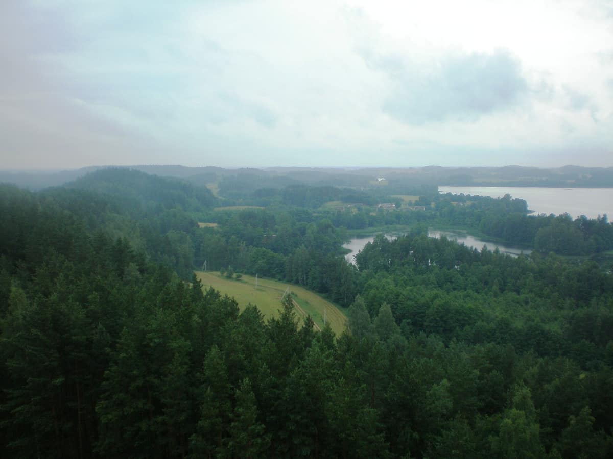
Aukštaitija National Park
Aukštaitijos nacionalinis parkas
Utena County (Ignalina / Palūšė) · Lithuania
Photo: Hugo.arg · CC BY-SA 3.0 · Wikimedia Commons
Lithuania's oldest National Park (1974), an intricate maze of 126 glacial lakes interconnected by clear streams through boreal pine woods.
One hundred and twenty-six lakes scattered among hills and pine forests: that is the simple essence of Aukštaitija. Lithuania's oldest national park, established in 1974, encompasses 410.56 km² in the north-east of the country. More than 70% is clothed in woodland, predominantly Scots pine forests with ancient stands up to 200 years old. Between the trees gleam pristine glacial lakes interconnected by winding streams and channels, making the park a classic destination for paddling.
What makes it unique
Here the landscape is a tapestry of lakes, pine ridges, and wooded hills, explored seamlessly by kayak, on foot, or by bicycle.
The place
Nature
The landscape
The park occupies the confluence of three distinct glacial regions: ancient and younger morainic uplands separated by the sandy fluvioglacial plain of the Žeimena River. Along the Meironys nature trail, these kames and kettle holes form an undulating rollercoaster of forested knolls hiding secluded ponds and lakes.
Water bodies cover 15.5% of the national park. The largest is Lake Kretuonas, spanning 8.29 km², while Lake Tauragnas reaches a depth of 60.5 metres, making it the deepest lake in Lithuania. Approximately 70 km of continuous waterways can be paddled through linked lakes and connecting channels. From Ladakalnis hill, rising to 176 metres along the Šilinškė ridge, opens one of the most celebrated panoramic vistas in Lithuania.
Wildlife and seasons
Scots pine woodlands dominate the expansive forests of Ažvinčiai and Mincia, comprising 81% of tree cover. Biodiversity is remarkably rich: 992 plant species and 2961 animal species, including 54 mammals, 41 freshwater fishes, and 243 birds. Sixty-four plant species, eight fungi, and 48 birds are listed in the Lithuanian Red Data Book.
Atlantic salmon migrate up the Žeimena River to spawn, while the surrounding forests harbour grey wolves, Eurasian lynx, moose, red deer, and roe deer; brown bears appear only as rare wanderers. Substantial bat colonies inhabit hollow trees, while the large island in Lake Kretuonas supports extensive breeding colonies of black-headed gulls. The finest birdwatching waters are lakes Asėkas and Kretuonas. Notable rarities include the black stork, western osprey, and Eurasian three-toed woodpecker. Strict nature reserves comprise 2.1% of the territory, accessible solely when accompanied by park personnel.
Species
With a page in the atlas
Being mentioned in a source doesn't guarantee sightings: check with the people who manage the area.
Memory and protection
History and conservation
The park was officially established on 29 March 1974 based around the former Ignalina and Ažvinčiai nature reserves, originally designated the National Park of the Lithuanian SSR. It protects 106 archaeological and architectural monuments and over 6500 ancient burial mounds. The historic Ginučiai watermill is the only mill among six in the park that preserves authentic working machinery, operating until 1968. The territory encompasses 116 traditional villages, mostly small homestead clusters; Stripeikiai houses the unique Museum of Ancient Beekeeping.
Before you set off
Visiting
How to visit
The network of walking trails is vast. The Meironys educational trail, linking Palūšė and Meironys along Lake Lūšiai, offers three coloured loops: the yellow route spans 3.7 km over two panoramic hills, while the green extension reaches 5 km across boggy depressions. Each loop interprets distinct forest and wetland habitats. The P1 botanical trail covers three and a half kilometres from Palūšė through varied woodlands; its seven interpretive boards detail pine stands, shaded swamp woods, peat mires, and lake vegetation. The Lake Taramas botanical trail, laid out in 1984, begins and ends near the Palūšė forestry office. Another waymarked trail leads from Palūšė through Meironys, Ginučiai, and Stripeikiai to Tauragnai.
For cyclists, the Pakretuonė–Palūšė–Ignalina circuit spans 30 km, taking about two hours. On the water, the V2 Lake Loop covers 30 km, requiring roughly three and a half hours; canoes and kayaks can be rented at the Palūšė water tourism base. The Palūšė visitor centre exhibition interprets traditional and modern lakeside culture, helping you plan your excursion.
Before you go
Camping and campfires are strictly restricted to designated official campsites. Check operating hours at the Palūšė visitor centre before your visit.
Check access, rules and visiting conditions in the official information from the managing body before you set off.
Location
Where it is and how far it reaches
Boundary of Aukštaitijos nacionalinis parkas · IUCN II · © EEA, CDDA (CC-BY) The coordinate is estimated; it isn't a verified access point.
Transparency
Sources
The research data with its sources, and the official links for this place, are in the Spanish version of this page. See the Spanish version
Around it
There are no direct neighbouring sites published in the atlas. With its maze of lakes, moose, and wolf packs, it shares ecological kinships with Soomaa, Žemaitija, Šumava, and Ķemeri.
Entry #369 of the original atlas.