Babia Góra National Park
Babiogórski Park Narodowy - Babia Góra
Lesser Poland (Zawoja) (PL) / Žilina (SK) · Poland / Slovakia
Photo: Pudelek · CC BY-SA 4.0 · Wikimedia Commons
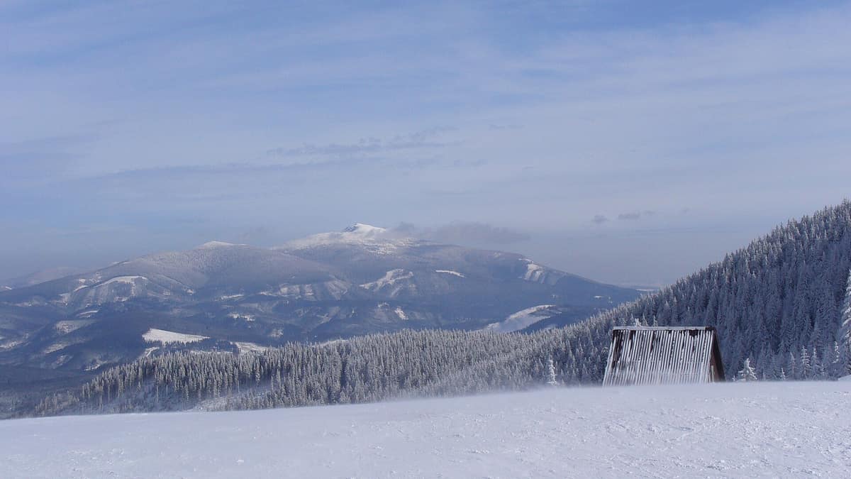
The 'Queen of the Beskids' (Diablak 1,725 m), an isolated windswept massif exhibiting a complete Carpathian altitudinal vegetation gradient.
In Poland, Babia Góra is known as Matka Niepogód, the 'Mother of Bad Weather'. Winds lash the massif with formidable regularity, conditions shift abruptly, and snow can cloak the upper slopes for over 200 days a year. It is a mountain with fierce personality, and in its shadow on the Polish-Slovak border lies Babia Góra National Park: 33.92 km², nearly 85% forested, crowned by Diablak at 1725 m, the highest summit in the Orava Beskids. It is a compact park preserving a complete mountain profile: from foothill beechwoods to the alpine rock tundra atop the peak.
What makes it unique
Here the entire mountain unfolds in distinct vertical zones, from foothill beech and fir woods up to an alpine zone hosting Cerastium alpinum subsp. babiogorense, found nowhere else on Earth.
The place
Nature
The landscape
The mountain rises with gentle southern slopes while plunging steeply on its northern face, with its summit ridge forming the continental drainage divide between Baltic and Black Sea catchments. Most striking is the strict vertical stratification of plant zones. The lower montane forest, extending to 1150 m, comprises European beech, Norway spruce, and silver fir. The upper montane forest reaches up to 1390 m. Above lies the dwarf mountain pine zone up to 1650 m, crowned finally by the alpine zone reaching 1725 m.
Within that alpine zone flourishes Cerastium alpinum subsp. babiogorense (rogownica alpejska), a strictly local endemic. The official park emblem features Laserpitium archangelica (okrzyn jeleni), which was long known in Poland exclusively from this massif. In total, 650 vascular plant species and nearly 280 bryophytes have been catalogued; 70 are high-alpine specialists and 54 enjoy statutory conservation protection.
Wildlife and seasons
The mountain forest provides sanctuary for Europe's large carnivores. Permanent breeding populations of brown bear, grey wolf, and Eurasian lynx inhabit the park, which supports 38 mammal species. The European wildcat, by contrast, has disappeared: the pelt of the last recorded animal, taken on the Orava side on 15 January 1936, is preserved in the park museum. The Tatra vole, a Western Carpathian endemic, ascends almost to the rocky summit.
Bird life is equally diverse: early twenty-first-century surveys recorded 115-119 bird species, with around 100 breeding. The western capercaillie inhabits upper montane spruce stands, while the black grouse occupies the dwarf pine belt. Two characteristic mountain birds, the water pipit (siwerniak) and the rare alpine accentor (płochacz halny), nest on the windswept summit boulderfields. There are 6 reptile and 7 amphibian species; among the latter, the fire salamander populates the lower forest zone. Invertebrate surveys have catalogued some 3.5 thousand species, dominated by beetles (around 1500) and molluscs (92).
Species
With a page in the atlas
Being mentioned in a source doesn't guarantee sightings: check with the people who manage the area.
Memory and protection
History and conservation
The earliest historical mention of the massif dates to the fifteenth century in the chronicles of Jan Długosz, and the first known mountain shelter was built in 1905. The summit ridge formed a state border until 1918, during which communities on either side developed distinct vernacular architecture, highland folklore, traditional attire, and local dialects.
A nature reserve was established in 1933, followed by national park status on 30 October 1954. In 1976 UNESCO designated Babia Góra a Biosphere Reserve. In 1997 the national park was expanded to 3391.55 ha, buffered by a peripheral zone of 8437 ha. Babia Góra protects 18 habitat types of European conservation priority.
Before you set off
Visiting
How to visit
Hiking is permitted strictly along marked tourist paths, maintained on the Polish side by the PTTK alpine club. A classic demanding approach to the summit is the yellow-blazed Perć Akademików trail, equipped with fixed chains and iron rungs on the steep rock walls, highly popular among experienced hillwalkers.
The park maintains eight educational nature trails interpreting the ecology, culture, and architecture of surrounding villages. The Rybny Potok valley trail spans 3.5 km, taking an hour-and-a-half to explore local mammals, birds, freshwater fish, and riparian succession. The Echa pierwotnej puszczy karpackiej route covers 8.4 km from Zawoja Czatoża to Fickowe Rozstaje beside ancient Czatoża woodland, contrasting pristine old-growth stands with human-modified secondary forests. The Mokry Kozub trail features 11 interpretive stops, ascending to 842 m before descending toward Zawoja Markowa, with viewpoints overlooking Babia Góra and the Skawica River valley.
In Zawoja, where park headquarters are located, the Park Education Centre interprets the natural wonders of the massif. In winter, since early 2023, park authorities have permitted ski-touring on designated winter routes, provided snow cover is adequate and wildlife quiet zones are respected.
Before you go
Park regulations require you to remain strictly on waymarked tourist paths and educational trails. Weather on the summit shifts with extreme speed due to fierce prevailing winds; check the mountain forecast before setting out.
Check access, rules and visiting conditions in the official information from the managing body before you set off.
Location
Where it is and how far it reaches
Boundary of Babiogórski Park Narodowy z siedzibą w Zawoi · IUCN II · © EEA, CDDA (CC-BY) The coordinate is estimated; it isn't a verified access point.
Transparency
Sources
The research data with its sources, and the official links for this place, are in the Spanish version of this page. See the Spanish version
Entry #359 of the original atlas.