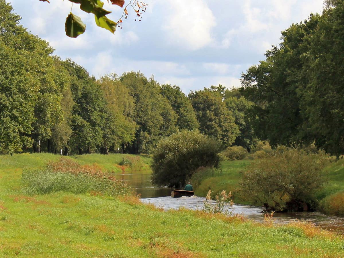
Black Elster Floodplain
Black Elster Floodplain (Schwarze Elster)
Saxony-Anhalt / Brandenburg (Elsterwerda / Jessen) · Germany
Photo: Silvio John, Elsterwerda · CC BY-SA 3.0 · Wikimedia Commons
Elbe tributary subject to ambitious dyke-relocation projects and retention-basin reconnections.
Until the mid-nineteenth century, the Black Elster was a braided maze: a labyrinthine network of secondary arms, gravel bars, and islands hemmed by reed beds and grey willows. Today it runs as a straight channel bounded by artificial dykes, its floodplain forming a verdant ribbon among agricultural fields that warrants far more appreciation than it typically receives. The middle reaches of the Schwarze Elster, flanking the southern and western margins of the Niederlausitzer Heidelandschaft Nature Park between Plessa and Uebigau-Wahrenbrück, retain precious fragments of this former wildness: wet meadows, quiet oxbows, veteran pedunculate oaks, and a river corridor that remains an ecological lifeline.
What makes it unique
A river once heavily canalised and polluted that now safeguards wild orchids, beavers, and rare butterflies dependent on a single meadow herb.
The place
Nature
The landscape
The river stretches 179 km as a right-bank tributary of the Elbe, traversing Saxony, Brandenburg, and Saxony-Anhalt. It rises at 317 m elevation in the Lusatian Highlands (Lausitzer Bergland) in Upper Lusatia. Beyond Elsterwerda it funnels through the narrowest seven-kilometre bottleneck of the Breslau-Magdeburg glacial spillway before swinging northwest toward its confluence with the Elbe.
Modern history transformed its morphology. Beginning in the mid-nineteenth century its meanders were systematically straightened and numerous lateral side-arms severed. In 1852 a major melioration statute was enacted, launching the dyking and channel straightening of 90 km of the waterway between Tätschwitz and Premsendorf. Through the nineteen-eighties, intense industrial pollution severely depleted fish stocks.
Nevertheless, sections of the river retain submerged macrophyte communities representing habitats of conservation interest. The floodplain shelters wet grasslands, alluvial meadows, and lowland hay meadows. These grasslands require continuous conservation management, such as grazing by sheep and goats, harmonised with local flood defence priorities. Scattered oxbow lakes and softwood riparian forests complete the fluvial tapestry.
Wildlife and seasons
Within the oxbow cut-offs, even where severed from annual flood pulses, the Eurasian beaver and Eurasian otter maintain thriving lodges. Along riverside tracks, veteran oaks casting generous shade provide vital wood-decay habitat for the stag beetle.
One of the river's most delicate ecological partnerships involves a rare lycaenid butterfly: the scarce large blue (Phengaris teleius) lays its eggs exclusively in the closed flowerheads of great burnet, after which meadow ants carry the caterpillars into their subterranean nests. In the damp meadows of Kahla, managed under strict conservation regimes, thousands of wild orchids flower in spring. From the path you will look out across fields and pastures that white storks use as primary foraging grounds.
Nearby in the nature park, wildlife flourishes in transformed post-mining landscapes. At Naturparadies Grünhaus—a former opencast pit of spoil tips, terraces, and water-filled hollows—birdwatchers using spotting scopes regularly observe western marsh harriers and greylag geese, alongside flocks of common cranes roosting communally in the shallows. Eroding sandy banks of newly formed mining lakes provide nesting sites for the common kingfisher, sand martins, and specialized burrowing insects. From mid-August to mid-September, a sweeping purple mantle of heather carpets the open heath of the Forsthaus Prösa reserve.
Species
With a page in the atlas
Being mentioned in a source doesn't guarantee sightings: check with the people who manage the area.
Memory and protection
History and conservation
The middle course of the Black Elster is bordered by a European protected area network under the Habitats Directive, encompassing tributary waterways such as the Rieke, Pulsnitz, and the Kleine and Große Röder. The comprehensive FFH management plan formulated between 2009 and 2013 unified conservation measures for the basin's species and biotopes. Since 2012 the nature park has also actively pursued reintroduction programmes for the western capercaillie, which had disappeared from the regional pine barrens.
Before you set off
Visiting
How to visit
Bicycle touring is the ideal mode of exploration. The Schwarze Elster Radweg is fully paved, flat, and segregated from motor traffic. A rewarding route recommended by park rangers runs from Bad Liebenwerda through Wahrenbrück to Neumühl.
To understand the river system, the erlebnisREICH Naturpark visitor centre at Doberlug Castle serves as the northern gateway to the nature park. The park's seasonal calendar offers ranger-led walks (RangerTouren) and family activity days, with opportunities to engage in citizen science and volunteer conservation projects. In winter you can track mammal footprints in the snow with guidance from the Naturwacht ranger service.
A waterway highlight: eleven historical oxbows of the Kleine Elster have been reconnected to the main stream, creating quiet havens that benefit sensitive native fish including European bitterling and weather loach. Beautiful demoiselle damselflies dart over the ripples, shimmering iridescent blue in the sunlight.
Before you go
Check trail advisories and visitor centre opening hours with the nature park administration before setting out.
Check access, rules and visiting conditions in the official information from the managing body before you set off.
Location
Where it is and how far it reaches
Boundary of Mündungsgebiet der Schwarzen Elster · © EEA, CDDA (CC-BY) The coordinate is estimated; it isn't a verified access point.
Transparency
Sources
The research data with its sources, and the official links for this place, are in the Spanish version of this page. See the Spanish version
Around it
Biosphärenreservat Mittelelbe lies approximately twenty-three kilometres to the northwest. Farther afield, the Llanura aluvial del Alto Rin and Parque Nacional de Słowiński share populations of red kites and beavers.
Entry #248 of the original atlas.