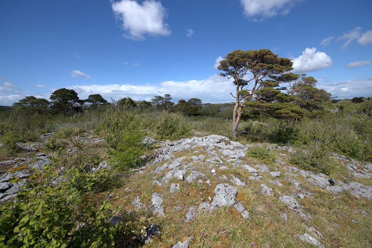
Burren National Park
Clare (Corofin / Mullaghmore) · Ireland
Photo: Limnoporus · CC BY-SA 4.0 · Wikimedia Commons
Limestone pavements where Arctic, alpine, and Mediterranean plants mingle beside ephemeral lakes known as turloughs.
It looks like barren rock, yet it is one of the most botanically prolific landscapes in Ireland. Burren National Park occupies the south-eastern corner of the Burren in County Clare, taking its name from the Irish Boíreann, "a rocky place". It is the smallest of Ireland's eight national parks and the only one managed as an integrated cultural landscape: its flora and fauna depend directly on cattle grazing and enduring rural tradition.
What makes it unique
Arctic, Mediterranean, calcicole, and acid-loving flora thrive side by side upon bare stone.
The place
Nature
The landscape
Begin with what lies before your eyes: grey rock. The limestone formed as seabed sediment in a warm tropical ocean some 350 million years ago, entombing fossil corals, crinoids, sea urchins, and ammonites. Then came the ice sheets, smoothing the hills into terraced contours and depositing massive granite erratics across the limestone pavement of Rockforest, east of Mullaghmór. The Burren ranks among the world's finest glaciokarst landscapes, and the surface karstification visible today dates only from the retreat of the last ice age, some 10,000 years ago: geologically youthful compared with Eastern European karst.
That rock is far from uniform. The park assembles examples of every major Burren habitat: clint-and-grike pavement, calcareous grasslands, hazel scrub, ash-hazel woodland, turloughs, springs, limestone cliffs, and low fen peatlands. The turloughs exemplify the hydrological quirk of the region: depressions that fill during wet winters and drain through underground conduits, their Irish name translating as "disappearing lake". While many comparable wetlands across Ireland have been lost to land drainage, the Burren preserves extensive, undisturbed fens.
Vast tracts in the south are cloaked in dense hazel scrub, offering cover to European badgers, pine martens, red foxes, red squirrels, wood mice, and pygmy shrews.
Wildlife and seasons
The flora is paramount. Approximately 75% of Ireland's native plant species are represented here, including 23 of the island's 27 native orchids. Iconic flowers emblematic of the Burren include the spring gentian, mountain avens, shrubby cinquefoil, and bloody cranesbill, joined on high terraces by hoary rockrose. Mountain avens, characteristic of subarctic and alpine tundra, grows in direct contact with bloody cranesbill and dense-flowered orchid, both of Mediterranean lineage.
Timing follows a precise botanical calendar. The vivid spring gentian, smallest of the gentians, blossoms from April to June. Earliest among the orchids are early-purple orchid and dense-flowered orchid. Fly orchid blooms in May and June across sheltered grikes, scrub, and dry rendzinas; bee orchid peaks in June and July; and the rare sword-leaved helleborine opens in June and July.
Among fauna, ninety-five bird species have been recorded in the park, with at least 50 breeding locally. Standouts include common raven, peregrine falcon, common kestrel, merlin, and hen harrier. In winter, when turloughs and lakes fill, wetland visitors arrive: Eurasian curlew, northern lapwing, European golden plover, and overwintering whooper swans.
Most mammals are crepuscular, though Irish hares, foxes, feral goats, and pygmy shrews are frequently encountered by day; stoats hunt along stone field boundaries. Seven bat species occur, notably the internationally threatened lesser horseshoe bat, which uses small solution caves for hibernation. Feral herds of Old Irish goats forage along crags in fair weather and shelter in hazel thickets during Atlantic gales. Ireland's two native reptile species occur, and the hills around Mullaghmore constitute the country's premier butterfly stronghold: twenty-seven of Ireland's 33 resident and regular migrant butterflies occur on site.
Species
With a page in the atlas
Being mentioned in a source doesn't guarantee sightings: check with the people who manage the area.
Memory and protection
History and conservation
During the Neolithic, around 4000 BC, early farming settlers reshaped the landscape through woodland clearance and burning, raising megalithic chamber tombs such as the Poulnabrone portal dolmen. The national park was established and opened to the public in 1991, forming part of the wider Burren and Cliffs of Moher UNESCO Global Geopark.
Today habitat management relies on an ancient pastoral mechanism: cattle graze the upland limestone terraces throughout the winter months, keeping fast-growing grasses cropped so that light can reach delicate seedlings in spring. This centuries-old practice is known as "winterage".
Before you set off
Visiting
How to visit
The principal gateway is the information point in Corofin, a village 8 km from the park boundary. Resident guides assist with trail selection, trail conditions, and maps. From May to September, a free shuttle bus operates between Corofin and the main trailheads at Kenny’s Cross/Gortlecka, situated in quiet countryside devoid of dedicated parking or facilities.
Seven waymarked trails cross the national park and the adjacent Slieve Carran Nature Reserve, alongside an unmarked green road. They range from a 30-minute stroll to a three-hour hike across terraced limestone hills. For an introductory walk, the Knockaunroe Turlough loop (orange route) covers 1.3 km through ash-hazel woods, dry meadow, and a turlough bed, suitable for all ages. The Nature Trail (white route) spans 1.5 km across doline woodland, hay meadows, and clints, with views toward Mullaghmore and Lough Gealáin. For a longer trek, the Mullaghmore Loop (blue route) circles the peak over 7.5 km along Lough Gealáin and wild limestone benches.
Across at Slieve Carran, the 2.5 km brown trail leads to a stone oratory, hermit cave, and sacred well dedicated to Saint Colman MacDuagh, who according to tradition founded a hermitage here in the seventh century.
Before you go
The limestone terrain is uneven, fissured, and occasionally steep; stick strictly to colour-coded trail markers. Do not disturb, collect, or remove stones or fossils, and leave all wild plants and animals unharmed. Dogs must be kept on leads at all times. On warm, humid days midges can be troublesome, and traversing rough scrub carries risk of tick bites and Lyme disease. Check visitor centre opening hours and shuttle schedules before travelling.
Check access, rules and visiting conditions in the official information from the managing body before you set off.
Location
Where it is and how far it reaches
Boundary of Burren National Park · © EEA, CDDA (CC-BY) The coordinate is estimated; it isn't a verified access point.
Transparency
Sources
The research data with its sources, and the official links for this place, are in the Spanish version of this page. See the Spanish version
Entry #1026 of the original atlas.