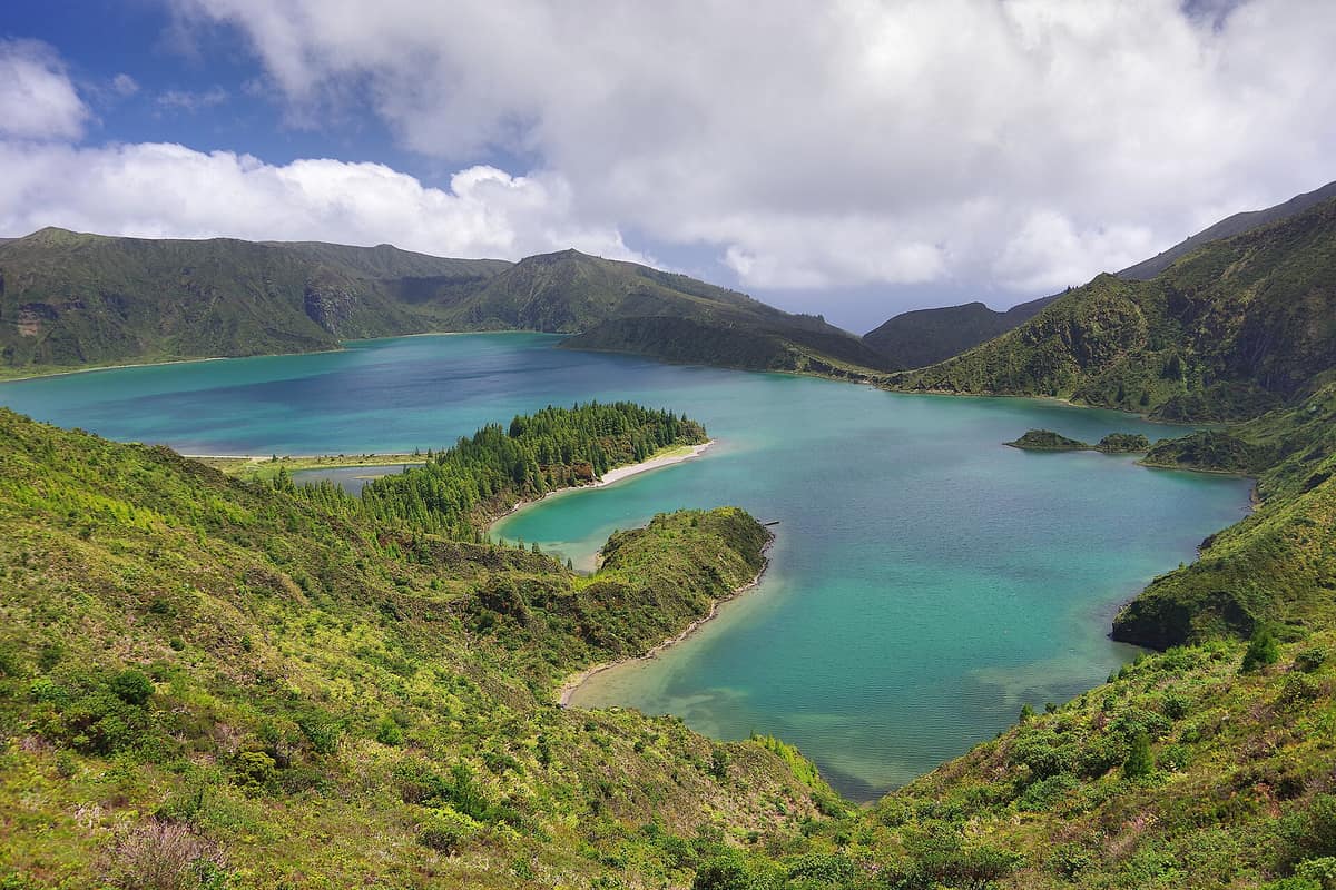
Lagoa do Fogo Nature Reserve (Azores)
Lagoa do Fogo
Autonomous Region of the Azores (São Miguel Island / Ribeira Grande / Lagoa) · Portugal
Photo: Jan Helebrant · CC0 · Wikimedia Commons
Collapsed volcanic caldera cradling a turquoise lake ringed by endemic Azorean flora, free from buildings or roads along its shores.
There is a crater lake on São Miguel where cars cannot reach the shoreline. It sits high up a volcanic cone within an elliptical caldera measuring some 3 by 2.5 kilometres whose walls plunge up to 300 metres, and regional conservation laws forbid any construction on its rim or shores. Lagoa do Fogo, the «lake of fire», is a nature reserve embracing the island's highest body of water and an unsettled caldera dominated by endemic Azorean vegetation.
What makes it unique
A pristine fifteen-thousand-year-old caldera free of buildings, its azure waters resting at 575 metres altitude beside a pumice-stone beach.
The place
Nature
The landscape
The Fogo volcano shapes the central massif of Serra de Água de Pau in central São Miguel, and the lake occupies its youngest caldera. The geological history is written in layered deposits. The outer caldera, measuring 4 by 13 kilometres, formed between 30,000 and 45,000 years ago; the inner one, holding the lake, emerged some 15,000 years ago. Its modern outline results from the last massive summit collapse about five thousand years ago, with the final eruption occurring in 1563. That historic event began with a hydromagmatic blast inside the caldera, followed four days later by effusive lava flows.
The lake water rests at 575 metres in elevation at the bottom of the elliptical caldera, reaching a maximum depth of 30 metres. The surrounding caldera rim climbs to 947 metres. The lake is fed primarily by rainfall and catchment runoff: most inflowing streams are seasonal torrents, swelling in winter and shrinking to trickles in summer. Roughly forty drainage lines score the inner walls, eighteen of which discharge directly into the lake. Its clean waters supply settlements on the southern flanks.
Vegetation varies dramatically around the crater rim. From west to south, low scrub blankets the slopes; to the east and north, where gradients soften, the cover is much denser with patches of native woodland. Between the northern cliff face and the water extends a low-lying sedimentary beach composed of pumice stones. In 2012 it was voted one of the 7 Wonders of Portugal in the wild beach category.
Wildlife and seasons
Flora takes centre stage. Endemic Azorean plants within the reserve include the Azores juniper, Azores laurel, and sanguinho, alongside Saint John's wort, Azores heather, and spurge flax. The sheltered inner crater slopes also nurture mountain grape (Vaccinium cylindraceum), Azorean holly, and viburnum (Viburnum treleasei).
Small passerines form the caldera's core resident community, joined occasionally by soaring raptors. Land birds include the Azores wood pigeon, common buzzard (known locally as milhafre or queimado), grey wagtail, and common blackbird. Over the water, a significant colony of yellow-legged gulls and common terns nests along the shores and gravel bars.
The recommended visiting season extends from May to October.
Species
With a page in the atlas
Being mentioned in a source doesn't guarantee sightings: check with the people who manage the area.
Memory and protection
History and conservation
Lagoa do Fogo has been protected as a nature reserve since 1974. It belongs to the Natura 2000 network as a Special Area of Conservation, approved by the European Commission on 28 December 2001, and is also a Ramsar wetland. In 2008 the reserve was incorporated into the São Miguel Natural Park, covering the entire lake catchment basin.
Before you set off
Visiting
How to visit
The hiking trail descending to the shore is the circular Praia–Lagoa do Fogo route, taking roughly four hours. It begins at Praia along an unpaved farm track and leads down to the lake's pumice shore.
The route passes a heritage landmark: the ruins of an old processing mill for New Zealand flax (Phormium tenax), once harvested across the slopes for cordage and coarse sacking.
Before you go
Crowds gather at the upper caldera viewpoints, and in summer vehicular access is restricted with a mandatory shuttle service. Check access regulations and weather conditions with park management before setting off.
Check access, rules and visiting conditions in the official information from the managing body before you set off.
Location
Where it is and how far it reaches
Boundary of Lagoa do Fogo · IUCN Ib · © EEA, CDDA (CC-BY) The coordinate is estimated; it isn't a verified access point.
Transparency
Sources
The research data with its sources, and the official links for this place, are in the Spanish version of this page. See the Spanish version
Entry #650 of the original atlas.