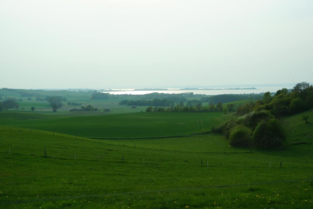
Mols Bjerge National Park
Central Jutland (Syddjurs / Ebeltoft) · Denmark
Photo: Sebastian Nils · CC BY-SA 3.0 · Wikimedia Commons
Hummocky glacial moraines and dry ice-age heathland sloping down towards the fjords of the Djursland peninsula.
Deep within the Mols hills lies Troldeskoven, the "Troll Forest", celebrated as the sole primeval woodland on the peninsula. It nestles in one of Denmark's most rolling, undulating terrains. Mols Bjerge National Park in Central Jutland was inaugurated on 29 August 2009, spanning 180 km² across the municipality of Syddjurs. At its heart rise the Mols Hills, reaching up to 137 metres: modest elevations that nonetheless yield sweeping panoramic seascapes.
What makes it unique
In a single day you can hike from Bronze Age burial mounds across dry heath to a cold-water kelp reef, passing a ruined medieval castle along the way.
The place
Nature
The landscape
The undulating topography was sculpted during the retreat of the last ice age, comprising dry heaths, oak woodlands, pastures, kettle bogs, and coastal shallows. This geological legacy fosters remarkable biodiversity: within a few kilometres, dense forest transitions into open dry heath and sheltered inlets. Centuries of peasant agriculture shaped the terrain, leaving only relic patches of ancient forest. Tolløkke Skov survives as the sole ancient woodland on the Ebeltoft peninsula, crowded with veteran trees. Skovbjerg preserves an ancient grazed oak woodland.
The land is not state property: 20 percent of the area is public land managed by the Danish Nature Agency (Naturstyrelsen), while 80 percent remains in private hands. Consequently, large tracts are enclosed in conservation pastures. Robust livestock keep the commons open through natural grazing: hardy cattle, horses, sheep, and goats; at Trehøje, an ancient grazed common, three Bronze Age barrows stand in a dramatic alignment, with 22 burial mounds scattered across the immediate area.
The coastline adds an entirely different marine dimension. Off Jernhatten lies a cold-water boulder reef carpeted in kelp forest, ideal for summer snorkelling. At Egsmark Plantage, fossil bluffs stand high and dry inland where Stone Age marine waters retreated to today's shoreline.
Wildlife and seasons
Each season brings distinctive natural spectacles. In summer, open heathlands shelter the red-backed shrike, woodlark, and tree pipit. Winter attracts swans, geese, and diving ducks to inland lakes, including the delicate smew. The shallow sands of Ahl attract flocks of gulls and feeding waders such as northern lapwings, curlews, and oystercatchers. The hide at the southeastern tip of Lake Stubbe provides birdwatching views over open water, while Ahl Hage offers coastal seabird watching, with Dragsmur acting as a bottleneck for migration.
At Bjørnkær Egedal in spring and late summer, metallic violet-black dor beetles burrow beneath horse droppings. Mammals include the red fox, European hare, and roe deer, alongside common lizards and adders. Rare dry-grassland flora includes the pasqueflower and mouse-ear hawkweed. Mycologists have recorded numerous red-listed fungi, some found nowhere else in Denmark.
Species
With a page in the atlas
Being mentioned in a source doesn't guarantee sightings: check with the people who manage the area.
Memory and protection
History and conservation
Kalø Castle was built in the fourteenth century upon a fortified island tied to the mainland by a cobbled causeway. Granite barrows, dolmens, and Stone Age passage graves dot the entire landscape. Bjørnkær-Egedal was an ancient royal oak forest logged for fuel to boil seawater for salt during the Dano-Swedish wars of 1660 and 1670. At Øer, industrial extraction of sand, gravel, and stone created long linear flooded quarry lakes.
The park encompasses 40 European habitat types of interest present in Denmark. Citizen science flourishes here: volunteers conduct regular butterfly monitoring transects and count devil's-bit scabious populations to track habitat health.
Before you set off
Visiting
How to visit
Principal gateways include car parks at Strandkær Strand, Femmøller Efterskole, Knebel Plantage, and Agri Bavnehøj. Regional bus 123 runs from Aarhus to Ebeltoft via Rønde, stopping at the Kalø Castle ruins.
Two visitor centres orient travellers. Karlsladen, set in a historic manor barn by the castle ruins, interprets natural and cultural history through prehistory, the Middle Ages, and hunting traditions. Øvre Strandkær focuses on flora, fauna, and glacial geology.
For walkers, the Mols Bjerge-stien is a premier 80-kilometre trail split into four daily stages: Bjergetapen, Kalø-etapen, Ebeltoft-etapen, and Gåsehage-etapen, interconnected by bus 123. Among shorter trails, the Hestehave Skov loop spans 5,5 km through coastal woods, castle views, and prehistoric barrows. Agri Bavnehøj, rising to 137 metres, is the park's highest summit. The Skovbjerg path loops through the gnarled Troldeskoven. Knurrehald-stien follows the Stone Age sea cliff down into a wooded gully with 40 metres of elevation gain. The Oldtidsstien leads past a long barrow, six passage graves, barrows, and a holy spring.
The walk of about 3 km out and back to the Kalø Castle ruins can be taxing for those with limited mobility, particularly along the uneven medieval cobbled causeway.
Before you go
In grazed enclosures, maintain distance from cattle and keep dogs on a short leash at all times; if livestock approach your dog, exit the enclosure immediately. Public forests permit access day and night on foot; bicycles must remain on established roads and tracks, and motorized vehicles are prohibited in woods.
Check access, rules and visiting conditions in the official information from the managing body before you set off.
Location
Where it is and how far it reaches
Boundary of Nationalpark Mols Bjerge · © OpenStreetMap contributors (ODbL) The coordinate is estimated; it isn't a verified access point.
Transparency
Sources
The research data with its sources, and the official links for this place, are in the Spanish version of this page. See the Spanish version
Around it
Vilsandi National Park and Saaremaa Sea Cliffs in Estonia lies far to the east across the Baltic, yet shares with Mols Bjerge coastal habitats and breeding natterjack toads.
Entry #601 of the original atlas.