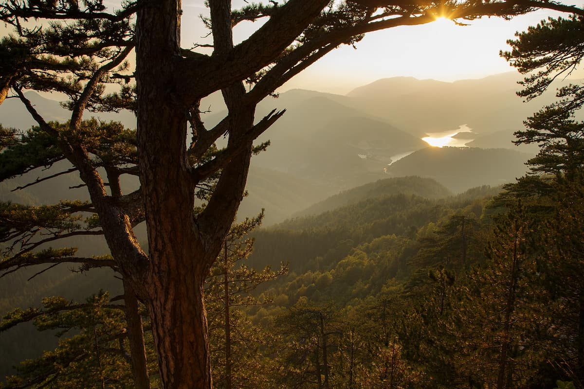
Tara National Park - Mountain Forests
Nacionalni park Tara - Planinske šume
Zlatibor District (Bajina Bašta) · Serbia
Photo: Thruserbia · CC BY-SA 4.0 · Wikimedia Commons
Mountainous plateau plunging vertically towards the Drina Canyon, harbouring relict Serbian spruce (Picea omorika) forests.
In western Serbia, the Drina River forms a sweeping elbow, cupping an entire forested mountain within its embrace. Tara is where that dramatic river bend turns into a national park: a realm of deeply incised limestone gorges, a Drina canyon falling from 1,000 to 250 metres with expansive vistas across western Serbia and Bosnia, and beech, fir, and spruce stretching as far as the eye can see. With 83.5 % of its territory cloaked in trees, it is the most forested expanse in Serbia, known as «the lungs of Serbia».
The national park was designated in 1981 and expanded on 5 October 2015; today it spans 24,991.82 hectares. The highest summit is Kozji Rid (1,591 m), and on the Tara plateau itself, Zborište (1,544 m).
What makes it unique
Tara is the sanctuary of Pančić's spruce, a relict and endemic conifer that survived the last ice age in the Drina canyons, and home to Serbia's largest brown bear population.
The place
Nature
The landscape
Look at the topography and Tara reveals itself as a creation of water. The Drina Canyon is carved through thick beds of Middle Tertiary limestone, and the adjacent Mount Zvijezda is separated from Tara by the sheer Derventa gorge. Within Zvijezda lies the deepest canyon in Serbia, discovered on 12 June 2010; because of its extreme isolation, bears and chamois thrive there undisturbed.
Forest constitutes the other half of the landscape. Due to the exceptional conservation and diversity of its forest ecosystems, many of which are ancient relicts, Tara ranks among Europe's richest woodland enclaves. Mixed forests of spruce, fir, and beech dominate, covering more than 85 % of the wooded area. Nine strict reserves, representing 16 % of the park, are completely protected from timber harvesting; some have remained untouched for centuries, resembling temperate rainforests. The oldest beeches are estimated to exceed 500 years of age.
Wildlife and seasons
Every single Serbian spruce tree is protected as a natural monument. It was discovered by botanist Josif Pančić in 1875 in the village of Đurići and grows naturally in only two localities in Tara: the Mileševka canyon and the Zvezda massif. The park shelters 1,156 species of vascular flora, fully a third of Serbia's entire flora, including 76 endemics.
Fauna is equally remarkable. There are 59 mammal species and around 140 bird species, alongside 12 amphibians, 12 reptiles, and 19 fishes. Inhabitants include the brown bear and Eurasian otter, as well as Balkan chamois, roe deer, Eurasian lynx, grey wolf, golden jackal, wild boar, pine marten, and European wildcat. In April 2019 there were roughly 60 bears in Tara, representing 80 % of Serbia's entire population. Satellite tracking reveals that females with cubs stay within a compact range, while solitary males roam widely westward across the Drina into Bosnia. One tracked male, Aleksandar, fitted with a GPS camera collar, hibernated from mid-November to late March and was reluctant to leave his den.
Birdlife features the golden eagle, griffon vulture, peregrine falcon, Eurasian eagle-owl, spotted nutcracker, Eurasian bullfinch, common crossbill, black woodpecker, rock partridge, and black grouse. On Lake Perućac a breeding population of goosander numbers some 50 pairs. Pančić's bush-cricket serves as the park's invertebrate emblem, an endemic relict species.
Species
With a page in the atlas
Being mentioned in a source doesn't guarantee sightings: check with the people who manage the area.
Memory and protection
History and conservation
Tara holds deep historical layers. At Crveni Tepih, archaeologists uncovered the oldest lead pollution evidence in Europe, dated to 3600 BC. Rača Monastery, founded by King Dragutin in the thirteenth century, stands as the park's foremost cultural monument, and the medieval stećci tombstones of Rastište and Perućac were inscribed on the UNESCO World Heritage list in 2016.
Tara, Šargan-Mokra Gora Nature Park, Zlatibor, and Bosnia's Drina National Park are proposed as a future transboundary UNESCO biosphere reserve.
Before you set off
Visiting
How to visit
The primary visitor hubs are Kaluđerske Bare in the north near Bajina Bašta, and Mitrovac in the south. The park is accessible from three main directions, and a network of gravel forest tracks links scenic spots and hamlets. The best starting point is a visitor centre or tourist office for orientation. The Mitrovac centre, opened in 2006, was the first of its kind in Serbia, while Bajina Bašta offers information and thematic exhibits.
There are 290 km of marked hiking trails. Paths exploring the Zvijezda and Crni Vrh sectors depart from the Predov Krst ranger post, with a popular numbered route running from Kaluđerske Bare to Zborište. The Banjska Stena viewpoint is the most frequented; other panoramic lookouts include Kićac, Vranovina, Veliki Teferič, Mali Teferič, and Vranica. Tara offers three signposted cycling circuits, with forest tracks providing ideal pedalling terrain.
The Banjska Stena interpretive trail covers six kilometres with moderate gradients, leading to the dramatic viewpoint and featuring five rest clearings with informational boards on woodland ecology and brown bears. The Bilješka Stena educational path spans six kilometres between Predov Krst and its namesake lookout, while the Tepih Livada trail traverses a protected peat bog within Crveni Potok reserve.
Before you go
The visitor centres at Mitrovac and Bajina Bašta provide up-to-date guidance for route planning. Open fires are strictly restricted to designated fireplaces, and wild camping is not permitted outside authorized sites.
Check access, rules and visiting conditions in the official information from the managing body before you set off.
Location
Where it is and how far it reaches
Boundary of Nacionalni park Tara · IUCN II · © EEA, CDDA (CC-BY) The coordinate is estimated; it isn't a verified access point.
Transparency
Sources
The research data with its sources, and the official links for this place, are in the Spanish version of this page. See the Spanish version
Around it
About thirty kilometres away lies the Prača River Karst Canyon and Govještica Cave.
What else to explore nearby
Approximate straight-line distance between the edges of each area. It doesn't indicate access, routes or driving times.
- Prača River Karst Canyon and Govještica Cave
Republika Srpska / Sarajevo Canton (Pale / Rogatica)
About 30 km away
Deep karst gorge following an abandoned narrow-gauge railway trace sheltering Pećina Govještica (Bosnia's longest cave, nearly 10 km).
JFMAMJJASONDMay – October · Crowding very low
Entry #84 of the original atlas.