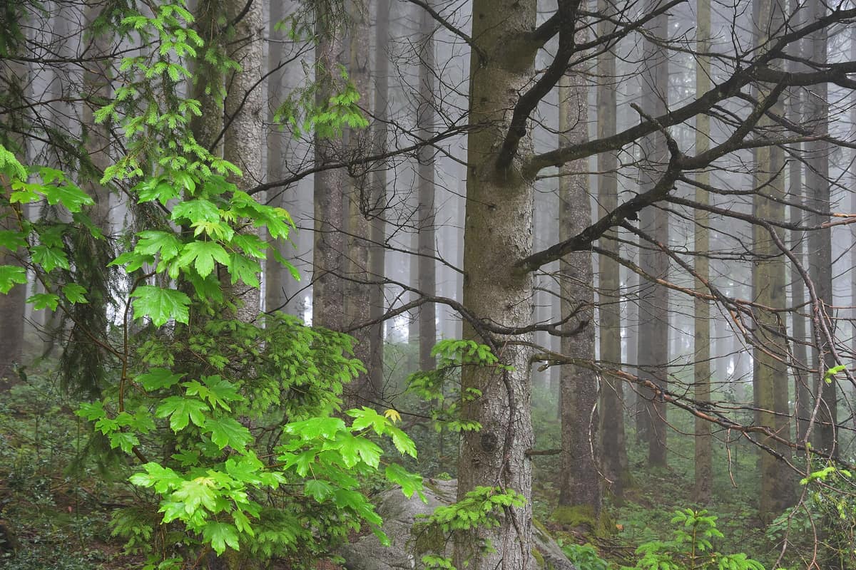
Black Forest National Park
Nationalpark Schwarzwald
Baden-Württemberg (Freudenstadt / Baden-Baden) · Germany
Photo: Josef A. Baumann · CC BY-SA 4.0 · Wikimedia Commons
Baden-Württemberg's first National Park (created in 2014), protecting wild spruce and fir woodlands along red sandstone ridges.
Along the Wildnispfad, trees felled by Cyclone Lothar in 1999 still lie across the track: the route leads over and beneath their weathered trunks. That simple decision encapsulates Black Forest National Park: a place where you can watch forest regenerate naturally after a storm. Established on 1 January 2014, it is the first national park in Baden-Württemberg and today covers 11.267 hectares across the main ridge of the Northern Black Forest, primarily between the Schwarzwaldhochstraße highway and the Murg Valley.
What makes it unique
A forest dominated by spruce transforms before your eyes into wild woodland, and among fallen logs there remains space for the capercaillie and the tracks of a lynx.
The place
Nature
The landscape
The mountain ascends in distinct steps. The Ruhestein sector reaches some 1150 m at the southeastern crest of the Hornisgrinde, the highest mountain in the Northern Black Forest, and drops down the western slopes of the Schliffkopf to the Allerheiligen waterfalls at around 500 m, the lowest and westernmost point in the park. The other sector, encompassing Hoher Ochsenkopf and Plättig, centres on the Hoher Ochsenkopf at 1054 m. Since 1 January 2026, a statutory expansion closes the gap between the two.
Glacial history lingers in three cirque tarns—the Wildsee, the Huzenbacher See and the Buhlbachsee—which offer critical habitat for amphibians and dragonflies. Mountain mixed forests, blanketing much of the park, comprise Norway spruce, European beech and silver fir, festooned with ferns, clubmosses and bryophytes. Interspersed among them are the Grinden and plateau raised bogs, accounting for nearly 3% of the park area; blanketed in moor grass, rushes and heather, they benefit rare insects, the common European adder, European serin, meadow pipit and Eurasian wryneck.
Wildlife and seasons
The western capercaillie commands a central focus in conservation efforts. Endangered with extinction, it maintains a critical presence in open montane conifer stands here: roughly one out of every three capercaillies in the Black Forest lives within the park, which accounts for just over 100 km² out of the mountain range's 6.000 km². During the population low in 2022, only 97 displaying males were counted across the entire Black Forest, 17 of them within the park; following an emergency action plan, male numbers in the park rebounded to 31 in 2026.
Deadwood sustains a rich avian community. Woodpeckers include black woodpecker, great spotted woodpecker, grey-headed woodpecker and the rare three-toed woodpecker; crossbills and spotted nutcrackers also thrive, while nocturnal raptors feature tawny owl, boreal owl and the Eurasian pygmy owlet. The Spechtpfad trail is home to all five woodpecker species of the park: great spotted, black, grey-headed, three-toed and the wryneck.
Large ungulates include red deer, roe deer and wild boar. Early Eurasian lynx records involved males arriving from Switzerland; by 2025, a territorial female was established in the Northern Black Forest. Since the winter of 2017/18, genetic testing confirms that the grey wolf has returned to the Northern Black Forest over 150 years after its extirpation. In total, researchers had catalogued 2100 animal species by 2019, including 1400 insects and roughly 750 beetles, along with 1050 fungal species.
Species
With a page in the atlas
Being mentioned in a source doesn't guarantee sightings: check with the people who manage the area.
Memory and protection
History and conservation
The park was born in 2014 following a contentious debate: the regional parliament voted for its establishment on 28 November 2013, in what was a politically heated decision. Forest composition is shifting: spruce is expected to give way to broadleaf species better adapted to heat and drought. Meanwhile, the capercaillie emergency action plan has been underway since 2022.
Before you set off
Visiting
How to visit
Begin at the Nationalparkzentrum Ruhestein, at an altitude of around 900 metres: it is an excellent starting point where staff provide route advice. It features a permanent exhibition, temporary galleries, a cinema and the Brücke der Wildnis skywalk. The multimedia exhibition, spanning some 1.000 m², explores woodland rewilding. In icy conditions or severe weather warnings, the bridge and tower may be closed. The annual programme offers more than 300 activities, from capercaillies to open-air woodland theatre.
The four themed trails are the most popular highlights. The Lotharpfad, around 900 metres long, shows how nature heals when left unmanaged after storm blowdowns; it follows boardwalks, stairs and footbridges leading to a panoramic platform overlooking Northern Black Forest summits. The Wildnispfad, approximately 3,5 km long, is narrow: you scramble over and under massive tree trunks, with the Adlerhorst clearing offering the best spot for a break. The Luchspfad sets out from the Plättig car park, covering some 4,5 km in about three hours and ascending 75 m; it starts at the Luchshütte, where you can hear the recorded call of a lynx. The Spechtpfad, measuring 1,2 km beside the Lotharpfad, is step-free and suitable for wheelchairs and prams.
In winter there are marked footpaths, cross-country ski trails and snowshoe routes. Seasonal closures dictate which paths can be used.
Before you go
Remain on designated paths to avoid disturbing wildlife, and check seasonal trail closures before setting out. Dogs must be kept on a leash. Lighting fires and smoking are strictly forbidden, as is gathering firewood, plants, plant parts or mushrooms. Do not enter the park's streams, rivers or lakes, whether swimming or wading: they are rare and fragile biotopes.
Check access, rules and visiting conditions in the official information from the managing body before you set off.
Location
Where it is and how far it reaches
Boundary of Schwarzwald · IUCN II · © EEA, CDDA (CC-BY) The coordinate is estimated; it isn't a verified access point.
Transparency
Sources
The research data with its sources, and the official links for this place, are in the Spanish version of this page. See the Spanish version
Around it
Twenty-three kilometres away lies the Upper Rhine Floodplain (Rheinauen).
Entry #362 of the original atlas.