Nemunas Loops Regional Park
Nemuno Kilpų Regioninis Parkas
Kaunas County (Birštonas / Prienai) · Lithuania
Photo: SUJIRENas · CC BY-SA 4.0 · Wikimedia Commons
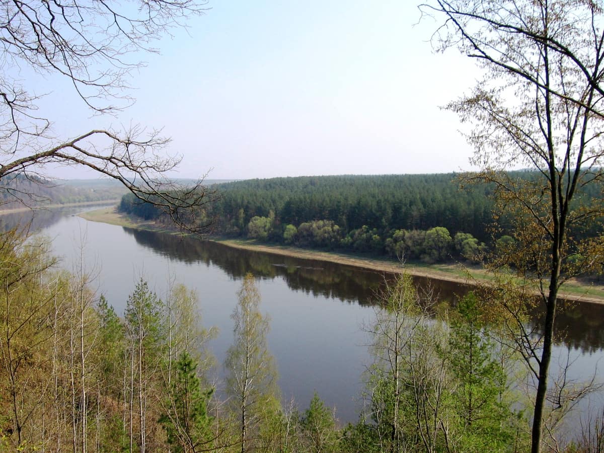
Gigantic incised meanders of the Nemunas River carving through wooded morainic ridges.
A river that refuses to run straight. For some sixty kilometres, the middle reaches of the Nemunas loop back upon themselves, carving three massive loops as they flow between high, densely wooded bluffs. That is what the Nemunas Loops Regional Park protects: a meandering valley, a forest preserving features of ancient Lithuanian primeval woodlands, and a network of trails to explore on foot or by bicycle.
What makes it unique
The great loops of the Nemunas form a unique geological and hydrographic structure in Lithuania and Europe, and in Punios šilas grow the tallest pines and spruces in the country.
The place
Nature
The landscape
The grand loops encompass those of Punia, Balbieriškis, Prienai and Birštonas. The elevation difference between the riverbed and the plateau rim spans between forty and sixty metres, flanked by dramatic bluffs and ravines where rushing streams have gouged steep gullies and canyons. Prominent outcrops bear their own names: Balbieriškis, Siponys and Škėvonys. Among them, the Škėvonys ridge stands out as a unique erosional landform in Lithuania, nested within the valley.
Atop this undulating relief thrives Punios šilas, a forest of immense botanical value preserving the primeval character of historic Lithuanian wilderness. Here stand the country's tallest Scots pines and spruces, alongside stately oak avenues commemorating grand dukes of Lithuania. One remarkable pine, around one hundred and sixty years old, soars to forty-two metres. Within the forest nature reserve, woodland processes unfold entirely free from direct human interference.
Wildlife and seasons
According to official park inventories, the area shelters nine hundred and seventy-three plant species, one thousand seven hundred and thirteen animal species, two hundred and three bird species, and fifty-six mammal species. In Punios šilas, rare highlights include black stork, lesser spotted eagle, edible dormouse and middle spotted woodpecker, alongside roe deer, wild boar and a substantial herd of red deer. In the Degsnė larch grove grow European larches reaching some forty-six metres, including Lithuania's tallest recorded tree.
On the sandy islets of the Nemunas near Prienai, a sprawling colony of gulls and terns thrives, and the riverbanks offer prime vantage points to witness seasonal bird migration. A designated observation post is situated directly facing these islets.
Species
With a page in the atlas
Being mentioned in a source doesn't guarantee sightings: check with the people who manage the area.
Memory and protection
History and conservation
The park was established in 1992, spanning 25.080 hectares, to preserve the great incised meanders of the Nemunas together with the forest landscapes and unique ecosystem of Punios šilas.
Before you set off
Visiting
How to visit
The park features a regional visitor centre and paths for all paces. The Škėvonys interpretive nature trail measures 1,6 km and is strictly pedestrian; the Žvėrinčius trail accommodates both walkers and cyclists, and Punios šilas offers its own nature learning path. Across the Prienai and Birštonas loop runs a ten-kilometre paved track dedicated to bicycles and pedestrians. Since 2019, visitors can also ascend the Birštonas observation tower at the southwestern edge of town.
To view the valley from above, one of the finest panoramas opens from the Nemunas bluff viewpoint near Balbieriškis, as well as from the valley slopes and historic hillforts of Punia and Birštonas. The park preserves twenty ancient hillforts, most famously Vytautas Hill in Birštonas and Margiris Hill in Punia. In the Punia forestry headquarters, a dedicated forest museum explores Punios šilas.
Before you go
Check with park administration regarding open sectors and operating services before planning your visit.
Check access, rules and visiting conditions in the official information from the managing body before you set off.
Location
Where it is and how far it reaches
Boundary of Nemuno kilpų regioninis parkas · IUCN V · © EEA, CDDA (CC-BY) The coordinate is estimated; it isn't a verified access point.
Transparency
Sources
The research data with its sources, and the official links for this place, are in the Spanish version of this page. See the Spanish version
Entry #232 of the original atlas.