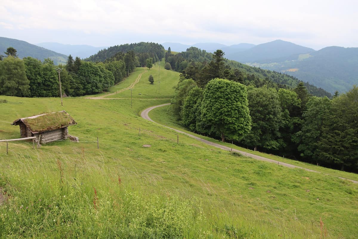
Ballons des Vosges Regional Nature Park
Parc Naturel Régional des Ballons des Vosges
Grand Est (Haut-Rhin / Vosges / Belfort) · France
Photo: FrDr · CC BY-SA 4.0 · Wikimedia Commons
The high rounded domes (Ballons) of the Vosges with glacial high meadows (chaumes) and beech-fir forests.
Fourteen summits above 1,300 metres, rounded like domes: the Ballons. The Ballons des Vosges Regional Nature Park was created in June 1989 on the initiative of three former regions and is organised around the Hautes Vosges, the highest part of the massif, in the south of the range. It is a large and densely settled park, bordering and partly including towns of the Alsace plain such as Colmar, Mulhouse and Belfort, and unlike a national park imposes no special nature protection regulations. What protects it is a permanent balance between nature, culture and local development.
What makes it unique
A ridge of high meadows, peat bogs and beech-fir forests rising from the Alsatian plain whose views reach, on a clear day, as far as the Alps.
The place
Nature
The landscape
The park covers the Hautes-Vosges and their forested slopes, the Vosges, haut-rhinois and comtois valleys, the Plateau of a Thousand Ponds, the sub-Vosges country and the Alsatian wine foothills. Among the rarest habitats are the hautes-chaumes, the peat bogs, the beech-fir forests, the low-altitude oak-beech woods, the calcareous grasslands, the rivers, lakes and ponds.
The highest summit of the massif is the Grand Ballon, at 1,424 metres. From its top, which has an orientation table, you can see Mulhouse, Basel, the Black Forest, the Jura and, in good weather, much of the Alps as far as Mont Blanc. It is also, with the Hohneck, the coldest and windiest point of the Grand Est region. The Ballon d'Alsace, at 1,247 metres, is one of the first great peaks of the massif if you approach from the south: its waters run to two basins, the Savoureuse to the Rhône and the Doller to the Rhine, and above about 1,000 metres the forest gives way to the chaumes, with wind-shaped beeches, yellow gentian and bilberry. Its very steep east face has an almost Alpine feel and accumulates wind-blown snow forming cornices until summer.
The Hohneck tells another part of the story. Its very abrupt Alsatian flank follows the line of the Rhine rift valley, and in the Quaternary glacial cirques were carved, leaving lakes and peat bogs. The flora of the Hohneck is one of the richest in the Vosges, and Jean-Baptiste Mougeot studied it from his first ascent, in 1795.
Wildlife and seasons
The emblematic species of the massif are the boreal owl, the lynx, the peregrine falcon, the capercaillie, the slender cottongrass, the superb pink, the bog bilberry and the sundew. The lynx is a story of slow recovery: between 1983 and 1993, a total of 12 males and 9 females were released on the Alsatian side, and the population remains fragile because of poaching and road traffic. The last wolves were reported in the Vosges in 1918 and 1919. The ridges also hold an important population of chamois, and the Hohneck massif has had some herds since their introduction in 1957; in summer, the gentle slopes welcome the Vosges cattle.
The best reference for seeing this world is the Tanet-Gazon du Faing national nature reserve, which protects 505 hectares of old chaumes between the col du Bonhomme and the col de la Schlucht. Its birds have a montane and Nordic character: the ring ouzel, the woodcock, the hazel grouse and the peregrine falcon. There are 519 catalogued botanical species, some characteristic of subarctic regions. Here the beech-fir forests of the lower slopes, once the capercaillie's domain, are retreating as Norway spruce plantations advance; the high chaumes are being invaded by ericaceous heathland, and there are about ten boggy heathlands.
Species
With a page in the atlas
Being mentioned in a source doesn't guarantee sightings: check with the people who manage the area.
Memory and protection
History and conservation
The Vosges mountain has been frequented since the Neolithic and is one of the cradles of the Industrial Revolution, with ironworking since the Middle Ages; Tyrolean miners arrived. The road of the crests was born of war, and the park from the need to balance protection and local development.
Before you set off
Visiting
How to visit
Start at a park house. The Maison du Parc de Munster has a 600 m² permanent exhibition on natural habitats, heritage, landscapes and geology, with guided tours in summer. The Grand Ballon welcome point, a summer relay on the ridges, provides information and is one of the stops on the navette des crêtes. And the Maison du Ballon d'Alsace offers exhibitions, guided walks and workshops during summer. In Haute-Saône, the Espace Nature Culture, in Haut-du-Them-Château-Lambert, has a 200 m² exhibition on the geological and human history of the Saône Vosges.
The route des Crêtes is the natural road for seeing the massif. It was created during the First World War for logistics and defence of the Vosges front, and runs from the col du Bonhomme to the Vieil Armand, via the col de la Schlucht, the Hohneck massif, the Markstein and the Grand Ballon, over more than 80 kilometres. In winter it is closed from the Grand Ballon to the Markstein and from there to the La Bresse-Kastelberg ski slopes. Interpretive walls invite visitors to discover the natural and scenic heritage of the Hautes Vosges at 17 points.
In the Tanet reserve, a 1.9 km educational trail starts from the ferme-auberge du gazon du Faing and explains its flora, fauna and landscape.
Before you go
In the Tanet there is a red zone closed to the public, a quiet habitat for the capercaillie and wildlife in general. At the top of the Hohneck, vehicle and pedestrian circulation is regulated to preserve the site. And the route des Crêtes closes in winter: check before going.
Check access, rules and visiting conditions in the official information from the managing body before you set off.
Location
Where it is and how far it reaches
Boundary of Ballons Des Vosges · IUCN V · © EEA, CDDA (CC-BY) The coordinate is estimated; it isn't a verified access point.
Transparency
Sources
The research data with its sources, and the official links for this place, are in the Spanish version of this page. See the Spanish version
Around it
At 0 km, the Upper Rhine Floodplain (Rheinauen) is the nearest neighbour in the atlas.
Entry #363 of the original atlas.