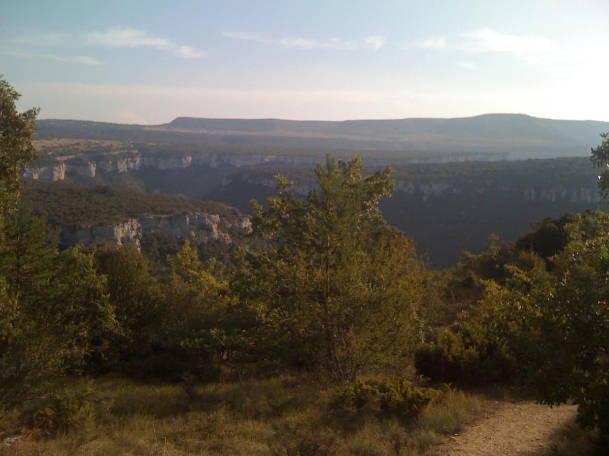
Hoces del Alto Ebro y Rudrón Natural Park
Parque Natural Hoces del Alto Ebro y Rudrón
Castile and León (Burgos / Sedano / Orbaneja del Castillo / Valdelateja) · Spain
Photo: HolzaugeEN · CC BY-SA 4.0 · Wikimedia Commons
Karst gorges of 200 m carved by the Ebro and Rudrón rivers, featuring the picturesque village of Orbaneja del Castillo and Pozo Azul.
Some rivers disappear underground and re-emerge kilometres away. The Rudrón does just that: it vanishes into the swallow hole of Basconcillos del Tozo and resurfaces in Barrio-Panizares. It is only one of the surprises of Hoces del Alto Ebro y Rudrón Natural Park, in north-western Burgos province, where the Ebro and Rudrón have carved a labyrinth of canyons across a limestone plateau. It covers 45,767 ha and was designated a natural park by Law 15/2008 of 18 December.
What makes it unique
A flat plateau that suddenly splits into canyons almost two hundred meters deep where one river disappears underground and another emerges from a cave.
The place
Nature
The landscape
Everything is shaped by water on limestone. The Ebro and the Rudrón have worked the plateau of La Lora, in the transition zone between the Duero plateau and the Cantabrian Mountains, sculpting Upper Cretaceous bedrock into a succession of canyons, gorges and defiles that reach nearly 200 m in depth. Above lie vast, nearly flat plateaus; below, narrow valley floors hemmed in between cliffs.
Water also bursts from the rock. The Fuente de Orbaneja springs from a karst cave in the Ebro canyon and cascades down to the river; at its foot lies Orbaneja del Castillo, an excellent viewpoint over the gorge. In Covanera, the Pozo Azul is a karst upwelling that opens into the longest submerged cave system in Spain, while in the Lower Rudrón there are also tufa cascades in Tubilla del Agua and the Valdemuriel dolmen. In its Burgos section, the Ebro flows for 150 km from Orbaneja del Castillo through a sequence of gorges and open valleys.
The vegetation follows another logic: two worlds meet here. The gorges lie in the transition between Atlantic and Mediterranean biogeographical regions, and the enclosed river courses create a microclimate that sustains Mediterranean plants at an Atlantic latitude. Portuguese oaks, holm oaks, Pyrenean oaks and maples grow alongside beeches, while willow, poplar and alder line the rivers. Among dry limestone meadows grow notable wild orchids.
Wildlife and seasons
Look up at the cliffs. They shelter the golden eagle, griffon vulture, Bonelli's eagle, Eurasian eagle-owl, Egyptian vulture, peregrine falcon and red-billed chough. Across the open moors live Montagu's harrier, hen harrier, short-eared owl, Eurasian stone-curlew and calandra lark.
Below, along the canyon floors, gallery forests provide shelter and feeding grounds for many species. Observers have recorded 117 birds and 21 mammals; prominent among them are the Eurasian otter, Pyrenean desman and Eurasian badger. The riverbanks and thickets are home to the Schreiber's green lizard, common kingfisher, Eurasian scops owl and lesser spotted woodpecker. In the waters live native white-clawed crayfish, brown trout, bermejuela, gudgeon and Eurasian minnow. The deciduous woodlands harbour longhorn beetles and the stag beetle, as well as carnivores like the grey wolf. Caves and rock faces serve as roosting and nursery sites for several bat species.
Species
With a page in the atlas
Being mentioned in a source doesn't guarantee sightings: check with the people who manage the area.
Memory and protection
History and conservation
The park is protected for the scenic beauty of its landscape, the pristine state of its woodlands and the rich wildlife tied to the rivers and their sheer vertical walls. The open valleys are more heavily settled and farmed, but the gorges preserve their flora and fauna remarkably well. Protection safeguards its geology, mixed forests and wildlife alongside its outstanding scenic value.
Before you set off
Visiting
How to visit
The trail network covers the park in sections. The Rudrón route between San Felices and Valdelateja spans 26.1 km and splits into three simpler trails: the circular San Felices walk of 7.8 km, and the stretch to Valdelateja of 10.7 km. From San Felices you can climb one kilometre to the hermitage of Saints Céntola and Elena for views over the Rudrón valley and the abandoned meander of Valdelateja.
The Upper Rudrón is among the least known corners of the park and can only be explored on foot, from Barrio de Panizares to Moradillo del Castillo. Between Orbaneja del Castillo and Pesquera de Ebro there are two paths; a third over the La Lora plateau offers vistas of the Ebro and Civil War parapets, passing through beech woods, mixed oak woodlands and Mediterranean scrub.
Before you go
Plan your visit in sections: the Rudrón route between San Felices and Valdelateja divides into three simpler trails, and the Upper Rudrón can only be reached on foot.
Check access, rules and visiting conditions in the official information from the managing body before you set off.
Location
Where it is and how far it reaches
Boundary of Hoces del Alto Ebro y Rudrón · IUCN V · © EEA, CDDA (CC-BY) The coordinate is estimated; it isn't a verified access point.
Transparency
Sources
The research data with its sources, and the official links for this place, are in the Spanish version of this page. See the Spanish version
Around it
Among distant landscapes, Serra do Courel shares the desman and otter between clear rivers and old-growth woods, while Parc national des Pyrénées shares the desman and golden eagle across deep gorges and mature forests.
Entry #498 of the original atlas.