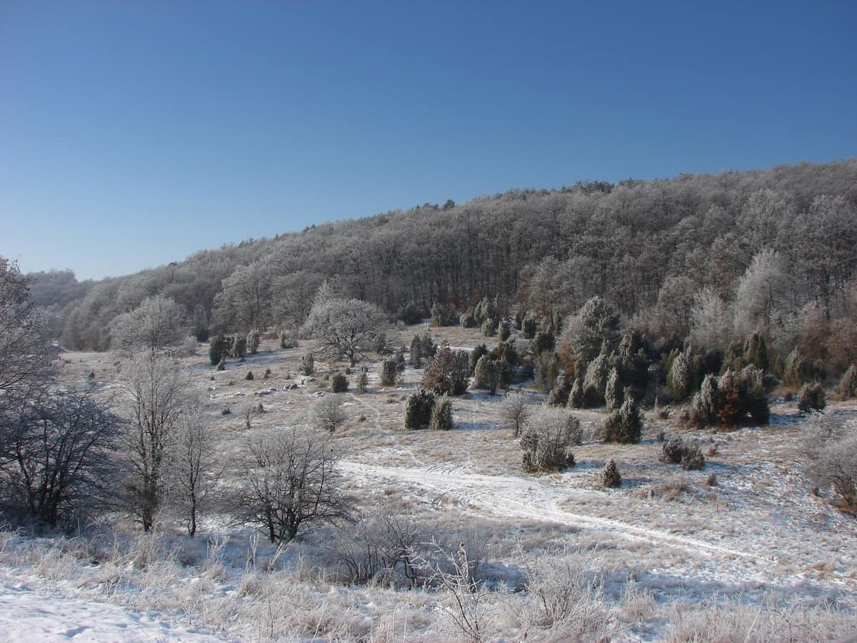
Aggtelek National Park
Aggteleki Nemzeti Park
Borsod-Abaúj-Zemplén (Aggtelek / Jósvafő) · Hungary
Photo: Kalyob · CC BY-SA 3.0 · Wikimedia Commons
Northern Hungary's karst plateau and cave systems, shared with Slovakia, including the Baradla-Domica network.
You enter through a cavern opening at the foot of a sheer white cliff, and within a few paces the subterranean air drops to around 10 °C as the world transforms in scale. Aggtelek National Park in northern Hungary was founded specifically to protect what lies beneath the limestone: 280 mapped caves, surface karst formations unique to soluble limestone, and one of Europe's largest dripstone caves. Above ground, rich life flourishes as well: oak and hornbeam woodlands, returning wolves, and a conservation stud of Hucul horses.
What makes it unique
Baradla Cave, stretching 26 km (8 km of which lie in Slovakia as Domica), is Europe's largest dripstone cave.
The place
Nature
The landscape
Aggtelek National Park was the first in Hungary created specifically to safeguard geological treasures: dramatic surface karst landforms and renowned stalactite caves. It spans 198.92 km², of which 39.22 km² enjoy heightened nature reserve protection across low-mountain terrain.
The genesis of this stone began in an ancient ocean. Most regional rocks formed during the Triassic period between 210 and 240 million years ago, when calcareous mud settled along the margins of the Tethys Ocean. At Vörös-tó, petrified remains of reef-building marine organisms remain plainly visible. Subsequent dissolution transformed limestone into karst, displaying nearly every surface feature typical of temperate karst plateaus.
Beneath this plateau, groundwater works ceaselessly. Around ninety karst springs issue from the subterranean labyrinth, feeding cave systems of remarkable mineralogical variety: local caverns exhibit roughly two-thirds of all known carbonate speleothem types recognized worldwide. Inside Meteor Cave lies the Hall of the Titans, among Hungary's largest subterranean chambers, housing massive stalagmites. In the Baradla–Domica system stands the world's tallest known stalagmite, measuring 37.2 m in height.
On the surface, sessile oak and European hornbeam forests predominate, yielding to montane beechwoods in deep humid ravines and lime-ash stands across plateau tops. Extreme microclimatic contrasts across karst plateaus, southern slopes, cave entrances, and dolines foster exceptional floral richness.
Wildlife and seasons
The park harbors 413 protected or strictly protected animal species. Its woodlands shelter abundant large mammals, notably red deer, roe deer, and wild boar, while the grey wolf and Eurasian lynx have re-established breeding packs across northern Hungary's mountains. Underground caverns host more than five hundred troglobitic and cave-dwelling species alongside 21 bat species—out of 28 bat species native to Europe, 21 occur right here.
Look skyward: the European ground squirrel provides key prey for raptors such as the common buzzard and the rare eastern imperial eagle. In the secluded forests nests the hazel grouse, Hungary's only resident native galliform bird, while the common kingfisher flashes along clear watercourses. The fire salamander serves as the park's official heraldic emblem. Lepidopteran diversity exceeds two thousand species, including Hungary's largest population of the scarce Apollo butterfly.
Among vascular plants, the endemic and strictly protected Onosma tornensis represents a botanical treasure. The park also maintains Hungary's sole state breeding herd of primitive Hucul horses, counting more than 120 animals.
Species
With a page in the atlas
Being mentioned in a source doesn't guarantee sightings: check with the people who manage the area.
Memory and protection
History and conservation
The national park was founded in 1985 and was inscribed on the UNESCO World Heritage list in 1995 jointly with the Caves of Slovak Karst.
Human presence extends deep into antiquity. At Rudabánya, fossil remains of Rudapithecus hungaricus were discovered, a hominoid primate living between 11.5 and 10 million years ago. More recently, the Polish settler village of Derenk was depopulated in 1943 to establish an aristocratic hunting estate; ruins of homesteads, the chapel graveyard, and the village school remain visible today.
The Jósvafő Environmental Education Centre, opened in 2004, hosts seminars, field courses, and nature school camps.
Before you set off
Visiting
How to visit
Most explorations begin underground, with three distinct tour itineraries available. The short tour of Aggtelek lasts about 60 minutes, graded easy over 1 km and 166 steps. It winds through grand halls adorned with stalactites, stalagmites, columns, and curtains; blackened cave walls and soot deposits preserve the memory of early human explorers from thousands of years ago. The cavern's Concert Hall is acclaimed for world-class acoustics.
The short tour of Jósvafő covers 1,400 m round-trip, taking about 60 minutes with moderate difficulty due to elevation changes. The first half showcases tectonic folds and faults, while the second half opens into lavishly decorated speleothem galleries. The medium tour departing from Vörös-tó spans 2.3 km, taking roughly 100 minutes.
Individual visitors cannot book online tickets in advance: admission must be purchased at the cave ticket office for the next scheduled departure. Subterranean temperatures remain consistently chilly on all routes, requiring warm layers.
Baradla Cave has welcomed visitors for centuries: its earliest written mention dates to 1549, developed tourist paths were installed in 1806, and organized tourism has operated since 1920. Its natural portal at Aggtelek sits dramatically below an imposing white cliff overlooking the village edge. Another cave, the Cave of Peace (Béke-barlang), houses a subterranean sanatorium for respiratory therapy.
Before you go
Check with park administration for updated tour schedules and open cave sectors before travelling. Individual visitors cannot reserve online: purchase tour tickets at the cave ticket office. Dress warmly: subterranean temperatures remain around 10 °C year-round.
Check access, rules and visiting conditions in the official information from the managing body before you set off.
Location
Where it is and how far it reaches
Boundary of Aggteleki Nemzeti Park · © EEA, CDDA (CC-BY) The coordinate is estimated; it isn't a verified access point.
Transparency
Sources
The research data with its sources, and the official links for this place, are in the Spanish version of this page. See the Spanish version
Around it
The Muráň River Gorge lies about 10 km away. Further afield, Buila-Vânturarița National Park - Bistrița Gorge and Jiu Gorge National Park - Primeval Forest share karst geology and subterranean bat communities with Aggtelek.
If you like this place, elsewhere in Europe
Distant places with uncommon wildlife and habitats in common. The most widespread species don't count. Sharing species doesn't imply a corridor or guaranteed presence.
- Vârghiș Gorge
Harghita and Covasna Counties (Baraolt / Vârghiș)
In common: Greater mouse-eared bat · Greater horseshoe bat — karst and caves
Limestone gorge reserve with over 120 caves of major chiropterological importance (Peștera Merești).
JFMAMJJASONDMay – October · Crowding low
Entry #1029 of the original atlas.