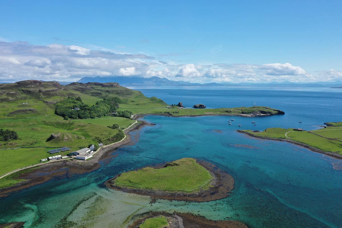
Isle of Canna
Canna
Scotland (Inner Hebrides / Small Isles) · United Kingdom
Photo: PaulT (Gunther Tschuch) · CC BY-SA 4.0 · Wikimedia Commons
Owned by the National Trust for Scotland, famed for Compass Hill, a basalt hill containing magnetite that distorts passing ship compasses.
Near Canna, compasses lie. Compass Hill, perched on the island's eastern fringe, holds so much magnetic iron ore that it deflects shipboard needles, drawing them toward the rock instead of magnetic north. Canna is the westernmost of the Small Isles in the Inner Hebrides: 6.9 km long by 1.6 km wide, linked to neighboring Sanday by a footbridge and tidal sands at low water. Its previous owners gifted it to the National Trust for Scotland in 1981, and it is run as a working farm and nature reserve.
What makes it unique
An island where the compass needle swerves, puffins nest on basalt cliffs, and an invaluable archive of Gaelic song rests in a Georgian manor.
The place
Nature
The landscape
Canna is ancient fire turned cold. Its bedrock comprises a stepped sequence of Paleocene basalt lava flows of the Canna Lava Formation, evident across the island: tiers of columnar basalt along the eastern shore and sheer cliffs plunging into the northern Atlantic. The highest point is Càrn a' Ghaill, "the rocky hill of the storm", at 210 m, while Compass Hill rises to 139 m of weathered volcanic tuff.
Between Canna and Sanday lies a natural sheltered harbour, the only deep-water haven in the Small Isles and heavily frequented by west-coast cruising yachts. On the slopes of Compass Hill, walkers seek out bell heather, Hebridean spotted-orchids, and wild primroses.
Wildlife and seasons
More than twenty thousand breeding seabirds crowd the sea cliffs, and the finest vantage is always toward the waves. Canna is celebrated for white-tailed eagles, golden eagles, and Atlantic puffins, alongside peregrine falcons and merlins; along the bluffs raptors hunt within sight of seabird colonies. The white-tailed eagle and golden eagle share the skies with the Atlantic puffin, razorbill, and common murre.
The bird colonies have a striking recent recovery story. Introduced brown rats once preyed heavily on nesting Manx shearwaters; a total eradication was launched, and by late 2006 Canna was declared rat-free. Breeding puffins and razorbills rebounded, and Manx shearwaters nested successfully for the first time since 1997. Ahead of baiting, an endemic population of wood mice—regarded as a distinct island subspecies—was temporarily removed to safety.
Offshore, the Sound of Canna between Canna and Rùm is a renowned corridor for cetaceans, with frequent encounters of minke whales. In the sheltered bay, grey seals and harbour seals haul out on skerries, particularly during tranquil winter months. The optimum season spans May to September, and from May to August a citizen-science puffin monitoring initiative encourages visitors to photograph puffins bringing fish to burrows.
Species
With a page in the atlas
Being mentioned in a source doesn't guarantee sightings: check with the people who manage the area.
Memory and protection
History and conservation
Canna has been inhabited since Neolithic times, yielding ceramic shards and enigmatic subterranean souterrains. Bronze Age remains feature hut circles and field boundaries, followed in the Iron Age by the promontory fort of Dun Channa. At Keill, two richly carved Celtic high crosses dating from the VIII-IX centuries testify to an early monastic foundation. Local folklore recounts that offenders had their thumb wedged into a socket on the Punishment Stone, an ancient standing stone at Keill.
Viking settlers left deep toponymic imprints such as sgor (sea-stack), gearaid (enclosure), tota (homestead), and Sanday ("sand island"). Economic hardship followed: following the kelp boom, in 1821 many islanders emigrated to Canada, and in 1847, following potato crop failures, the inhabitants of Keill were evicted to make way for sheep grazing. In 1938 folklorist John Lorne Campbell purchased Canna and managed it as a farm and sanctuary. Canna House preserves the Campbell and Shaw archives of Scottish Gaelic literature, folklore, and song.
Most of Canna is designated a Site of Special Scientific Interest (SSSI). Following rat eradication, rabbit numbers exploded, undermining archaeological earthworks and vegetable gardens; the following year some 9,000 rabbits were culled out of an estimated 16,000.
Before you set off
Visiting
How to visit
Access is aboard the CalMac ferry MV Lochnevis, linking Canna with Rùm, Eigg, Muck, and the mainland port of Mallaig in two and a half hours. Bringing private vehicles onto the island requires prior permission from the National Trust.
The Canna Bay Walk departs directly from the pier, takes an hour and a half, and provides an easy, low-level walk sheltered from winds. The hike up Compass Hill also sets off from the pier, taking about an hour and a half; the ascent offers an easier zig-zag path along the right-hand shoulder. The Puffin Trail starts beside St Edward’s Church, requires two hours, and leads out to the seasonal puffin breeding colony on the Puffin Stacks of Sanday. Along the path, coastal heathland hosts Hebridean orchids, caterpillars, butterflies, and day-flying moths, while Sanday’s moorland provides sightings of common snipe, skylarks, lapwings, great skuas, cormorants, and auks.
Before you go
Canna has no mobile network coverage and roads are entirely unpaved gravel tracks.
Check access, rules and visiting conditions in the official information from the managing body before you set off.
Location
Where it is and how far it reaches
Boundary of Canna · © OpenStreetMap contributors (ODbL) The coordinate is estimated; it isn't a verified access point.
Transparency
Sources
The research data with its sources, and the official links for this place, are in the Spanish version of this page. See the Spanish version
Around it
The Isle of Rum National Nature Reserve lies some 6 km across the sound, overlooking the waters where whales and dolphins surface.
What else to explore nearby
Approximate straight-line distance between the edges of each area. It doesn't indicate access, routes or driving times.
- Isle of Rum National Nature Reserve
Scotland (Inner Hebrides / Rum / Kinloch)
About 6 km away
The largest of the Small Isles, a volcanic island reserve where a third of the world's Manx shearwater (Puffinus puffinus) population nests.
JFMAMJJASONDMay – October · Crowding very low
Entry #621 of the original atlas.