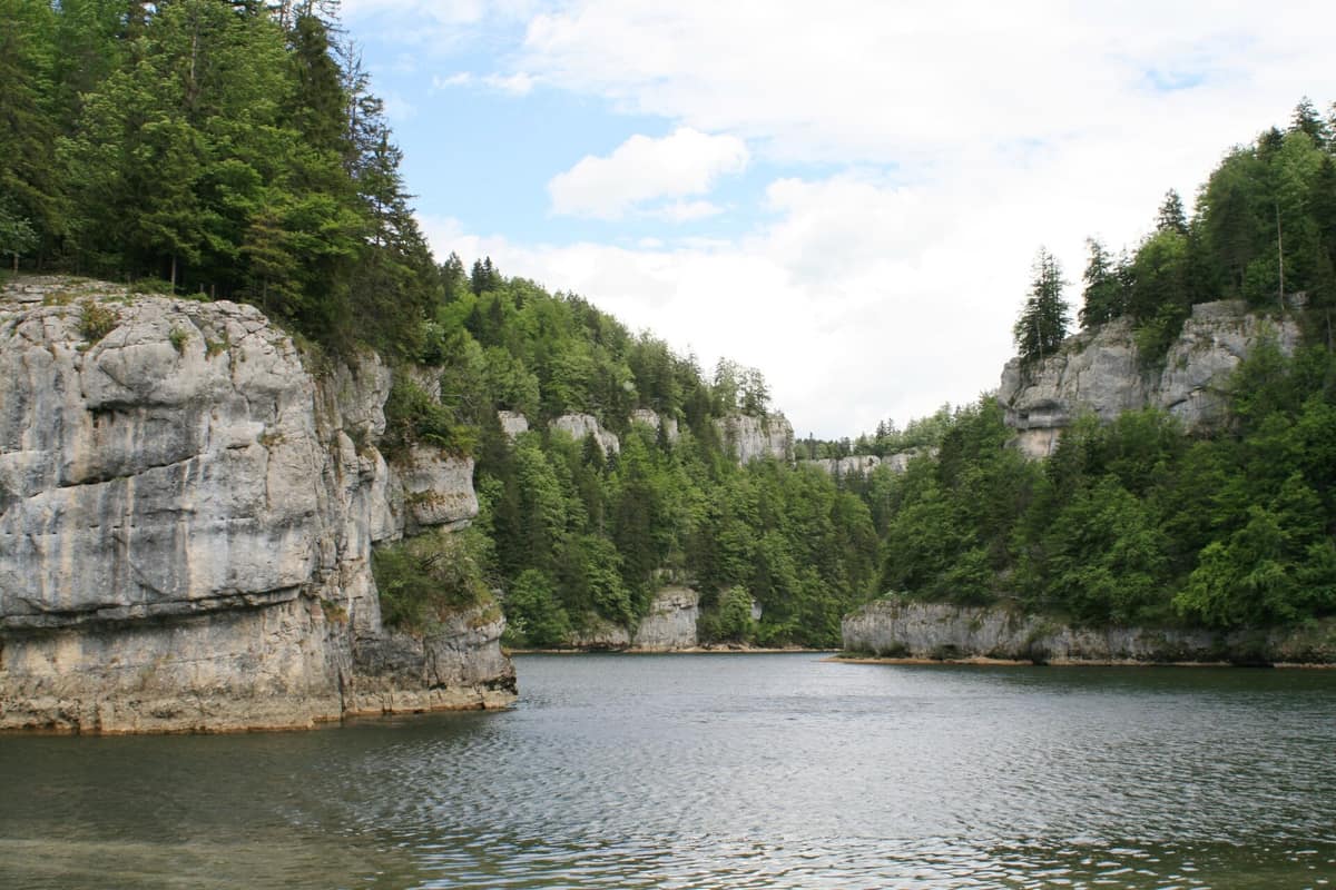
Gorges of the Doubs River
Gorges du Doubs - Franco-Suisses
Doubs (FR) / Canton of Jura (CH) · France / Switzerland
Photo: Wernain Samuel at French Wikipedia · CC BY-SA 3.0 · Wikimedia Commons
A meandering river canyon marking the natural frontier between France and Switzerland with limestone cliffs and cascading falls.
A river serves as both an international border and a regional backbone. Flowing out of Lake Les Brenets, the Doubs plunges 27 metres down an echoing cascade, the Saut du Doubs, then carves its course from west to east between Switzerland and France, deeply entrenched in a steep-sided gorge towards Saint-Ursanne. It constitutes the core axis of the Parc du Doubs, a Swiss regional nature park covering about 300 square kilometres, and the setting of cross-border gorges where the river defines the park's northern fringe.
What makes it unique
A river acting simultaneously as a national border and ecological corridor, featuring a 27-metre waterfall born of a prehistoric landslide at a lake outflow.
The place
Nature
The landscape
It all began some 12,000 years ago when catastrophic landslides detached from both valley flanks, likely triggered by a seismic tremor. The resulting mass created a natural dam impounding the upstream gorge, forming the ancient Lake Morteau of which Lake Chaillexon (or Les Brenets) is the living remnant. The diverted Doubs now leaps over the limestone precipice at the Saut du Doubs. The natural dam remains semi-permeable, formed of loose limestone rubble, causing noticeable seasonal lake fluctuations.
Downstream, the Doubs winds along the canyon floor between Les Brenets and Saint-Ursanne. Above lie the wooded pastures and deep spruce-fir forests of the Franches-Montagnes, shaped over centuries by horse breeding and cattle grazing, crowned by the park's highest summit, Pouillerel at 1,275 metres, offering panoramic vistas from the Alps to the Vosges in clear weather. At Lake Biaufond, the Refrain reservoir forms a tranquil mirror framed by wooded bluffs, offering sanctuary for wild waterfowl.
Halfway between Saignelégier and Tramelan, the Étang de la Gruère nestles within an ancient peat bog, preserved within a nature reserve whose ericaceous vegetation recalls Scandinavian taiga.
Wildlife and seasons
The Doubs is guarded by precipitous banks, harbouring exceptional yet vulnerable aquatic life including the critically endangered Rhône streber and the endemic painted fritillary. The trout of the Doubs remains characteristic of the river, though wild stocks are restricted.
Along the water, the white-throated dipper is well established throughout the canyon; a pioneer census in June 2010 located multiple breeding pairs downstream of the Refrain dam. The common kingfisher is more elusive, boring nesting burrows into soft earthen banks. Along the limestone cliffs nests the peregrine falcon, present year-round and hunting ducks or wintering passerines in the valley; scattered pairs of Eurasian eagle-owls breed in the crags, while the boreal owl depends on black woodpecker tree cavities. The Eurasian lynx roams the forested slopes.
Species
With a page in the atlas
Being mentioned in a source doesn't guarantee sightings: check with the people who manage the area.
Memory and protection
History and conservation
Suspended above the river gorge, the Échelles de la Mort link Switzerland and France: originally wooden ladders used by cross-border smugglers, today replaced by secure steel rungs anchored directly into the rock face. These dizzying ladders and the entire Valley of Death bear witness to the fear and folklore once evoked by this isolated chasm.
The Doubs faces ecological strains from hydroelectric peaking, residual wastewater, agricultural runoff, and riverbed modifications, solvable only through binational management: since 2011, joint French-Swiss working groups have implemented concerted remediation programmes. The park inventories and marks veteran habitat trees across woodlands, and its 2016 and 2017 ecological infrastructure survey gathered one hundred and sixty thousand observations across more than six thousand species. The park charter identifies the Doubs valley as a major regional ecological corridor.
Before you set off
Visiting
How to visit
The waterfall is the signature excursion: from Les Brenets railway station it is reached via an agreeable woodland walk or by passenger boat from the port; foot access is also provided by the GR 5, concurrent here with the Grande Traversée du Jura. The premier route is the Chemin au fil du Doubs, a four-day, sixty-eight-kilometre trek between Les Brenets and Saint-Ursanne, divided into daily stages of nineteen, twenty-one, thirteen, and fifteen kilometres, lasting four to five and a half hours each.
To interpret the terrain, the park publishes an annual calendar of naturalist outings, while the Centre Nature Les Cerlatez, founded in 1993, hosts exhibits and guided tours of the Gruère reserve, alongside tracking excursions searching for lynx sign; it is accessible by PostBus. A gentle 600-metre boardwalk encircles the Gruère pond, allowing visitors to appreciate mire ecology without disturbance.
Before you go
Information for Parc du Doubs pertains to the Swiss side, while the Échelles de la Mort sit on the French side. Verify path accessibility and seasonal boat timetables to the waterfall before setting out.
Check access, rules and visiting conditions in the official information from the managing body before you set off.
Location
Where it is and how far it reaches
Boundary of Doubs Horloger · IUCN V · © EEA, CDDA (CC-BY) The coordinate is estimated; it isn't a verified access point.
Transparency
Sources
The research data with its sources, and the official links for this place, are in the Spanish version of this page. See the Spanish version
Around it
Very close by lie the Loue Valley and Gorges, and twenty-six kilometres away is Haut-Jura Regional Nature Park.
Further afield, the Upper Ain Valley, Acheron River Wild Upper Gorge, Kvačianska Valley, and Tyroler Lechtal Nature Park share dippers, trout, or lynx with the Doubs.
What else to explore nearby
Approximate straight-line distance between the edges of each area. It doesn't indicate access, routes or driving times.
- Haut-Jura Regional Nature Park
Jura / Ain / Doubs (Saint-Claude / Les Rousses)
About 26 km away
The highest crests of the Jura Range (Crêt de la Neige 1,720 m) with ancient spruce forests and peat bogs.
JFMAMJJASONDMay – October · Crowding low
Entry #242 of the original atlas.