Käina Bay and Kassari Landscape Conservation Area
Käina lahe-Kassari maastikukaitseala
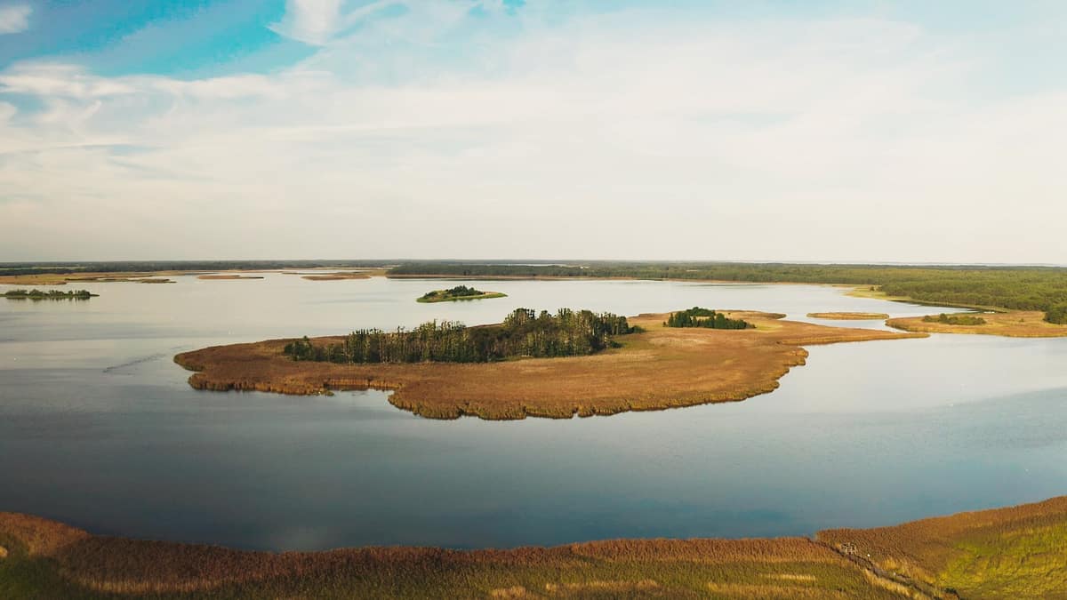
Hiiu — Käina and Vaemla bays and Kassari Island · Estonia
Photo: Esthonos · CC BY-SA 4.0 · Wikimedia Commons
Brackish coastal bays and semi-natural alvar meadows with observation platforms at Orjaku.
A thousand years ago, two separate islands lay here: Kassari to the east and Orjaku to the west. They merged into one roughly five hundred years ago. Today Kassari and Käina Bay form a landscape conservation area in southeastern Hiiumaa: 5652 ha of which 3189 comprise dry land, with the remainder composed of shallow brackish inlets, reedbeds, and coastal meadows. The bay is very shallow, covering around 9 km² with a maximum depth of barely one metre, shielded from the open Väinameri Sea by Kassari.
What makes it unique
Home to the sole surviving Estonian population of slender hare's ear (Bupleurum tenuissimum).
The place
Nature
The landscape
The island of Kassari is an intimate coastal realm of some three hundred inhabitants scattered across four historic villages: Esiküla, Kassari, Orjaku, and Taguküla. Its coastline, stretching over 56 km, is deeply indented. A glacial esker ridge traverses the island from north to south, reaching 15 metres above sea level at its highest elevation. Dense juniper stands and coastal meadows dominate the vegetation, with Kassari harbouring rich alvars, wooded meadows, and semi-natural coastal pastures.
The bay presents a contrasting environment: calm brackish waters, numerous emergent islets, and expansive reedbeds.
Wildlife and seasons
The seasonal rhythms of the reserve are set by migratory waterfowl. Shallow Käina Bay with its sheltering reed fringes and shoreline meadows serves as a vital staging post for thousands of waterbirds and shorebirds during spring and autumn migration, gathering here to rest and feed in safety. For this reason, the reserve is best visited during those two passage seasons. Well-positioned observation towers at Silmakare and along the Orjaku nature trail allow fine viewing of both migrants and local breeders.
Beside the walking track lies a restored coastal grazing meadow, illustrating the positive role of low-intensity human grazing in maintaining open biodiversity.
Memory and protection
History and conservation
Kassari first appears in written records in 1520. In the nineteenth century, Orjaku harbour was constructed, functioning today as a small-craft marina. From an ecological perspective, the reserve safeguards the only surviving Estonian population of the endangered umbellifer Bupleurum tenuissimum, along with a cherished semi-natural landscape of open, wooded, and coastal meadows.
Before you set off
Visiting
How to visit
Begin your exploration at Orjaku. There you will find a timber boardwalk and observation platforms looking out across Käina Bay, two of which are fully accessible for prams and wheelchairs. The Orjaku educational trail measures between 0.7 and 2 km, guiding visitors through distinct wetland habitats; the birdwatching and identification experience typically takes two to three hours.
To complement nature with local culture, the estate manager's residence of the historic Kassari manor houses an exhibition curated by the Hiiumaa Museum. The people of Kassari were traditionally known in folklore as the "hare island folk".
Before you go
Seasonal access restrictions apply across sensitive sectors of Käina and Vaemla bays: check the environmental board's regulations before visiting. The management requires all dogs to be kept on leads. Open campfires are strictly prohibited at Orjaku.
Check access, rules and visiting conditions in the official information from the managing body before you set off.
Location
Where it is and how far it reaches
Boundary of Käina lahe-Kassari maastikukaitseala · © EEA, CDDA (CC-BY) The coordinate is estimated; it isn't a verified access point.
Transparency
Sources
The research data with its sources, and the official links for this place, are in the Spanish version of this page. See the Spanish version
Around it
The Vormsi Landscape Conservation Area lies around twenty-three kilometres to the east, while the Kõpu Nature Reserve is situated some twenty-five kilometres away.
What else to explore nearby
Approximate straight-line distance between the edges of each area. It doesn't indicate access, routes or driving times.
- Kõpu Nature Reserve
Hiiu — Kõpu Peninsula, Hiiumaa
About 25 km away
Coastal dune forests, ancient fossil bluffs, and calcareous spring fens on Western Estonia's oldest landmass.
JFMAMJJASONDNo recommended season · Crowding no data
Entry #1068 of the original atlas.