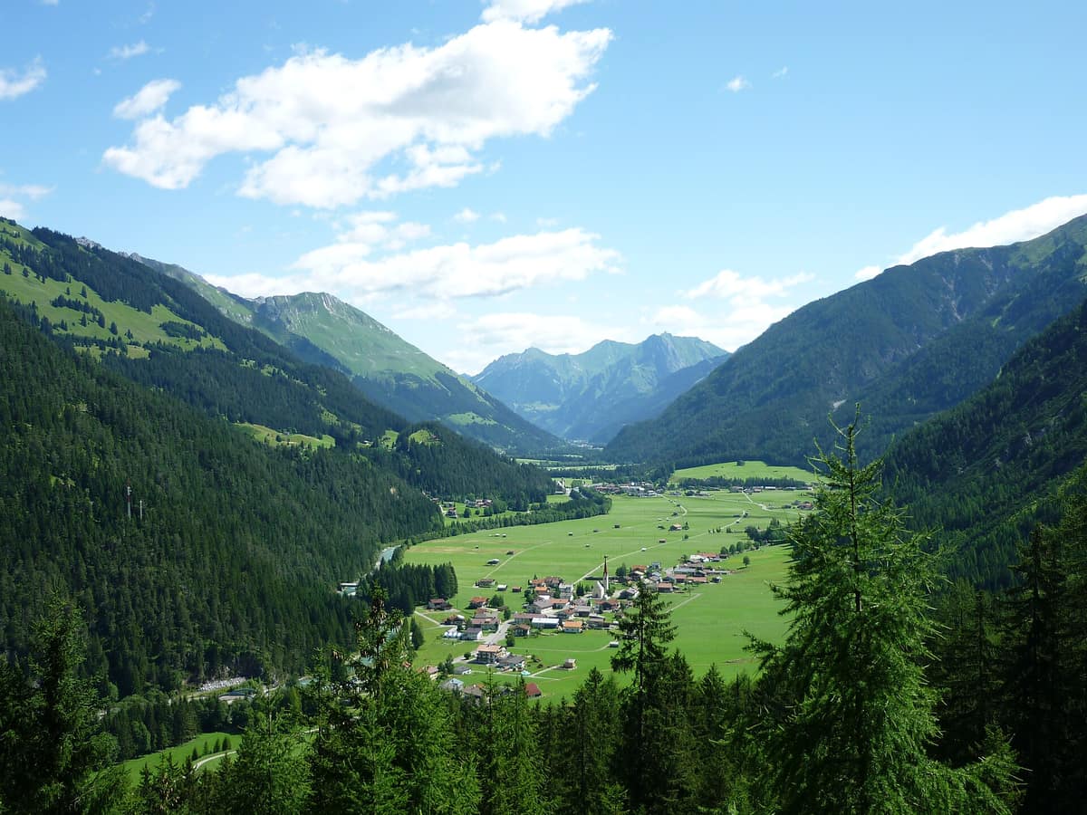
Tyrolean Lech Valley Nature Park - Lechtal Alps
Naturpark Tiroler Lechtal - Lechtaler Alpen
Tyrol (Elbigenalp / Reutte) · Austria
Photo: StevRush · CC BY-SA 3.0 · Wikimedia Commons
The last unconstrained, wide braided wild river system of the Northern Limestone Alps.
Across the European Alps almost every river is hemmed in by stone walls, flood embankments or hydropower dams. The Tyrolean Lech is the magnificent exception. It remains the last wild braided river of the Northern Alps, a dynamic force reaffirmed with every seasonal flood: following heavy rainfall and during spring snowmelt, its landscape can transform completely within hours. The Naturpark Tiroler Lech protects this braided gravel river flowing between the Allgäu and Lechtal Alps, along with its riparian gallery forests, dynamic gravel bars and pristine tributary valleys.
What makes it unique
Tyrol’s only nature park centered on a valley floor, where an alpine river still shapes its course freely.
The place
Nature
The landscape
You recognize a wild river by what it does with gravel and stone. The Lech features dynamically shifting multiple channels, expansive gravel islands and broad floodplain woodlands of willow, grey alder and dry pine forest. That bedload sediment forms its structural spine: if the natural transport of bedload gravel were halted, the Lech would incise into its floor, its gravel bars would vanish, and it would become a sterile, canalised river through the valley. From a distance, all river pebbles appear monochrome grey; viewed up close they reveal greens, reds, pinks and whites, each stone telling the story of its geological origins.
The regional bedrock is ancient. During the Late Triassic, roughly 220 million years ago, the Raibl strata formed in shallow tropical seas fringed by reefs. The protected territory, highly fragmented into linear corridors, encompasses elevations spanning 810 to 1780 m, with protected parcels extending from the German border up to the headwaters of the Lech. High above tower the Lechtaler Alpen, culminating at Parseierspitze at 3036 m, the only three-thousand-metre peak in the entire Northern Limestone Alps.
This continuous interface of river and forest yields a remarkable botanical result: no other alpine river corridor in the Northern Alps serves so effectively as an ecological corridor for plant dispersal between the Alps and the Jura. Here grows one third of all Tyrolean flora—1.116 distinct plant species—and one third of them (392) are highly prized and threatened. Riverine dwarf junipers and gravel bars of German tamarisk are especially celebrated.
Wildlife and seasons
The open gravel bars provide critical nesting grounds for the common sandpiper and little ringed plover. Their clutches, laid directly in camouflaged scrapes among gravel stones, are constantly vulnerable to floods, natural predators, and disturbance from careless people or roaming dogs. This makes remaining strictly on waymarked trails imperative.
At Fallerschein a dedicated wildlife viewing station allows visitors to observe red deer without causing disturbance. Among flora, a delicate slipper-shaped orchid thrives in the semi-shaded floodplain forests, while in lake Riedener See, strikingly turquoise, highly mineralised water wells up from sub-lacustrine springs within the lake bed itself.
During winter, guided ranger walks offer wildlife tracking in the snow, and down in the valley floor a continuous cross-country ski trail stretches nearly 40 km from Forchach to Steeg.
Species
With a page in the atlas
Being mentioned in a source doesn't guarantee sightings: check with the people who manage the area.
Memory and protection
History and conservation
Around 15 BC, the Roman legions of Augustus arrived, eventually constructing the Via Claudia Augusta. The ancient hydronym "Lic" may trace its roots to the Likatier, an early Celtic tribe. Centuries later, the "Schwabenkinder"—older children from impoverished alpine families—trekked over the mountains into the Allgäu towards child labour markets in Kempten or Isny to work seasonal contracts.
To secure farmland and settlements, nineteenth-century engineers channelised the Lech behind stone dykes, which proved counterproductive: where the river had retained its broad braided bed, flood destruction was far less severe. Today those artificial training works are progressively removed in what is heralded as a European benchmark for river restoration. While an official national park was originally envisioned for the Lechtal, authorities settled on a nature park, partly due to hunting stakeholder concerns. In 2004 the Tyrolean provincial government established a nature reserve combined with nature park status, and the Lech has been designated a Natura 2000 protected zone since June 2000.
Before you set off
Visiting
How to visit
The park visitor centre, Naturparkhaus Klimmbrücke, is perched atop a bridge spanning the Lech near Elmen. It houses the park administration and the permanent interactive exhibition "Abenteuer Wildfluss". The display guides visitors along the river system across gravel banks, side valleys and floodplain woods to highlight the rare flora and fauna of the Lech. Guided outings led by official nature interpreters set out directly from the centre.
The Jöchelspitze botanical trail traverses ridges between the Lechtal and Allgäu Alps. The outing to Fallerschein leads to the wildlife observation hide. And Riedener See provides an easy stop to marvel at deep turquoise waters.
Before you go
Open fires are strictly prohibited throughout the nature park; designated barbecue areas are provided. Dogs must be kept on leashes at all times across the protected areas. Operating drones without written permit from nature conservation authorities is prohibited. Off public motorways, driving motor vehicles is banned. Harvesting flora, fungi or taking fauna is strictly forbidden.
Check access, rules and visiting conditions in the official information from the managing body before you set off.
Location
Where it is and how far it reaches
Boundary of Tiroler Lech · IUCN V · © EEA, CDDA (CC-BY) The coordinate is estimated; it isn't a verified access point.
Transparency
Sources
The research data with its sources, and the official links for this place, are in the Spanish version of this page. See the Spanish version
Around it
Other dynamic river systems that share this braided fluvial corridor character include Gesäuse National Park, Acheron River Wild Upper Gorge, Gorges du Doubs and Haute Vallée de l'Ain.
If you like this place, elsewhere in Europe
Distant places with uncommon wildlife and habitats in common. The most widespread species don't count. Sharing species doesn't imply a corridor or guaranteed presence.
- Gesäuse National Park - Enns Gorge
Styria (Admont / Hieflau)
In common: White-throated dipper · Chamois — river corridor, high mountain, old-growth forest
Vertical limestone precipices towering over 1.000 m above the thundering whitewater of the Enns river.
JFMAMJJASONDMay – October · Crowding low
Entry #349 of the original atlas.