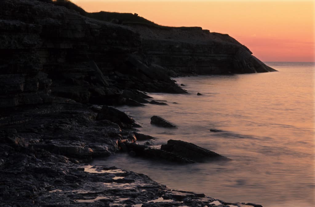
Osmussaar Landscape Reserve
Osmussaare maastikukaitseala
Läänemaa — Lääne-Nigula, island of Osmussaar · Estonia
Photo: Tõnis Saadre · CC BY-SA 3.0 · Wikimedia Commons
Alvar grasslands and limestone coast shaped by the sea in a Baltic island reserve.
Between 2000 and 3000 years ago, a section of the great Baltic limestone escarpment broke the surface and was left alone. That is Osmussaar: an island of rock, gravel and wind reached by boat from the port of Dirhami in twenty to thirty minutes. Estonia's Swedes called it Odensholm, the island of Odin. Its landscape reserve, created in 1996, protects what that isolation has preserved: geological features, birds and the memory of a people who lived here until 1944.
What makes it unique
A limestone island of alvar grasslands, with a cliff the sea keeps shaping and boulders born from a meteorite explosion.
The place
Nature
The landscape
On the north coast you can see a stretch of the Baltic klint, a cliff running 1200 km of coastline that here, on an island, can be seen close up. It is not a wall that stays still: it changes slowly under the action of the sea. The south, by contrast, is low and flat, and there several lakes lie, such as Inahamne and Kappelkärre. They were bays until the land rose and separated them from the sea. The rise is still visible in one detail: the chapel, built by the harbour, stands today a kilometre and a half from it.
Among the rocks there is something less common. Nearly 60 boulders of gneiss breccia came from the explosion of a meteorite that occurred 535 million years ago. The best known are Skarvan and the Twins, the Kaksikud.
The reserve brings together coastal lagoons open to the sea, cliffs, meadows, low bogs and old broadleaved forests, and among them the alvar grasslands stand out — open pastures on limestone. To keep them open, Highland cattle graze on the island. The flora is extensive: between 1885 and 1998 a total of 607 species of vascular plants were recorded, 25 of them protected, and of those protected 14 are orchids. There are also 129 species of mosses.
Wildlife and seasons
Osmussaar lies on the Eastern Atlantic Flyway, through which millions of birds pass, and the numbers reflect it: 178 species have been observed and in 2003 a total of 90 breeding birds were found, 63 of them protected. For this reason in May and June you should avoid disturbing birds near the southern harbour, at Cape Boan and at Lake Inahamne.
On land the beaver, the fox and several bat species live, and on the coast you can see the grey seal. Among the amphibians there are the smooth newt, the common toad and the moor frog, and among the reptiles the grass snake. The insects contribute figures of another scale: 226 species of macro-lepidoptera and 158 of micro-lepidoptera.
If you are interested in plants, there is a guided orchid walk where you learn to identify different species.
Memory and protection
History and conservation
Before the last of Estonia's Swedes fled in 1944, the island had a single village, Bien, of seven farms. The limestone chapel was consecrated in 1766 and the battles of 1941 nearly destroyed it; today its restored ruins remain. The current lighthouse, of reinforced concrete and 35 metres tall, was completed in 1954, after Soviet troops blew up its predecessor in 1941. Earlier, on the night of 26 August 1914, the German cruiser Magdeburg ran aground off the island and its crew blew it up.
The island was demined between 1996 and 1998 and is today one of the areas of Estonia most free of unexploded ordnance. Since 2001 permanent inhabitants have lived there again.
Before you set off
Visiting
How to visit
The reference route is the RMK trail, 9 km long. It starts at the southern harbour and follows the path to the northwest, beside the cliff coast. Along the way you encounter breccia boulders, relict lakes, extensive gravel banks, junipers and military defences. It has two information boards, one at each end of the island, and six points of interest. At the north-western tip stands the black-and-white striped lighthouse, admired from outside.
With a local guide you can choose the route; the traditional walk is around 8 or 9 km and can last up to six hours. There is also a driving route along the coast, about 12 or 13 km, for those who cannot walk much.
Before you go
Arrival must be arranged in advance with the island foundation or with RMK: you cannot get there on your own. Camping and fires are allowed only in the places RMK provides. It is not recommended to bring dogs, and you must avoid disturbing the sheep. Take all your waste back with you.
Check access, rules and visiting conditions in the official information from the managing body before you set off.
Location
Where it is and how far it reaches
Boundary of Osmussaare maastikukaitseala · © EEA, CDDA (CC-BY) The coordinate is estimated; it isn't a verified access point.
Transparency
Sources
The research data with its sources, and the official links for this place, are in the Spanish version of this page. See the Spanish version
Around it
The other landscape reserves on the Estonian coast are a similar distance away: Pakri, about twenty-six kilometres, and Vormsi, about twenty-eight kilometres.
What else to explore nearby
Approximate straight-line distance between the edges of each area. It doesn't indicate access, routes or driving times.
- Pakri Landscape Reserve
Harjumaa — Lääne-Harju, Pakri peninsula and islands
About 26 km away
Sea cliffs and limestone formations in the reserve of the Pakri peninsula and islands.
JFMAMJJASONDAll year · Crowding no data
Entry #1073 of the original atlas.