Pakri Landscape Reserve
Pakri maastikukaitseala
Harjumaa — Lääne-Harju, Pakri peninsula and islands · Estonia
Photo: Ivar Leidus · CC BY-SA 3.0 · Wikimedia Commons
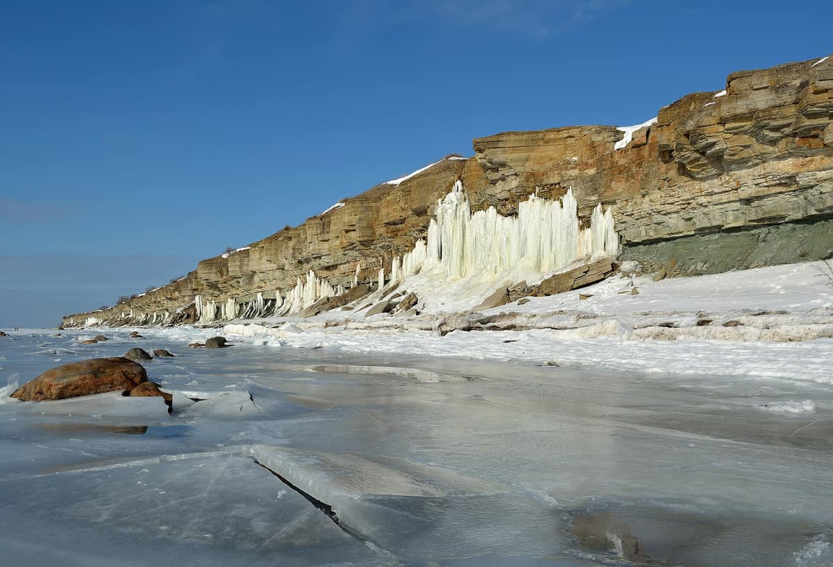
Sea cliffs and limestone formations in the reserve of the Pakri peninsula and islands.
The sea gnaws here at a limestone cliff that crumbles in slow motion. At Cape Pakri, at the tip of the peninsula that juts twelve kilometres into the Baltic, the coast rises to about 25 metres and is so close to falling that lighthouse builders had to erect another one when the precipice drew too close to the first. The Pakri landscape reserve, created on 18 May 1998, protects that coast, the islands of Väike-Pakri and Suur-Pakri, the sea between them and the islets of Kappa and Bjärrgronne.
What makes it unique
A limestone cliff that the waves keep undermining, with a new lighthouse built to escape its edge.
The place
Nature
The landscape
The Pakri peninsula is 12 km long and covers about 40 km², projecting from north-west Estonia into the sea. Its highest wall, about 25 metres, is at the cape. The rock is not uniform: vertical fractures and layers of different hardness leave a jagged edge prone to rockfalls. Below, the waves ceaselessly bite into the sandstone at the base; above, the limestone holds out until the void overcomes it. Springs also emerge on the cliff face.
On the islands the escarpment is lower. It forms part of the Baltic klint and rises to 4 m on Suur-Pakri and to 13 m on Väike-Pakri. On the islands, the reserve protects the limestone cliffs, the alvars and the rare species.
Wildlife and seasons
Pakri is protected for its landscape more than for any particular animal: limestone cliffs open to the sea and, on the islands, the alvars, that thin layer of soil over rock. The reserve was created in 1998 to care for them, together with the rare species that live there.
There is no bad time to visit. The coastal route, from Paldiski to the cape, is proposed in any season. That said, the cliff edge changes: check its state before approaching.
Memory and protection
History and conservation
Pakri has two overlapping pasts. The first is Swedish: the islands are called Rågöarna, the rye islands, because rye was the main crop, and in 1345 five Swedish families bought the western island from the monastery of Padise. For centuries they were inhabited by Estonia's Swedes, until the Second World War forced all the civilian population to leave. The second is that of the tsars: in 1718 Peter I decided to build a deep-water, ice-free military port in Pakri Bay. The plan was never fully executed, but the ruins of the sea fortress, the Muula mäed, remain near the end of Muuli Street, with its bastions.
The most recent past was military. From 1944 to 1991 the islands served as a firing range for aerial bombardments. When the last Russian troops left, in 1994, Estonia began to remove the unexploded ordnance. In 2004 the islands had their first permanent inhabitant in decades.
Before you set off
Visiting
How to visit
The way to understand the place is to walk it. The Paldiski route, 15 km long, is circular and is done clockwise: it starts at Paldiski station, follows the coast to Cape Pakri and returns via the wind farm. It is estimated at five hours and is possible all year. The first section is waymarked with the blue and white stripes of the coastal trail; the second returns to town along public paths.
Towards the north the cliff gains height and you must climb a staircase to reach the top of the wall. At the cape two lighthouses await you: the walls of the old fire depot of Peter I and the new one, of 1889, the tallest in Estonia. The red limestone tower stands 52 metres from its base and its light is 73 metres above sea level. Paldiski is reached by car, electric train or bus from Tallinn.
Before you go
The cliff crumbles: do not approach the edge. The reserve manager publishes the regulations and zoning of the different sectors; consult them before visiting the islands.
Check access, rules and visiting conditions in the official information from the managing body before you set off.
Location
Where it is and how far it reaches
Boundary of Pakri maastikukaitseala · © EEA, CDDA (CC-BY) The coordinate is estimated; it isn't a verified access point.
Transparency
Sources
The research data with its sources, and the official links for this place, are in the Spanish version of this page. See the Spanish version
Around it
The Osmussaar landscape reserve is about twenty-six kilometres away along the Estonian coast.
What else to explore nearby
Approximate straight-line distance between the edges of each area. It doesn't indicate access, routes or driving times.
- Osmussaar Landscape Reserve
Läänemaa — Lääne-Nigula, island of Osmussaar
About 26 km away
Alvar grasslands and limestone coast shaped by the sea in a Baltic island reserve.
JFMAMJJASONDNo recommended season · Crowding no data
Entry #1074 of the original atlas.