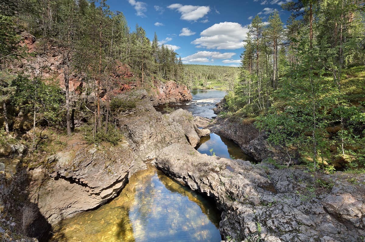
Oulanka National Park
Finnish Lapland / North Ostrobothnia (Kuusamo / Salla) · Finland
Photo: Ximonic (Simo Räsänen) · CC BY-SA 3.0 · Wikimedia Commons
Torrential rivers carved into sandstone gorges and pristine boreal pine forests, crossed by suspension bridges along the Karhunkierros trail.
In Oulanka, spring is measured in the river. When the snow melts, the Oulankajoki overflows its banks, cutting off access to many trails and leaving a single vantage point to witness it all: Kiutaköngäs, in the heart of the park. This national park in northern Finland, set between Kuusamo and Salla, is a crossroads of northern, southern, and eastern nature: unlogged boreal pine forests, valleys with sand banks and rushing rapids, and expansive peatlands to the north.
What makes it unique
Here north, south, and east Finland converge, and every bank of the Oulankajoki proves it.
The place
Nature
The landscape
Two major rivers flow east across the park, the Oulankajoki and the Kitkajoki. The valley floors sink to 151 meters, while the highest hills reach 380. Where the water accelerates, rapids roar: Kiutaköngäs stretches for about one hundred meters and lies less than one kilometer from the nature center, while Jyrävä on the Kitkajoki is the other celebrated landmark. In the Sami language, kiutaköngäs translates to a large rapid in a deep gorge.
Around the waters grows an almost untouched woodland: pristine boreal pine forests near the Arctic Circle. Beneath them lies nutrient-rich soil that explains why rare and demanding plants flourish here. More than five hundred vascular plant species have been documented. It is also a botanical crossroads: northern and southern species overlap, and numerous eastern Finnish species reach their westernmost range boundary in Oulanka. After the last ice age, the river valley served as a crucial migration corridor for flora arriving from the east.
Among local plants, the fairy slipper (Calypso bulbosa) stands out—an endangered orchid that serves as the park's emblem and is remarkably common here. Other nationally threatened species surviving in Oulanka include pohjanailakki and tikankontti.
Wildlife and seasons
The herb-rich forests harbor rare birds such as the Siberian jay and the western capercaillie. More than one hundred bird species inhabit the park, while riverbanks and flood meadows shelter scarce butterflies. Threatened mammals residing here include the brown bear, the Eurasian lynx, and the wolverine, alongside the moose.
The seasons set the rhythm. In mid-to-late May the spring flood reaches its peak at Kiutaköngäs; around the same time, from late May through mid-June, the fairy slipper blooms as the snow recedes. The Karhunkierros trekking season opens in late May and remains bustling throughout the summer. In late summer, bilberries and mushrooms abound, and wild orchids rank among the most sought-after blooms in the area. In autumn the ruska arrives, displaying vibrant foliage that draws legions of hikers. In winter, snowshoes are well suited to the terrain.
Species
With a page in the atlas
Being mentioned in a source doesn't guarantee sightings: check with the people who manage the area.
Memory and protection
History and conservation
The earliest inhabitants were Sami people, who lived here until the late seventeenth century, when Finnish settlers arrived. Today's hikers walk along trails once trodden by Stone Age hunters. Many of the open shelters were once reindeer herders' cabins. During the logging boom, timber fellers floated down the Oulankajoki standing upright on logs.
By the late nineteenth century the area was already attracting artists and naturalists, but formal protection took time: world war and the so-called Kuusamo rapids conflict delayed conservation efforts. In the nineteen-fifties there were plans to harness the Oulankajoki and the Kitkajoki for hydroelectric power; the project was abandoned when authorities recognized that preserving wild nature benefited tourism, leaving the rapids free-flowing. The Karhunkierros trail was marked out in 1954; the national park was established in 1956 and expanded in 1982 and 1989. In 2002 it received WWF PAN Parks certification. To the east it borders Russia's Paanajärvi National Park, with which it maintains ongoing cross-border cooperation.
Before you set off
Visiting
How to visit
The trail that brought fame to the park is Karhunkierros, Finland's best-known hiking route: roughly 80 km, requiring between three and seven days depending on your fitness, and passable year-round. Along the trail stand eight wilderness huts free for overnight use and two day-trip shelters. In summer they can fill up quickly, so bring a tent.
If you lack the time for a multi-day trek, the park offers excellent day hikes. Pieni Karhunkierros measures 11,8 km, is challenging, and typically takes between three and five hours. Other options include Hiiden hurmos (5 km) and Könkään keino (8 km), both ideal for families, the Rytisuo nature trail (5 km), and Kanjonin kurkkaus (6 km), which showcases much of the park's highlights in a single day. To admire the falls effortlessly, Könkään kuohu is an accessible trail of one hundred meters below Kiutaköngäs. In summer you can also canoe or kayak along the Oulankajoki.
Beside the visitor center stands the Oulanka Research Station, founded in 1966 for biological and geological studies. In winter, the parking areas at the visitor center, Juuma, and Ristikallio are kept clear of snow, serving as starting points for most winter walks.
Before you go
Spring floods submerge many trails, yet Kiutaköngäs remains accessible. Foraging for berries and mushrooms is permitted in the park. Reindeer husbandry is reserved exclusively for the people of Lapland.
Check access, rules and visiting conditions in the official information from the managing body before you set off.
Location
Where it is and how far it reaches
Boundary of Oulangan kansallispuisto · IUCN II · © EEA, CDDA (CC-BY) The coordinate is estimated; it isn't a verified access point.
Transparency
Sources
The research data with its sources, and the official links for this place, are in the Spanish version of this page. See the Spanish version
Around it
The Riisitunturi National Park lies roughly twenty-five kilometers away. Further afield, the Drava River and Floodplains shares with Oulanka a protected river corridor, expansive wetlands, and the common kingfisher.
What else to explore nearby
Approximate straight-line distance between the edges of each area. It doesn't indicate access, routes or driving times.
- Riisitunturi National Park
Finnish Lapland (Posio / Kuusamo)
About 25 km away
World-famous for heavy snow and hard frost formations on boreal spruce trees (tykky) across upland fells.
JFMAMJJASONDJune – September · January – March · Crowding low
Entry #581 of the original atlas.