Millevaches en Limousin Regional Nature Park
Parc Naturel Régional de Millevaches en Limousin
Nouvelle-Aquitaine (Corrèze / Creuse / Haute-Vienne) · France
Photo: Sjwells53 · CC BY-SA 3.0 · Wikimedia Commons
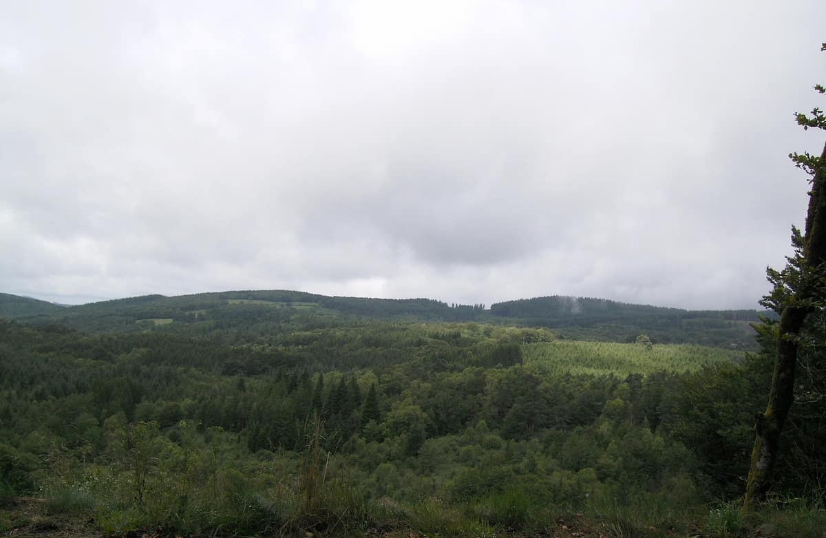
The "Plateau of a Thousand Springs", a granite water tower of south-west France teeming with sphagnum bogs and river headwaters.
A thousand cows, a thousand springs or a thousand rocks: nobody can agree on the name. The most popular explanation in the area reads it as "a thousand springs"; another, by Ernest Nègre, sees in it the bare granite rocks grouped like herds of cows; and a legend tells that a shepherdess handed over her thousand cows, made unruly by a storm, to the devil, who turned them into rocks one by one. What is clear is the landscape: the Millevaches plateau, a granite massif, is the backbone of this regional nature park, created by decree on 18 May 2004 in Nouvelle-Aquitaine, between Corrèze, Creuse and Haute-Vienne.
What makes it unique
The "water tower" of the Limousin, a granite plateau of peat bogs and heathland where eleven rivers of more than 50 km are born and whose night sky is an International Starlight Reserve.
The place
Nature
The landscape
The plateau is a massif of large-crystal granite, some 300 million years old and highly eroded. On it rise the Vienne, the Creuse, the Vézère and other rivers — eleven in total, each more than 50 km long. Mont Bessou is the highest point of the park and of the entire Limousin.
The climate is oceanic with a touch of mountain: it can snow until April and in the peat bogs it can freeze even in August at dawn. Between 1,600 and 1,700 mm of rain falls per year on the plateau, with an average annual temperature of around 7.5 °C.
The look you see today is relatively recent. At the end of the nineteenth century the landscape was almost completely open, dominated by heathland and pastures; in the twentieth century, with agricultural abandonment, conifers such as Norway spruce, larch and Douglas fir were planted. The park forest is mainly these plantations, almost monospecific and usually avoided by wildlife, although fragments of ancient woodland remain, such as holly beech woods rich in biodiversity, with old trees and dead wood hosting saproxylic beetles. The heathlands and dry and wet grasslands, in mosaic with the peat bogs, used to dominate the plateau and are today conservation targets.
Wildlife and seasons
The emblem of the park is the otter. Almost disappeared from France in the eighties, it is recolonising the country from strongholds such as this plateau, and is detected by its tracks along the rivers. In the fast streams lives the freshwater pearl mussel, whose presence indicates very high water quality. There is also the wildcat and 22 of the 37 bat species of Europe.
Among the breeding birds, the black woodpecker and the boreal owl have benefited from forest expansion. In heathlands and extensively managed grasslands lives the great grey shrike, with about thirty pairs at the beginning of the 2010s, while the red-backed shrike, much less rare, stops over in summer. In the open spaces the skylark, the yellowhammer, the meadow pipit, the whinchat and the common kestrel are plentiful.
Among fungi, in four seasons near Meymac 260 species of macromycetes were recorded over ten years of sampling — a high result.
Species
With a page in the atlas
Being mentioned in a source doesn't guarantee sightings: check with the people who manage the area.
Memory and protection
History and conservation
The Special Protection Area of the Millevaches plateau (2006) holds 42 species of community interest, such as the woodlark, the boreal owl and the red-backed shrike. The park defined 28 sites of major ecological interest, and among the scenic ones are the Lavaud-Gelade lake, Mont Gargan, the Bariousses lake and the Monédières massif. The Longeyroux bog is part of the Natura 2000 site Landes et zones humides de la Haute-Vézère.
Human history is also in the soil. From the Gallo-Roman villa of Les Cars, from the second century, two funerary buildings and a large dwelling remain. Until the end of the nineteenth century roofs were thatched with rye straw, because there was no reed on the plateau; today the slates of Travassac and Allasac have replaced it.
Before you set off
Visiting
How to visit
The star site is the Longeyroux bog, at around 900 metres altitude: an accessible pastoral wetland, the largest bog in the park. Two maintained trails, of one and nine kilometres, cross its open landscape, and there are also pastoral walks. Otter and viviparous lizard live there, and among the rare plants are sphagnum and sundew, an insectivorous plant. Maintenance includes summer grazing by a flock of around five hundred sheep accompanied by a shepherd, and the great grey shrike finds its food among viviparous lizards and insects. The walk from Millevaches to Longeroux is the longest itinerary in the guide, with 16 kilometres and five hours.
For more routes, Rando Millevaches is a digital guide with more than 400 routes filtered by type, length, points of interest and elevation, and the Chamina guide proposes 45 walking circuits throughout the park, with information on heritage, geology, economy and agriculture. La Maison du Parc, in the village of Millevaches, is the entry point.
At night, the park has identified 11 accessible sites very propitious for observing the sky. Bring warm clothing, because it is usually cool at altitude, a red torch and a sky map.
Before you go
Dress warmly: it can snow until April and in the peat bogs it can freeze even in August, at dawn. On the bog, stay on the maintained trails.
Check access, rules and visiting conditions in the official information from the managing body before you set off.
Location
Where it is and how far it reaches
Boundary of Millevaches En Limousin · IUCN V · © EEA, CDDA (CC-BY) The coordinate is estimated; it isn't a verified access point.
Transparency
Sources
The research data with its sources, and the official links for this place, are in the Spanish version of this page. See the Spanish version
Around it
At 22 km are the Gorges de la Sioule. And, far away, the Parque Natural Hoces del Alto Ebro y Rudrón shares with the plateau the otter and the Montagu's harrier.
If you like this place, elsewhere in Europe
Distant places with uncommon wildlife and habitats in common. The most widespread species don't count. Sharing species doesn't imply a corridor or guaranteed presence.
- Hoces del Alto Ebro y Rudrón Natural Park
Castile and León (Burgos / Sedano / Orbaneja del Castillo / Valdelateja)
In common: Montagu's harrier · Eurasian otter — old-growth forest
Karst gorges of 200 m carved by the Ebro and Rudrón rivers, featuring the picturesque village of Orbaneja del Castillo and Pozo Azul.
JFMAMJJASONDApril – June · September – November · Crowding low
Entry #382 of the original atlas.