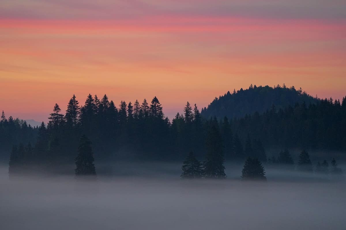
Jura Vaudois Nature Park
Parc Naturel Régional Jura Vaudois
Canton of Vaud (Saint-Cergue / Le Marchairuz) · Switzerland
Photo: Giles Laurent · CC BY-SA 4.0 · Wikimedia Commons
Beech and pine-clad hills across morainic karst terrain overlooking Lake Geneva and the Mont Blanc massif.
Climb up to the crest of Mont Tendre and the Jura reveals its signature scenery: a gentle ridge of pasture dotted with solitary trees that suddenly falls away to reveal Lake Geneva and the Alps. Rising to 1,679 metres, it is the highest summit in the Swiss Jura, and the entire Jura Vaudois regional nature park is scaled to these sweeping rolling hills, mountain passes and expansive forests. It unites 35 municipalities in Vaud between the summit of La Dôle and the historic borough of Romainmôtier, traversed by three passes: La Givrine, Le Marchairuz and Le Mollendruz.
What makes it unique
A Jura of wooded pastures where dry-stone walls, peat bogs and the Mont Tendre ridge coexist a stone’s throw from urban centres.
The place
Nature
The landscape
The park can be understood as five linked landscapes: the gorges and valleys of the Orbe and Nozon, the high Jura ridge, the foot of the Jura, the Risoux massif and the Vallée de Joux. The map sets them out from top to bottom, but the topography follows its own geological logic.
The high crest is limestone, and beneath it the water works deep inside the rock. The park boasts the highest concentration of chasms and caves in Switzerland, notably the Vallorbe caves and the Saint-George ice cave. In the Vallée de Joux, a vast polje, the waters of Lac de Joux have virtually no surface outlet: almost all runoff sinks into the porous limestone bed to resurface lower down in the Vallorbe caves.
Overlaid on this is centuries of human stewardship. The wood-pastures of spruce and silver fir result from long-standing pastoral practices, sustaining rich biodiversity so long as grazing pressure remains light. Here flourish species such as sticky thistle, cabbage thistle and large-flowered butterwort. Within the park lie 40% of the canton’s dry grasslands and meadows and 58% of its raised bogs of national importance. Encircling them all run 250 kilometres of traditional dry-stone walls.
Standing apart is the Grand Risoud, covering 2,200 hectares as the largest continuous forest tract in Switzerland. Its centuries-old slow-growing Norway spruces produce wood with growth rings so dense that it is prized for musical instrument soundboards in master lutherie.
Wildlife and seasons
This is the domain of secretive large carnivores. During the winter of 2017-2018, a total of 12 independent lynx were identified across the Jura vaudois. In 2018, trail cameras detected two adult wolves between the La Dôle massif and the Marchairuz pass, without evidence of breeding or pack formation. A male lynx captured in the Vallée de Joux was subsequently relocated to the Palatinate Forest in Germany as part of a European species recovery project.
Far easier to encounter is the white-throated dipper, mascot of the water trail and guide for the treasure hunt along the Nozon.
The seasons determine where and how to walk. From April to mid-July dogs must be leashed in woods and forest margins to protect breeding wildlife. In winter, forest fringes and snow-free patches are avoided. The park also provides snowshoe and cross-country ski trails, with groomed Nordic routes throughout the Risoux.
Species
With a page in the atlas
Being mentioned in a source doesn't guarantee sightings: check with the people who manage the area.
Memory and protection
History and conservation
Everything began with an agreement. On 1 August 1973, the Vaud League for the Protection of Nature signed a formal charter with alpine pasture owners, founding what was originally the Parc jurassien vaudois. It encompasses the Noirmont federal hunting reserve and 59 nature reserves.
The Vallée de Joux holds cultural stories of another kind. It is one of the historic cradles of Swiss precision watchmaking, and the Risoux forest served as a clandestine escape route into Switzerland during the wartime occupation of France. Romainmôtier and Bassins feature among the park’s noted Cluniac heritage sites.
Before you set off
Visiting
How to visit
There are two visitor welcome centres, the Espaces découvertes: one at the Marchairuz pass and another in the historic town of Romainmôtier-Envy. They offer insights into park conservation projects and suggest excursions across the surroundings. All trails highlighted by the park are signposted and connect with public transport; for example, the pass at La Givrine is served directly by train from Nyon via Saint-Cergue.
The quintessential day hike is Mont Tendre. The trail departs from Le Sentier railway station at 1,000 m, traverses the Vallée de Joux and the Orbe river, skirts wetland margins and ascends through spruce pastures to the summit. From the crest the panorama takes in the foot of the Jura, Lake Geneva, the Alps and the entire Risoud forest spread above the Vallée de Joux. It descends to Montricher at 750 m. Spanning sixteen kilometres with 760 m of climb, 1,000 m of descent and taking around five hours: technically straightforward yet demanding on endurance. The optimal walking season runs from May to November.
For a gentler outing, the La Givrine botanical trail covers fifteen kilometres in about four hours, with 656 metres of elevation gain and easy footing. The Sentier de l'eau et du Vallon du Nozon links Vaulion, Croy and Romainmôtier with twelve interpretive stops explaining how water shaped the geology, biodiversity and local craftsmanship. It measures 5.6 km and lasts two hours; the initial 400 metres run alongside a cantonal road. For multi-day journeys, the park maps out the Grande Traversée, completed on foot across distinct stages.
Before you go
Dogs must be leashed year-round in nature reserves, protected habitats and pastures with livestock. Near cattle, keep a respectful distance and step off the path if necessary. Respect quiet wildlife zones and designated sanctuaries, remain on recommended paths and carry out all your waste.
Check access, rules and visiting conditions in the official information from the managing body before you set off.
Location
Where it is and how far it reaches
Boundary of Parc naturel régional Jura vaudois · © OpenStreetMap contributors (ODbL) The coordinate is estimated; it isn't a verified access point.
Transparency
Sources
The research data with its sources, and the official links for this place, are in the Spanish version of this page. See the Spanish version
Around it
The Parc Naturel Régional du Haut-Jura in France lies contiguous, just 1 km away. The Haute Vallée de l'Ain is about 8 km off, and La Loue - Vallée et Gorges lies some twenty-eight kilometres distant.
What else to explore nearby
Approximate straight-line distance between the edges of each area. It doesn't indicate access, routes or driving times.
- Haut-Jura Regional Nature Park
Jura / Ain / Doubs (Saint-Claude / Les Rousses)
About 1 km away
The highest crests of the Jura Range (Crêt de la Neige 1,720 m) with ancient spruce forests and peat bogs.
JFMAMJJASONDMay – October · Crowding low
Entry #333 of the original atlas.