Albanian Alps National Park
Parku Kombëtar i Alpeve të Shqipërisë - Valbonë & Theth
Shkodër / Kukës County (Theth / Valbonë / Tropojë District) · Albania
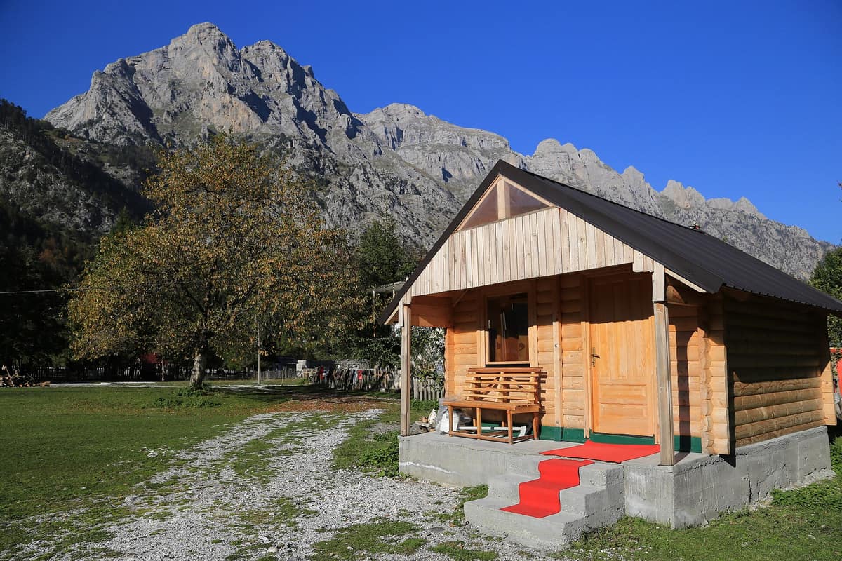
Photo: Tobias Klenze · CC BY 3.0 · Wikimedia Commons
The heart of the Albanian Alps (Prokletije), featuring deep glacial canyons, isolated valleys, and the historic lock-in tower of Theth.
Theth is enclosed by mountains over two thousand metres on all four sides: Radohima to the west, Arapi and Poplluka to the north, Jezerca to the east. It is the heart of a park that since 2022 unites the Theth Valley, the Valbona Valley, and the Gashi River strict nature reserve under a single banner: the Albanian Alps National Park. It encompasses 82,844.65 hectares of limestone, forest, and water in northern Albania, along the border with Montenegro.
What makes it unique
Glaciers carved deeper traces here than anywhere else in the Balkans, and limestone shaped the rest: caves, canyons, and sheer walls.
The place
Nature
The landscape
The Albanian Alps measure 64 km long and 60 km wide, and most Albanian peaks rising above 2,000 m are concentrated here. The highest, Jezerca, reaches 2,694 m. The rock is predominantly limestone and dolomite, and water has worked it in two ways: dissolving it from within to create caves such as Puci, up to 5 km long, and sculpting it from outside with ice. After the Central European Alps, these are the most heavily glaciated mountains in Europe south of the Scandinavian ice sheet, and nowhere else in the Balkans did glaciers leave such extensive erosion marks. In the Valbona Valley during the Würm glaciation, ice extended up to 9.5 km.
The result is clear on the map. There are gorges such as Grunas Canyon, the southern wall of Arapi considered the highest vertical rock face in the Balkans, around thirty glacial lakes clustered in the Gashi range, Runicë, and the Jezerca massif, and rivers like the Shala, Valbona, Cem, Kiri, and Gashi. The Grunas waterfall in Theth drops 30 m. Rain and snow are abundant: these mountains rank among the wettest places in Europe, receiving between 2,000 and 2,500 mm annually.
Vegetation is layered into belts, but with a peculiarity. In Theth and Valbona the belts are inverted, as cold air settles in the valley bottom like a lake. Forests cover around 36 % of the park. Between 900 and 1,800 m beech woodland dominates, mingled with silver fir and spruce; higher up, from 1,900 to 2,300 m, an alpine belt of grasses and shrubs opens up, with juniper and willow. The terrain's extreme isolation and fragmentation have nurtured many endemic plants: Wulfenia baldaccii, Viola dukagjinica, Lilium albanicum, Gentianella albanica. For Theth alone, between 1,500 and 1,650 plant species are estimated, 70 of them threatened.
Wildlife and seasons
This is prime habitat for large mammals. Among the park's rare and protected residents are the Eurasian lynx, roe deer, brown bear, grey wolf, and chamois, which heads up into the high crags far from human activity. The critically endangered Balkan lynx is concentrated mainly in Theth, with some 20 to 50 individuals, though poaching remains a persistent threat. In the alpine streams lives the Eurasian otter, and notable among fish is the sea trout.
Look also to the skies and cliff ledges. Birds include the golden eagle, western capercaillie, Eurasian eagle-owl, and eastern imperial eagle; in Valbona 145 species have been recorded, including Egyptian vultures, lanner falcons, and saker falcons. Common amphibians and reptiles include the alpine salamander and Alpine newt, while snakes include the horned viper.
The best time for hiking runs from June to October.
Species
With a page in the atlas
Being mentioned in a source doesn't guarantee sightings: check with the people who manage the area.
Memory and protection
History and conservation
Theth was protected as a national park in 1966 and Valbona in 1996. In 2022 they were merged, alongside the Gashi reserve, into a single park; the Gashi River is also part of the UNESCO World Heritage primeval beech forests of the Carpathians and other regions of Europe.
Residents of Theth trace their arrival back between 300 and 350 years, seeking to preserve their Catholic faith. One of the few historic lock-in towers that offered refuge to families caught in blood feuds still stands. Today the village suffers from depopulation, and most inhabitants remain only in summer. The Balkans Peace Park Project promotes sustainable tourism and has funded trail markings, and an official information centre is planned beside the Thethi bridge.
Before you set off
Visiting
How to visit
You reach Theth via the Shkodër–Theth road, which is passable for all types of cars. Trails set out from there.
To begin, the trail from Valbonë to Kukaj via Bregu i rrethit: 5.4 km, easy, rising from 950 m in the village to 1,529 m through beech woods, conifer forests, and meadows with endemic flora. There are no springs along the way, so carry all the water you need. Shorter is the route from Valbonë to Kukaj and Maja e Rosit, at 2,542.59 m and taking about 40 minutes, though difficult.
For experienced hikers, the itinerary from Qafa e Pejës to Maja e Jezercës spans 5 km each way, taking about two and a half hours, ascending from 1,685 to 2,664 m. It follows the path from Theth to Vusanje, passing the Natural Monument of the Gropa e Bukur glacial cirque. In Theth, a footbridge built by the Albanian Challenge project links the village with the Grunas waterfalls.
Before you go
The protected areas agency asks visitors to use only designated paths and respect conservation rules. The ascent of Jezerca is strenuous and recommended solely for experienced mountaineers. Long trails lack water sources: carry plenty from the start.
Check access, rules and visiting conditions in the official information from the managing body before you set off.
Location
Where it is and how far it reaches
Boundary of Alpet e Shqiperise · IUCN II · © EEA, CDDA (CC-BY) The coordinate is estimated; it isn't a verified access point.
Transparency
Sources
The research data with its sources, and the official links for this place, are in the Spanish version of this page. See the Spanish version
How it fits into the territory
Calculated from the Atlas boundaries. «Part of» is only stated with an official boundary; an estimated area only means that they overlap.
Shares territory with
- Gashi River Strict Nature Reserve
Tropojë District (Albanian Alps / Tropojë)
Their official boundaries overlap
Pristine glacial valley and undisturbed primeval beech forest designated a UNESCO World Heritage site in Albania.
JFMAMJJASONDJune – October · Crowding very low
Around it
Adjoining this park, just 1 km away, are Parque Nacional de Prokletije and Parque Nacional Bjeshkët e Nemuna. About 8 km away lies Cañón del Río Morača, and roughly 11 km away are Cañón del Río Cijevna and Meseta Kárstica de Sinjajevina. The Reserva Natural Estricta del Río Gashi lies within the park itself.
What else to explore nearby
Approximate straight-line distance between the edges of each area. It doesn't indicate access, routes or driving times.
- Cijevna River Canyon
Tuzi Municipality / Podgorica
About 11 km away
Narrow miniature canyon carved into pure limestone on the way to Lake Skadar.
JFMAMJJASONDApril – June · September – October · Crowding low
Entry #318 of the original atlas.