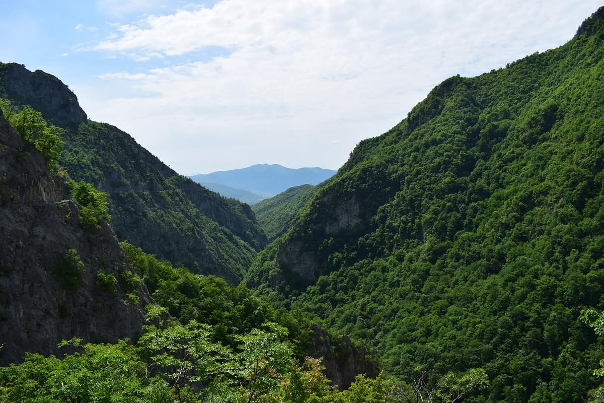
Gashi River Strict Nature Reserve
Rezervati Natyror i Strazuar Lumi i Gashit
Tropojë District (Albanian Alps / Tropojë) · Albania
Photo: Mensur Gashi · CC BY-SA 4.0 · Wikimedia Commons
Pristine glacial valley and undisturbed primeval beech forest designated a UNESCO World Heritage site in Albania.
The Gashi rises at 2.238 m at the Dobërdol Pass and carves its way through the highest peaks of northern Albania. It hollows out a deep gorge, and up its steep flanks climbs the largest primeval beech forest in the Albanian Alps. This is the Gashi River Strict Nature Reserve, spanning some 3.000 hectares in the Tropojë region, now part of the Albanian Alps National Park and included in the UNESCO World Heritage Ancient Beech Forests of Europe.
What makes it unique
A beech forest that has grown untouched by human activity for centuries, in a valley where the river remains truly wild.
The place
Nature
The landscape
The river originates in the Gashi Mountain massif and flows through a landscape of deep canyons, steep scarps, and dramatic gorges. Further south it cuts through a narrow ravine before descending to the Tropojë basin, where it joins the Valbona. Nearby lie the glacial tarns of Dobërdol and Sylbica.
The forest dominates the scene. European beech climbs the steep valley slopes, while silver fir marks the montane belt. Mixed among the beeches are Macedonian pine, Bosnian pine, Norway spruce, and silver fir, alongside Heldreich's pine, a Mediterranean endemic tree that enriches the beech groves. The southerly latitude and sharp elevation gradients account for such high endemism.
Wildlife and seasons
The reserve shelters 64 mammal species, including the brown bear, the grey wolf, the chamois, the Eurasian lynx, the roe deer, the wild boar, and the Eurasian otter. There are also 14 amphibian species, including the Italian crested newt.
In the skies soar the bearded vulture, the griffon vulture, the eastern imperial eagle, the western capercaillie, and the rock partridge.
The recommended visiting season extends from June to October.
Species
With a page in the atlas
Being mentioned in a source doesn't guarantee sightings: check with the people who manage the area.
Memory and protection
History and conservation
The Gashi Valley was inscribed on the World Heritage List as part of the Ancient and Primeval Beech Forests of Europe. It ranks among Europe's best-preserved forest ecosystems and forms part of the European Green Belt. In 2022, the reserve was integrated into the Albanian Alps National Park.
The area is also renowned for its traditional pastoral routes connecting Albania with Montenegro and Kosovo.
Before you set off
Visiting
How to visit
To reach the Gashi, the journey starts from the town of Bajram Curri and continues through mountain villages like Dragobi, Qerem, Markovçë, Rorkuz, and Dobërdol. From there, visitors hike toward the natural area for about 45 minutes across rugged mountain terrain.
Inside the valley, you can hike through pristine forests across Mount Bjeshkët e Nemuna and its surroundings. Glacial tarns, crystal-clear streams, and emerald forests provide stunning backdrops for nature photography.
Before you go
This is a strict nature reserve, and access is on foot: the final stretch takes about 45 minutes of mountain walking. The starting base is Bajram Curri.
Check access, rules and visiting conditions in the official information from the managing body before you set off.
Location
Where it is and how far it reaches
Boundary of Alpet e Shqiperise · © EEA, CDDA (CC-BY) The coordinate is estimated; it isn't a verified access point.
Transparency
Sources
The research data with its sources, and the official links for this place, are in the Spanish version of this page. See the Spanish version
How it fits into the territory
Calculated from the Atlas boundaries. «Part of» is only stated with an official boundary; an estimated area only means that they overlap.
Shares territory with
- Albanian Alps National Park
Shkodër / Kukës County (Theth / Valbonë / Tropojë District)
Their official boundaries overlap
The heart of the Albanian Alps (Prokletije), featuring deep glacial canyons, isolated valleys, and the historic lock-in tower of Theth.
JFMAMJJASONDJune – October · Crowding low
Around it
Around six kilometers away lies Bjeshkët e Nemuna National Park and about nine kilometers away is Prokletije National Park. The reserve is today integrated into the Albanian Alps National Park.
What else to explore nearby
Approximate straight-line distance between the edges of each area. It doesn't indicate access, routes or driving times.
- Cijevna River Canyon
Tuzi Municipality / Podgorica
About 11 km away
Narrow miniature canyon carved into pure limestone on the way to Lake Skadar.
JFMAMJJASONDApril – June · September – October · Crowding low
If you like this place, elsewhere in Europe
Distant places with uncommon wildlife and habitats in common. The most widespread species don't count. Sharing species doesn't imply a corridor or guaranteed presence.
- Blidinje Nature Park - Čvrsnica Massif
West Herzegovina and Herzegovina-Neretva Cantons (Posušje / Jablanica)
In common: Bosnian pine · Eurasian lynx · Brown bear — high mountain
High karst mountains around the glacial Lake Blidinje featuring the iconic natural rock arch of Hajdučka Vrata.
JFMAMJJASONDJune – October · Crowding very low
- Prenj Mountains
Herzegovina-Neretva Canton (Konjic / Jablanica)
In common: Bosnian pine · Brown bear · Grey wolf — high mountain
The 'Bosnian Himalayas', an ultra-rugged alpine massif of white limestone ridges and glacial cirques.
JFMAMJJASONDJune – October · Crowding very low
Entry #75 of the original atlas.