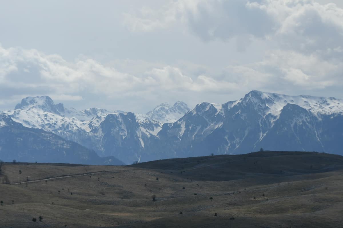
Prenj Mountains
Planina Prenj
Herzegovina-Neretva Canton (Konjic / Jablanica) · Bosnia and Herzegovina
Photo: A81t · CC BY-SA 4.0 · Wikimedia Commons
The 'Bosnian Himalayas', an ultra-rugged alpine massif of white limestone ridges and glacial cirques.
There is a wall of over a thousand metres in Bosnia and Herzegovina. It is the Cetina wall in Prenj, a Dinaric massif where limestone and dolomite rise into razor-sharp crests above 2,000 metres, boasting at least 11 peaks that exceed that mark. It is known as the 'Bosnian Himalayas' because its crest, stretching about 15 km, looks as if it belongs to another land: a rampart of grey rock above green valleys and dense forests. It is an untamed, sparsely visited realm, and its designation as a national park is underway.
What makes it unique
A white limestone ridge with a wall over a thousand metres high, and a salamander found only here that emerges solely at night or during rainfall.
The place
Nature
The landscape
Prenj consists of Mesozoic and Cenozoic sedimentary rock, predominantly limestone and dolomite, exhibiting pronounced karst features. And karst governs all: despite abundant precipitation, surface water barely flows. That is why, amidst so many peaks, there are so few streams.
The topography unfolds in three levels: the lower valley, the intermediate karst, and the high glacial zone. Down below, up to 1,000 metres, grows a lush deciduous forest dominated by beech; up to 1,200 metres pine prevails. In between extend plateaus like Glogovo, largely barren and karstic, with occasional hay meadows. High above stands the crest, about 15 km long, running northwest to southeast, with the sharp contours characteristic of the Dinarides.
The highest peak is Zelena Glava, and its recorded altitude varies by source: old maps indicate 2103 m, whereas the summit marker itself reads 2155 m. Nearby rises Otiš, reaching 2,093 metres according to route descriptions. At Tisovica, below, two tarns, Gornje and Donje jezero, form during peak autumn rains and spring snowmelt. And on the northeastern flank, at 397 metres, lies Lake Boračko, of glacio-tectonic origin and the largest natural lake of its kind in the country.
Names carry weight here too: one hypothesis holds that Prenj derives its name from Perun, the god of thunder of the ancient Slavs.
Wildlife and seasons
The most unique inhabitant is the Prenj salamander, endemic to the massif, which dwells on the karstic plateau of Zakantar and is only glimpsed at night or during rain. The massif is also home to the chamois, the grey wolf, and the brown bear. Among trees, the munika, or Heldreich's pine, stands out among the botanical highlights along the route.
The best season runs from June to October, but weather shifts swiftly and abruptly: Prenj is 'like a house set in a gale-swept place', and sudden changes have led to multiple accidents. In summer it can snow, and temperatures can plummet below zero degrees.
Species
With a page in the atlas
Being mentioned in a source doesn't guarantee sightings: check with the people who manage the area.
Memory and protection
History and conservation
Old military combat positions can still be spotted up to about 2,000 metres on the flanks of Otiš. Several mountain huts have been reopened, including Bijele Vode and Hrasnica, and marked routes to the main summits have been restored. One peak, Windy Peak, was first climbed in October 2003 and was likely one of the last virgin 2,000-metre peaks in Europe.
Conservation currently faces two battlegrounds. One is its designation as a protected area, currently pending. The other is the planned Prenj tunnel through the central massif, measuring 10.45 km, which will become Bosnia and Herzegovina's first tunnel exceeding six kilometres.
Before you set off
Visiting
How to visit
The great crossing is the Via Dinarica stage traversing Prenj from west to south: 58.1 km, about 24 hours of hiking, and 3,813 metres of cumulative elevation gain, graded difficult with technical difficulty T4. It begins in Jablanica town centre, crossing the bridge and tunnel, and tracks the Neretva towards Glogošnica. From there the trail concludes on an exposed ridge with vistas towards the Cetina wall.
It then drops to the green Medjuprenje pass, where two shelters stand with one always kept unlocked, and veers east across Zakantar into the Tisovica valley at the foot of Zelena Glava. Half an hour from Tisovica lies the Vrutak hut. The route crests Zelena Glava at 2,155 metres, the highest point, and Otiš, before continuing to Bijele Vode, home to another shelter and a former shepherd's cabin providing refuge.
Ascents are also feasible from Konjic through the Bijela valley to Tisovica (eastern route) or from Mostar up to Grabovčići (western route).
Before you go
Unexploded ordnance and landmines remain present, particularly east of a line connecting Čelebići to the summit of Zelena Glava and the village of Ravni. The main route is safe, yet it crosses a mine-suspected zone upon leaving the asphalt road, and two other points, the Zakantar spring and near Vrutak, are clearly signposted: never stray from the waymarkers and heed all warnings. The terrain is exceedingly rocky and snakes occur. The mountain rescue number is 121, and much of the massif lacks mobile reception. While many hikers drink from springs in Prenj, filtering water from smaller flows is strongly advised.
Check access, rules and visiting conditions in the official information from the managing body before you set off.
Location
Where it is
No official boundary yet: the circle is an approximation with a radius of 20 km, not the real shape. The coordinate is estimated; it isn't a verified access point.
Transparency
Sources
The research data with its sources, and the official links for this place, are in the Spanish version of this page. See the Spanish version
Around it
About three kilometres away rise the Vran Mountains, and adjoining Prenj lies the Blidinje Nature Park - Čvrsnica Massif. It also roughly overlaps with the Čabulja Mountains.
What else to explore nearby
Approximate straight-line distance between the edges of each area. It doesn't indicate access, routes or driving times.
- Blidinje Nature Park - Čvrsnica Massif
West Herzegovina and Herzegovina-Neretva Cantons (Posušje / Jablanica)
Borders this area
High karst mountains around the glacial Lake Blidinje featuring the iconic natural rock arch of Hajdučka Vrata.
JFMAMJJASONDJune – October · Crowding very low
If you like this place, elsewhere in Europe
Distant places with uncommon wildlife and habitats in common. The most widespread species don't count. Sharing species doesn't imply a corridor or guaranteed presence.
- Pirin National Park - Forest Wilderness
Blagoevgrad Province (Bansko / Sandanski)
In common: Bosnian pine · Chamois · Brown bear — high mountain, karst and caves, glacial landscape
Dramatic granite and karst peaks sheltering the ancient Baykushev pine (over 1,300 years old).
JFMAMJJASONDJune – October · Crowding low
- Mount Olympus National Park
Pieria / Larissa (Litochoro)
In common: Bosnian pine · Chamois · Grey wolf — high mountain
Greece's inaugural national park (1938): the country's highest peak, incised by the Enipeas Gorge and renowned for endemic flora.
JFMAMJJASONDJune – October · Crowding moderate
Entry #306 of the original atlas.