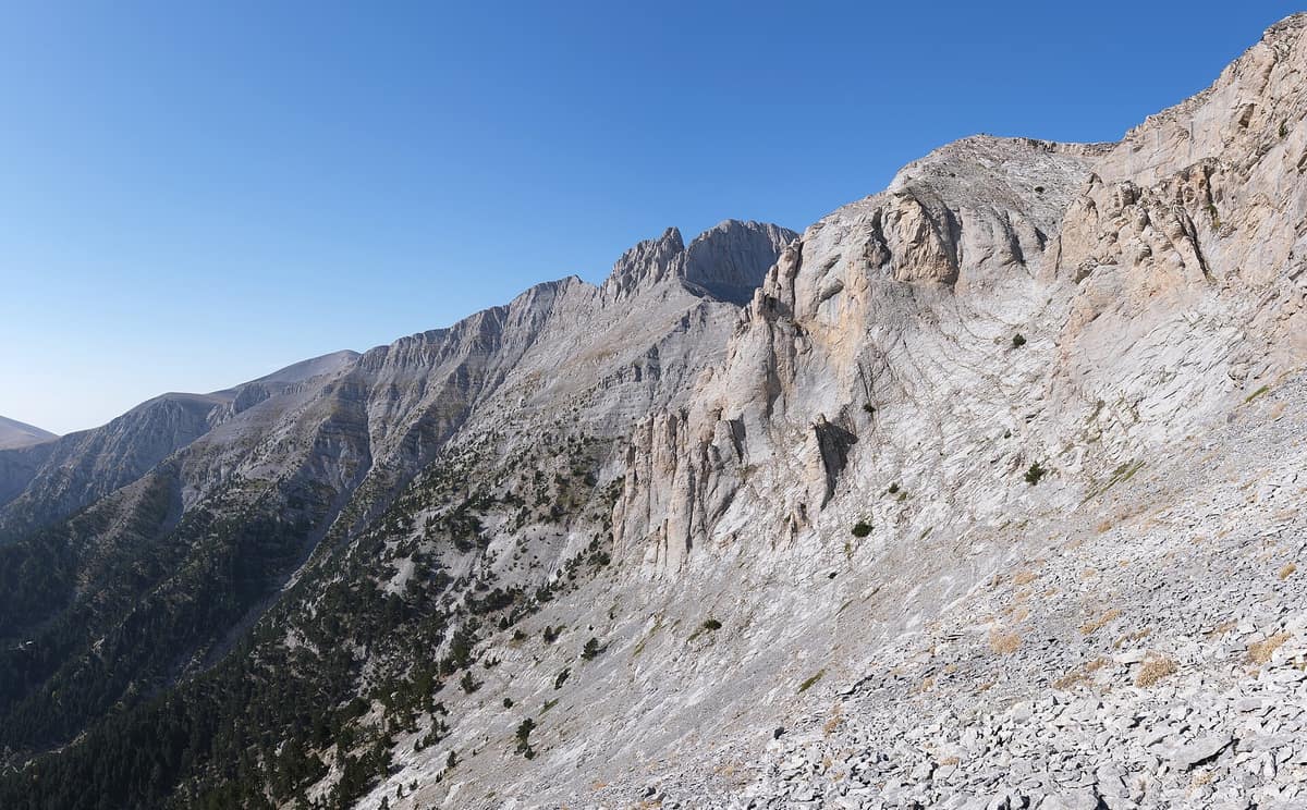
Mount Olympus National Park
Εθνικός Δρυμός Ολύμπου
Pieria / Larissa (Litochoro) · Greece
Photo: kallerna · CC BY-SA 4.0 · Wikimedia Commons
Greece's inaugural national park (1938): the country's highest peak, incised by the Enipeas Gorge and renowned for endemic flora.
Seen from Litochoro, the mountain carves a sharp "V" against the Aegean sky between twin companion peaks. To the left rises Mytikas, Greece's apex at 2,917.727 metres; to the right stands Stefani, the Throne of Zeus. Mount Olympus National Park encompasses this near-circular massif of roughly 500 square kilometres, bristling with 52 summits and cleft by deep ravines. Established in 1938, it was Greece's very first national park, later designated a UNESCO biosphere reserve, with the coastal town of Litochoro serving as its historic base.
What makes it unique
A fortress of limestone rising straight from the sea, home to 23 plants found nowhere else on Earth.
The place
Nature
The landscape
The massif is built of marine limestone deposited some 200 million years ago in a shallow tropical sea. Then came the ice: one million years ago, glaciers mantled Olympus, carving cirques, hanging valleys, and high plateaux. Rain, frost, and winds chiselled the remainder into an isolated mountain citadel.
The most imposing rock architecture crowns the heights. From Litochoro the skyline reveals the cleft between Mytikas and Stefani, the Throne of Zeus, while to the south the 13 km Ziliana gorge cleanly separates Mount Olympus from Lower Olympus.
The microclimate changes with every metre gained. Above 2,000 metres snow cloaks the crests for roughly nine months, from September through May. Weather shifts unpredictably within hours, and summer afternoons frequently trigger violent thunderstorms, often accompanied by heavy hail.
Wildlife and seasons
Vegetation zones layer the mountainsides. The park protects nearly 1,700 plant taxa, representing 25% of all Greek flora; 56 are endemic to Greece, and 23 occur nowhere else on the planet. Ramonda heldreichii, a delicate Tertiary relict from the Ice Age, holds special fame among botanists. Higher up, the Bosnian pine climbs to 2,750 metres, forming one of the highest alpine treelines in the Balkans. In contrast, the humid depths of the Enipeas Gorge shelter deciduous diversity and ancient yews.
Among mammals, thirty-two species are recorded, including Balkan chamois, European roe deer, wild boar, wildcat, stone marten, red fox, and red squirrel. The avifauna numbers 108 species, featuring cinereous vulture, golden eagle, short-toed snake eagle, booted eagle, and peregrine falcon; many raptors remain scarce. There are also 22 common Greek reptile species, eight amphibians inhabiting streams and snowmelt pools, and prolific butterflies.
Species
With a page in the atlas
Being mentioned in a source doesn't guarantee sightings: check with the people who manage the area.
Memory and protection
History and conservation
Myth and history merge across these crags. Atop the peak of Profitis Ilias at 2,803 metres perches a sixteenth-century stone chapel, the highest ecclesiastical shrine in the Orthodox Christian world. The ruined Old Monastery of St Dionysios lies lower in the Enipeas gorge at 820 m. The first recorded ascent of Mytikas was achieved by Swiss mountaineers Boissonnas and Baud-Bovy, led by Litochoro hunter Christos Kakkalos, on 2 August 1913.
The strictly protected national park core covers roughly 4,000 hectares on the eastern face, where all commercial exploitation is barred by law. The park comprises a core zone of 40 km² and an overall perimeter of 240 km² including buffer areas.
Before you set off
Visiting
How to visit
Most hikers set out from Litochoro. From town, a paved road ascends 18 km to Prionia, the highest drivable point and the trail start, where the Enipeas River surfaces from karst springs. In Litochoro, the Olympus National Park Information Centre opened in June 2016 to interpret geology, archaeology, mythology, and wildlife; down in Leptokarya, the Olympus Geological Museum details mountain stratigraphy.
The classic ascent climbs from Prionia at 1100 m to Refuge Spilios Agapitos at 2100 m along the E4 international trail, shaded largely by black pine and beech. The upper zig-zags emerge onto open limestone exposed to intense summer heat; the refuge cautions against dehydration and heatstroke. From Prionia all the way to Mytikas, the full route spans 11.5 km with 1830 m of cumulative ascent taking roughly seven hours, graded very demanding.
The path continues to Skala at 2866 m, the initial summit plateau and junction for Skolio and Mytikas. Bitter winds can scour this crest even in bright sun. Ascending Olympus is a straightforward mountain trek except for the final traverse from Skala across the Kakiskala gully to Mytikas, which involves a Class 3 YDS scramble with severe exposure; loose scree flanks the line, and a slip could result in a 1000 m drop. If Mytikas feels daunting, an easier path from Skala ascends Skolio, the second summit.
Over 10,000 climbers visit Olympus each year, though most turn around at Skala or Skolio.
Before you go
Visitors may only enter along recognised trails between sunrise and sunset. Children under 14 years of age must be accompanied by an adult. Disturbing nests, eggs, or chicks and molesting wildlife is strictly prohibited.
Above 2,000 metres natural springs disappear: carry plenty of drinking water and clothing suited to sudden freezes. Snow blankets the upper summits from September until May.
Check access, rules and visiting conditions in the official information from the managing body before you set off.
Location
Where it is and how far it reaches
Boundary of Εθνικός Δρυμός Ολύμπου · © OpenStreetMap contributors (ODbL) The coordinate is estimated; it isn't a verified access point.
Transparency
Sources
The research data with its sources, and the official links for this place, are in the Spanish version of this page. See the Spanish version
If you like this place, elsewhere in Europe
Distant places with uncommon wildlife and habitats in common. The most widespread species don't count. Sharing species doesn't imply a corridor or guaranteed presence.
- Sierra de las Nieves National Park
Andalusia (Málaga — Ronda / Tolox / Yunquera)
In common: Taxus baccata · Martes foina · Griffon vulture — high mountain
Spanish fir forests (pinsapares), a relict conifer growing only in these ranges, over deep karst harboring some of the deepest chasms in Spain.
JFMAMJJASONDMarch – May · October – December · Crowding low
- Retezat National Park
Hunedoara County (Hațeg)
In common: Martes foina · Chamois · Golden eagle — high mountain, old-growth forest
The realm of the granitic and glacial Retezat, with over 80 crystal tarns and the Gemenele scientific reserve.
JFMAMJJASONDJune – October · Crowding low
Entry #1040 of the original atlas.