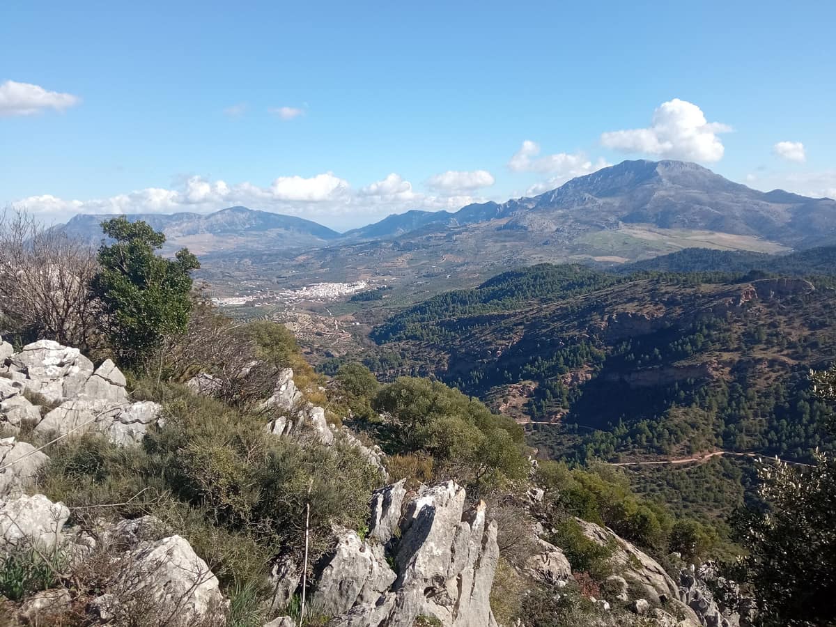
Sierra de las Nieves National Park
Parque Nacional Sierra de las Nieves
Andalusia (Málaga — Ronda / Tolox / Yunquera) · Spain
Photo: 80kmh · CC BY 4.0 · Wikimedia Commons
Spanish fir forests (pinsapares), a relict conifer growing only in these ranges, over deep karst harboring some of the deepest chasms in Spain.
In the heart of southern Spain there was once a demanding profession: climbing the mountain peaks, packing snow into pits during winter, and distributing ice down to villages during summer. These ice-harvesters (neveros) gave the sierra its name, though the trade came at an environmental cost, contributing to the severe degradation of high-mountain gall oak stands. Sierra de las Nieves National Park covers 22,979.76 hectares in western Málaga province within the Serranía de Ronda. It is Spain's sixteenth national park and the third in Andalusia, designated in 2021 after being a UNESCO Biosphere Reserve since 1995.
What makes it unique
Here flourishes the world's largest expanse of pinsapo, a relict fir from Tertiary forests that survives only across a handful of Andalusian mountain ranges.
The place
Nature
The landscape
The sierra reveals itself through striking colour contrasts. On one hand, the white ranges of limestone, carved into cliffs, lapiaz pavements, caves, and chasms: the GESM chasm plunges 1,101 m, making it the deepest in Andalusia. On the other hand, the reddish ranges of peridotite, extraordinarily rare ultramafic mantle rocks that turn red as their iron oxidises; the Ronda peridotite massifs rank among the most extensive on Earth. Between them lie brown soils, historically cultivated by local farming hamlets. Torrecilla peak, at 1,919 m, forms the highest crest in western Andalusia.
Climate shapes the rest. Influenced by both Mediterranean air and Atlantic fronts, precipitation concentrates from October to March, dropping below 15 mm monthly in summer. High elevations are cooler and receive heavier rainfall, explaining why the Spanish fir (pinsapo) clings to survival here.
Forests climb in altitudinal bands. Mid-elevation slopes host holm oaks, maritime pines, junipers, and mixed stands of pine and pinsapo. In moist southern shade, cork oak stands integrate gall oaks and pinsapos. High elevations support relict gall oaks alongside maples, whitebeams, and yews, currently degraded by centuries of charcoal burning and livestock overgrazing. Pinsapo forests occupy roughly 2,000 ha, representing 60 % of the global range of these relict woods, while the botanical catalogue exceeds 1,400 plant species, with 15 threatened taxa including the pinsapo, subalpine gall oak, and giant mullein.
Wildlife and seasons
The Spanish ibex represents the soul of these rugged heights, in keeping with their alpine terrain. Alongside it live roe deer, stone martens, the common genet, Egyptian mongooses, and the Eurasian otter, present along all major streams. The skies shelter the golden eagle, Bonelli's eagle, short-toed snake eagle, Eurasian eagle-owl, and peregrine falcon. Reptiles include the Lataste's viper; the native white-clawed crayfish preserves here some of its last Andalusian refuges. In total, nearly 200 vertebrate species breed or dwell here, with 14 listed on the Andalusian Catalogue of Threatened Species, including rare bats and dragonflies.
Autumn creates a scenic masterpiece: chestnut groves tint the Valle del Genal around Igualeja and Parauta in glowing copper and gold, creating the renowned Bosque de Cobre.
Species
With a page in the atlas
Being mentioned in a source doesn't guarantee sightings: check with the people who manage the area.
Memory and protection
History and conservation
A succession of cultures has overlapped here: from prehistoric hunter-gatherers to Phoenicians, Iberians, Romans, Visigoths, and above all, Islamic communities.
The forest has endured heavy pressures. Wildfires represent the gravest peril, having razed whole fir groves such as Cañada de la Encina and Cerro Corona. Overgrazing drives severe soil erosion on high slopes and inhibits gall oak regeneration. A recovery plan for the pinsapo was ratified in 2011 to safeguard surviving populations and restore woodlands in burnt areas.
Before you set off
Visiting
How to visit
Two primary gateways lead into the heart of the park. One is the forest track departing the Ronda–San Pedro de Alcántara road toward Los Quejigales recreation area; the other climbs from Yunquera toward the viewpoints of Saucillo and Caucón (Luis Ceballos). The core routes, Quejigales-Torrecilla and Puerto Saucillo-Torrecilla, climb to the highest summit in western Andalusia.
For a first outing, three distinct trails stand out. Las Escaleretas is a short circular walk leading to a monumental specimen fir: over 350 years old, it was long the largest in the park. Conejeras forms another gentle loop through the La Nava holm oak woods, one of the park's best-preserved forests, interspersed with gall oaks and pinsapos; five large million-litre water basins stand ready for firefighting vehicles. Caucón-Tajo de la Caína spans 4.4 km of moderate walking through fir woods to a dramatic cliff featuring a sheer drop of over 100 metres. Local lore holds that its name recalls a woman known as La Caína, whom the Inquisition condemned to be cast over the edge for witchcraft.
For seasoned trekkers, the Caucón-Peñón de los Enamorados trail (8 km, demanding, circular, about 210 minutes) winds through pinsapar, subalpine gall oak woods, and high limestone crags.
Gateway villages feature municipal tourist desks providing route advice and cultural background.
Before you go
Natural springs are scarce across high elevations: always carry sufficient drinking water, sun protection, and proper footwear, and keep strictly to waymarked paths. Check local weather forecasts before setting out. From Málaga, take the A-357 to Cártama and then the A-366 toward Coín, Yunquera, or Alozaina, reaching the park in approximately an hour.
Check access, rules and visiting conditions in the official information from the managing body before you set off.
Location
Where it is and how far it reaches
Boundary of Sierra de las Nieves · © EEA, CDDA (CC-BY) The coordinate is estimated; it isn't a verified access point.
Transparency
Sources
The research data with its sources, and the official links for this place, are in the Spanish version of this page. See the Spanish version
Around it
Around twenty-nine kilometres away lies Parque Natural Los Alcornocales. Further afield, Parc Natural dels Ports shares with Sierra de las Nieves the Spanish ibex, griffon vulture, and rugged karst highland habitats; Parc Natural de la Serra de Montsant coincides in sheltering the ibex, Bonelli's eagle, and griffon vulture over similar calcareous karst.
What else to explore nearby
Approximate straight-line distance between the edges of each area. It doesn't indicate access, routes or driving times.
- Los Alcornocales Natural Park
Andalusia (Cádiz / Málaga / Alcalá de los Gazules / Jimena de la Frontera)
About 29 km away
The largest continuous cork oak forest on the Iberian Peninsula (170,000 ha) and humid ravines (canutos) preserving relict Tertiary laurel forest flora.
JFMAMJJASONDOctober – May · Crowding very low
If you like this place, elsewhere in Europe
Distant places with uncommon wildlife and habitats in common. The most widespread species don't count. Sharing species doesn't imply a corridor or guaranteed presence.
- Sierra Nevada National and Natural Park
Andalusia (Granada / Almería / Capileira / Trevélez / Monachil)
In common: Vipera latasti · Monticola saxatilis · Common genet — karst and caves, high mountain
The roof of the Iberian Peninsula (Mulhacén 3,479 m and Veleta 3,396 m), a Biosphere Reserve with over 80 exclusive endemic plant species.
JFMAMJJASONDMay – October · Crowding moderate
- Els Ports Natural Park
Catalonia / Aragon / Valencian Community (Tarragona / Teruel / Castellón / Roquetes / Tortosa)
In common: Bonelli's eagle · Spanish ibex · Circaetus gallicus — karst and caves, high mountain
A rugged karst massif between Catalonia, Aragon, and the Valencian Community featuring limestone cliffs, southern beech groves, and the Iberian ibex.
JFMAMJJASONDApril – June · September – November · Crowding low
- Retezat National Park
Hunedoara County (Hațeg)
In common: Martes foina · Circaetus gallicus · Eurasian eagle-owl — high mountain
The realm of the granitic and glacial Retezat, with over 80 crystal tarns and the Gemenele scientific reserve.
JFMAMJJASONDJune – October · Crowding low
- Paklenica National Park - Velebit Plateau
Zadar County (Starigrad-Paklenica)
In common: Circaetus gallicus · Griffon vulture · Eurasian eagle-owl — karst and caves, high mountain
Vertical incised canyons (Velika and Mala Paklenica) plunging straight towards the Adriatic Sea from the crests of Velebit.
JFMAMJJASONDApril – June · September – October · Crowding low
Entry #1023 of the original atlas.