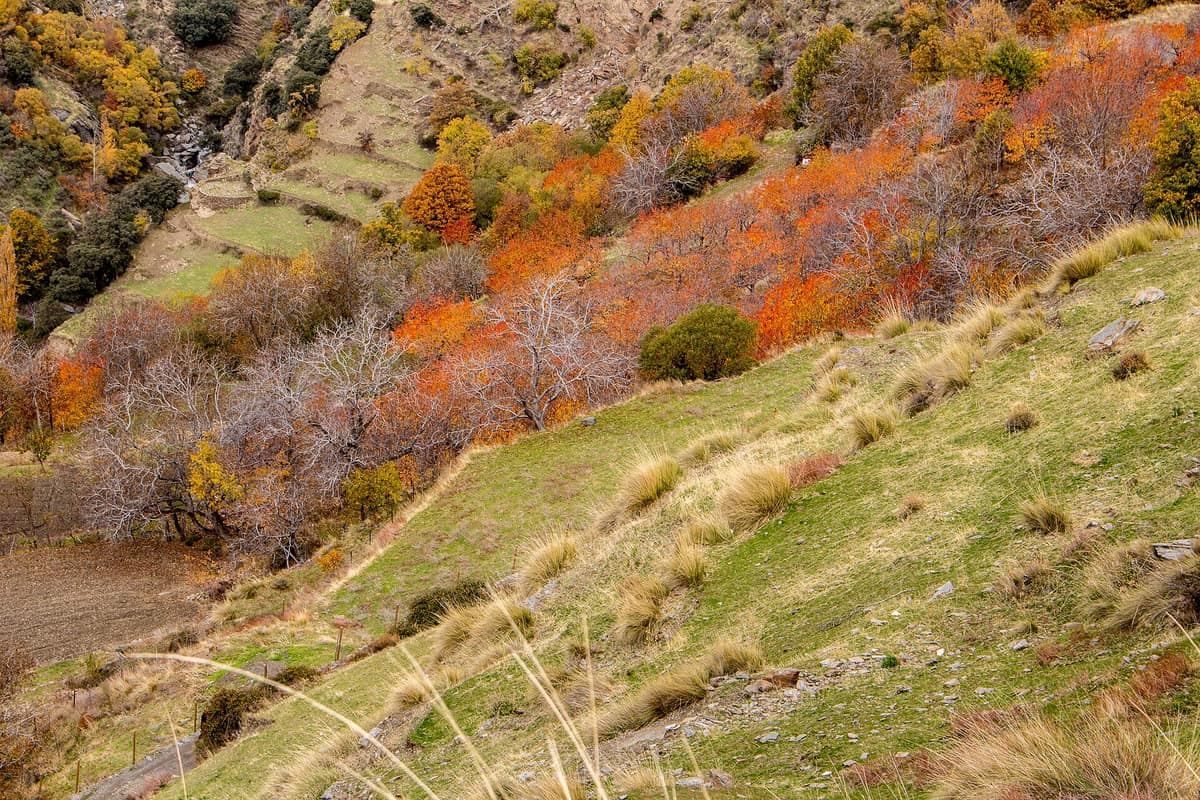
Sierra Nevada National and Natural Park
Parque Nacional y Natural de Sierra Nevada
Andalusia (Granada / Almería / Capileira / Trevélez / Monachil) · Spain
Photo: Jerryviaja.com · CC BY-SA 4.0 · Wikimedia Commons
The roof of the Iberian Peninsula (Mulhacén 3,479 m and Veleta 3,396 m), a Biosphere Reserve with over 80 exclusive endemic plant species.
For centuries, an ancient pack trail brought mountain snow down to Granada. Known as the Camino de los Neveros, it earned its name because until relatively recent times it was the customary route for hauling ice blocks down to the provincial capital. Islamic scholars called this range Yabal Sulayr (Mountain of the Sun or Air) and Yabal-al-Tay (Mountain of Snow). Today it is the Sierra Nevada National and Natural Park, a sprawling massif shared between Granada and Almería crowned by Mulhacén at 3479 m, the highest summit on the Iberian Peninsula.
What makes it unique
A towering massif where perennial snow patches coexist with endemic flora that took refuge from ice-age glaciations and became trapped on the high summits.
The place
Nature
The landscape
Sierra Nevada formed, alongside the rest of the Betic ranges, during the Tertiary Alpine orogeny. Its central core, where the loftiest peaks rise, consists of dark schists and slates locally termed La Lastra. Then came the ice: Quaternary glaciers carved cirques, moraines, tarns, and U-shaped troughs. On the southern watershed, nearly fifty glacial tarns survive as living relics of those ancient icefields.
The climate exhibits extreme seasonal contrasts. In summer precipitation is negligible, while in winter precipitation falls almost entirely as snow above 2000 m. Above 3000 m the annual mean temperature stays below 0 °C. Consequently, vegetation stratifies into distinct elevation bands. Between 1300 and 1900 m holm oak woodlands prevail; between 1900 and 2700 m stretch Scots pine stands and creeping savin juniper scrub. Higher up, from 2600 to 2800 m, intense cold prevents woody growth: borreguiles dominate, wet high-mountain bogs analogous to Arctic tundra.
Then comes the botanical marvel. Following the retreat of the last glaciers, the massif became an isolated sanctuary for high-latitude northern flora and specialized local endemics. There are 2,100 catalogued plant species, 116 of which are threatened. Famous endemics include royal chamomile, Sierra Nevada daffodil, and the iconic snow star (estrella de las nieves), the quintessential emblem of the range.
Wildlife and seasons
The undisputed monarch of the local fauna is the Spanish ibex, frequently grazing across high alpine pastures. Only a few hardy species endure on the uppermost crests, principally the snow vole and alpine accentor. Scattered crags host nesting pairs of Bonelli's eagle, golden eagle, and Eurasian eagle-owl. Forests shelter wild boars, European wildcats, red foxes, least weasels, stone martens, and the common genet. There are 80 endemic animal species, including over 20 endemic butterfly species among the invertebrates.
The annual cycle governs mountain life. Summer, spanning May to October, brings dry skies; winter blankets the peaks under thick snow. Violent convective thunderstorms occur regularly during spring and summer afternoons.
Species
With a page in the atlas
Being mentioned in a source doesn't guarantee sightings: check with the people who manage the area.
Memory and protection
History and conservation
Islamic heritage endures in the sophisticated network of mountain water-channels (acequias) that harvest snowmelt and surface runoff along steep slopes. In the Barranco del Poqueira, the whitewashed villages of Pampaneira, Bubión, and Capileira preserve flat-roofed Berber architecture, designated a Historic Site.
The mountain was proclaimed a natural park in 1989 in recognition of its extraordinary flora, fauna, and geomorphology. As a national park, Sierra Nevada incorporated previously unrepresented Mediterranean high-mountain ecosystems into Spain's National Parks Network.
Conserving this botanical treasure poses intricate challenges: overgrazing, illegal plant collecting, ski development, road infrastructure, deforestation, non-native species, and heavy tourism create acute vulnerability. Current stewardship focuses on revitalizing historic acequias to preserve the agroforestry cultural landscape.
Before you set off
Visiting
How to visit
Begin your exploration at a visitor centre. Main centres operate at El Dornajo and Laujar de Andarax, supplemented by information kiosks in Pampaneira and the Puerto de La Ragua pass. In Hoya de la Mora at roughly 2500 m, the Sierra Nevada University Botanical Garden, open since 1965, focuses on endemic mountain flora.
From June to October, conditions permitting, an official guided shuttle bus ascends to the highest ridges: from the university hostel at 2500 m up to Posiciones del Veleta at 3100 m. On the southern slopes, a companion service runs from Capileira up to Alto del Chorrillo at 2740 m on the lower flanks of Mulhacén.
On foot, a rich trail network traverses contrasting landscapes. The Dornajo-Campos de Otero trail leaves the visitor centre and bypasses the crowded ski station. The route from Hoya del Portillo to Refugio del Poqueira is the most gradual approach to the refuge, penetrating the headwaters of Barranco del Poqueira beneath Mulhacén and Veleta near glacial tarns like La Caldera and Río Seco. El Aguadero wanders through pine groves, oak woods, sweet chestnut forests, and alder corridors. Cerro Huenes offers frequent wildlife sightings, while at Monterrey you follow the lush gallery forest of the Andarax, lined with poplars, alders, ashes, and elms.
The Puerto de la Ragua pass highlights regional contrasts: an arid northern plateau on one side, and terraced Mediterranean orchards on the other. The Río Bermejo trail wanders among sweet chestnut woods naturalized since the sixteenth century.
Before you go
Inside the park, lighting fires, unauthorized camping, letting dogs off leash, taking rocks, plants, or animals, and cross-country cycling or driving are strictly prohibited. Inexperienced hikers attempting high peaks should hire an accredited mountain guide. From Granada, the Alpujarra is reached via the N-323 dual carriageway to the Lanjarón turnoff and then along the C-332 road traversing the entire southern slope.
Check access, rules and visiting conditions in the official information from the managing body before you set off.
Location
Where it is and how far it reaches
Boundary of Sierra Nevada · IUCN IV · © EEA, CDDA (CC-BY) The coordinate is estimated; it isn't a verified access point.
Transparency
Sources
The research data with its sources, and the official links for this place, are in the Spanish version of this page. See the Spanish version
Around it
Paraje Natural Desierto de Tabernas lies roughly five kilometres away. Further afield, Parque Regional de la Sierra de Gredos shares the Spanish ibex, golden eagle, alpine terrain, and glacial landforms, while Parc Natural dels Ports also combines the ibex and golden eagle across rugged karst massifs.
What else to explore nearby
Approximate straight-line distance between the edges of each area. It doesn't indicate access, routes or driving times.
- Tabernas Desert Natural Area
Andalusia (Almería)
About 5 km away
The only proper desert on the European continent, an extreme badlands landscape where torrential downpours have sculpted canyons and ravines, celebrated as the backdrop for legendary spaghetti westerns.
JFMAMJJASONDOctober – May · Crowding low
If you like this place, elsewhere in Europe
Distant places with uncommon wildlife and habitats in common. The most widespread species don't count. Sharing species doesn't imply a corridor or guaranteed presence.
- Sierra de las Nieves National Park
Andalusia (Málaga — Ronda / Tolox / Yunquera)
In common: Vipera latasti · Monticola saxatilis · Common genet — high mountain, karst and caves
Spanish fir forests (pinsapares), a relict conifer growing only in these ranges, over deep karst harboring some of the deepest chasms in Spain.
JFMAMJJASONDMarch – May · October – December · Crowding low
- Retezat National Park
Hunedoara County (Hațeg)
In common: Martes foina · Eurasian eagle-owl · European wildcat — high mountain, glacial landscape, old-growth forest
The realm of the granitic and glacial Retezat, with over 80 crystal tarns and the Gemenele scientific reserve.
JFMAMJJASONDJune – October · Crowding low
- Els Ports Natural Park
Catalonia / Aragon / Valencian Community (Tarragona / Teruel / Castellón / Roquetes / Tortosa)
In common: Spanish ibex · Eurasian eagle-owl · European wildcat — high mountain, karst and caves, old-growth forest
A rugged karst massif between Catalonia, Aragon, and the Valencian Community featuring limestone cliffs, southern beech groves, and the Iberian ibex.
JFMAMJJASONDApril – June · September – November · Crowding low
- Gerês-Xurés Transboundary Biosphere Reserve
Northern Portugal (Viana do Castelo / Braga / Vila Real) (PT) / Galicia (Ourense / Lobios) (ES)
In common: Spanish ibex · Eurasian eagle-owl · European wildcat — high mountain, karst and caves, old-growth forest
Portugal's sole National Park joined with Galicia's Serra do Xurés Natural Park, forming a transboundary reserve of granite monoliths and herds of free-roaming Garrano horses.
JFMAMJJASONDMay – October · Crowding low
Entry #507 of the original atlas.