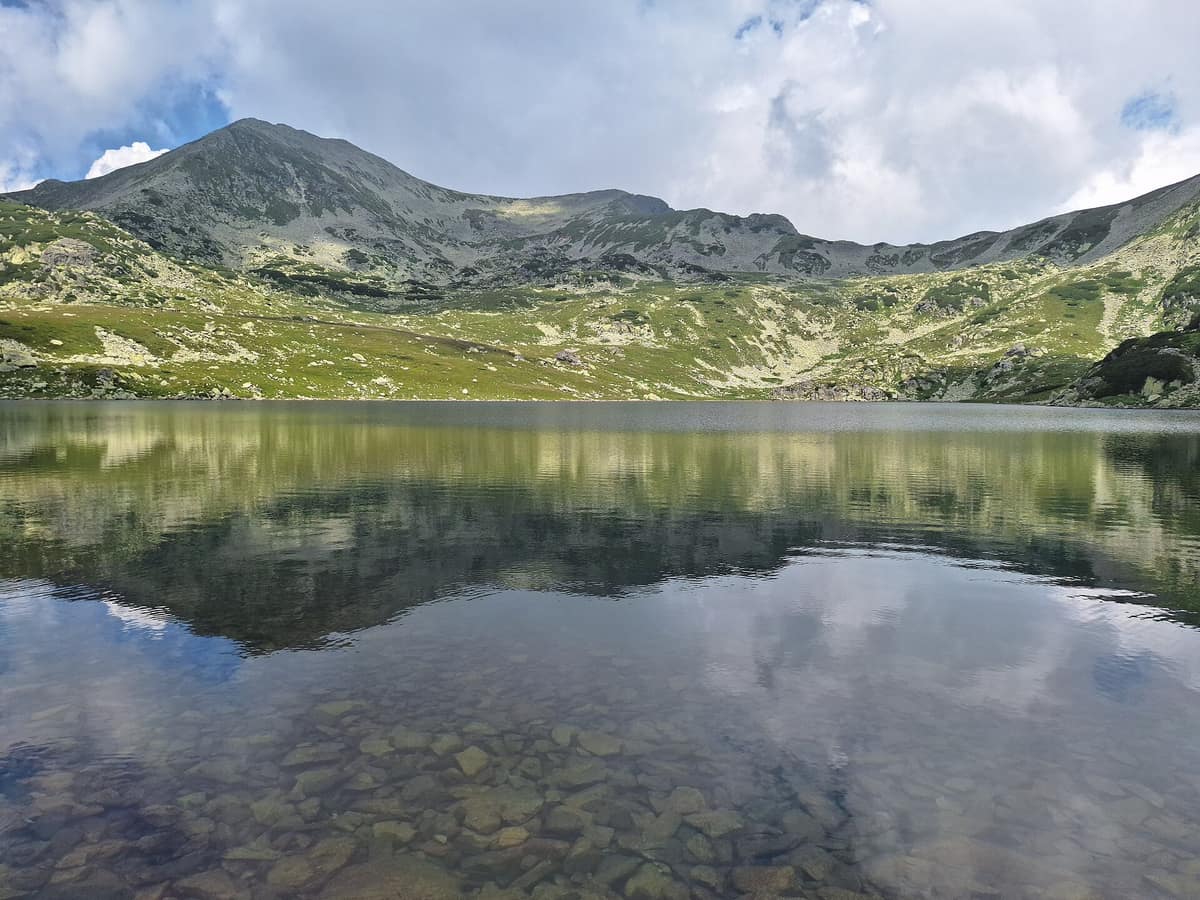
Retezat National Park
Parcul Național Retezat
Hunedoara County (Hațeg) · Romania
Photo: Gugalcrom123 · CC BY 4.0 · Wikimedia Commons
The realm of the granitic and glacial Retezat, with over 80 crystal tarns and the Gemenele scientific reserve.
A multitude of glacial tarns scattered across a single massif, so numerous that the park earned the moniker "Land of Blue Eyes". Retezat is Romania's oldest national park: founded in 1935 by Professor Alexandru Borza, it has grown from roughly 13.000 hectares to over 38.000. Its crown is Peleaga, rising to 2509 m.
What makes it unique
A single massif gathers the country's largest and deepest glacial tarns, fifty peaks above 2000 m, and ancient foothill forests merging into alpine landscapes.
The place
Nature
The landscape
There are 50 peaks rising above 2000 m. Closely following Peleaga stands Păpușa, at 2508 m.
Yet what defines this realm is water. The tarns are legacies of ancient alpine glaciers, fed by snow melting off the high ridges. They encompass roughly 38 % of all glacial lakes in Romania. Lake Bucura, spanning 8,9 ha, is the country's largest tarn; Lake Zănoaga, reaching 29 m, the deepest; and Tăul Porții, at 2260 m, the highest in the massif. Bucura has its own folklore: legend calls it the palm of a giant turned to headless stone—the Retezat peak—with its fingers forming lakes Slăvei, Lia, Ana, Viorica, and Zănoaga.
The south is another world. Retezatul Mic rests on limestone, displaying classic karst features: gorges, caves, and chasms. Habitats include peat bogs sheltering moisture-loving orchids like Gymnadenia frivaldii and Dactylorhiza cordigera, beside the insectivorous common butterwort, Pinguicula vulgaris.
Woodlands cover roughly 20.500 hectares, or 53 % of the park, and their Swiss stone pine population is likely the most representative in the Carpathians. Above them, mountain pine forms dense scrub that stabilizes scree slopes and shields soil from erosion.
Wildlife and seasons
The administration documents 1190 native vascular plant species, 53 mammals, 98 birds, six fish, and seven reptiles and amphibians. A subsequent census recorded 108 bird species. Mammals include the grey wolf, brown bear, Eurasian lynx, chamois, red deer, and roe deer. The alpine marmot was introduced in 1973 into the Gemenele scientific reserve, spreading through the massif's central alpine zone.
The flora features distinctive rarities: the endemic Draba dorneri, edelweiss, and lady's slipper, while four plants are protected Natural Monuments of Romania: Gentiana lutea, Gymnadenia rhellicani, Leontopodium alpinum, and Cypripedium calceolus. Insect life features 1100 butterfly species, and Lunca Berhina was declared a Prime Butterfly Area of European importance.
For birds, the Gura Apelor reservoir on the western perimeter has become an important wetland for waterfowl during wintering, breeding, and feeding. In summer, mountain hikes double as prime birdwatching and wildlife photography outings.
Species
With a page in the atlas
Being mentioned in a source doesn't guarantee sightings: check with the people who manage the area.
Memory and protection
History and conservation
Before park creation, the territory served as a royal chamois hunting reserve. From 1880, Norwegian spruce stands were heavily clear-cut using Italian timber workers brought in by estate owners. Formal conservation arrived in 1935 through Borza's advocacy, and in 1955 the Gemenele scientific reserve was delineated. In 1979 UNESCO's Man and the Biosphere programme designated it a biosphere reserve, and in 2008 it received the European Diploma of Protected Areas.
Rewilding projects
Before you set off
Visiting
How to visit
The park recommends several classic routes. From Cârnic, the trail via Lake Galeș and Șaua Zănoagelor, or the ascent via Cabana Pietrele and Lake Stânișoara to Retezat peak. From Gura Bucurii, the route leading past Lake Bucura, Căldarea Berbecilor, and Peleaga, alongside the circuit of the Bucura glacial tarns. Detailed trail overviews are maintained by the Salvamont mountain rescue service.
A primary access point is Râușor, reached via road DJ 686 from Râu de Mori.
Bucura mountain refuge, standing at 2041 m on the lakeshore, lies a two-hour hike from Poiana Pelegii. High-altitude refuges may only be occupied under exceptional emergency conditions with Salvamont clearance, so overnight visitors must carry tents and camp only in designated areas. Cycling is permitted along forest roads but barred on hiking footpaths. Winter offers ski mountaineering along park trails.
Before you go
Study the map, select routes matching your endurance, monitor mountain weather, and equip yourself properly. Hiking is at your own risk on marked paths only. Camp exclusively at designated campsites, refrain from feeding wildlife, and leave only footprints behind.
Check access, rules and visiting conditions in the official information from the managing body before you set off.
Location
Where it is and how far it reaches
Boundary of Parcul Național Retezat · IUCN II · © EEA, CDDA (CC-BY) The coordinate is estimated; it isn't a verified access point.
Transparency
Sources
The research data with its sources, and the official links for this place, are in the Spanish version of this page. See the Spanish version
Around it
Directly bordering Retezat at 0 km is Domogled - Cerna Valley National Park. At 11 km rise the Șureanu Mountains, and at 19 km lie Sohodol Gorge and the Parâng Mountains. With Călimani National Park it shares the common viper, marten, and capercaillie, as well as old-growth forests and high-alpine realms.
What else to explore nearby
Approximate straight-line distance between the edges of each area. It doesn't indicate access, routes or driving times.
- Domogled - Cerna Valley National Park
Caraș-Severin, Mehedinți, and Gorj Counties
Borders this area
Deep tectonic canyon flanked by Banat black pine and catchments with virgin montane beech woods.
JFMAMJJASONDMay – October · Crowding very low
If you like this place, elsewhere in Europe
Distant places with uncommon wildlife and habitats in common. The most widespread species don't count. Sharing species doesn't imply a corridor or guaranteed presence.
- Rodna Mountains National Park
Bistrița-Năsăud and Maramureș Counties (Pietrosu Rodnei)
In common: Pinus cembra · Vipera berus · Bombina variegata — high mountain, glacial landscape, old-growth forest
The highest glacial mountains in the Eastern Carpathians hosting the Pietrosu Rodnei scientific reserve.
JFMAMJJASONDJune – October · Crowding low
- Bucegi National Park - Western Slopes
Dâmbovița, Argeș, and Prahova Counties
In common: Pinus cembra · Vipera berus · Bombina variegata — high mountain, old-growth forest
Dramatic conglomerate cliffs rising toward the plateau of the Babele and Sphinx wind-sculpted rock formations.
JFMAMJJASONDJune – October · Crowding low
- Havešová Strict Nature Reserve
Prešov Region (Poloniny National Park)
In common: Vipera berus · Bombina variegata · Rosalia longicorn
Virgin beech forest with record-breaking trees exceeding 50 metres in height in the Eastern Carpathians.
JFMAMJJASONDMay – October · Crowding very low
Entry #281 of the original atlas.