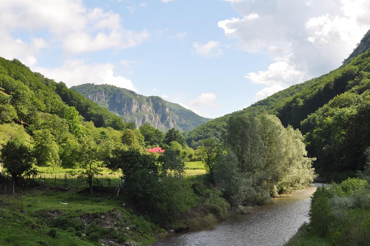
Domogled - Cerna Valley National Park
Parcul Național Domogled - Valea Cernei
Caraș-Severin, Mehedinți, and Gorj Counties · Romania
Photo: Flori & Nicu Farcaș · CC BY-SA 4.0 · Wikimedia Commons
Deep tectonic canyon flanked by Banat black pine and catchments with virgin montane beech woods.
Air rising along the Cerna Valley carries Mediterranean and oceanic warmth, and it shows: temperatures run higher than across the rest of Romania. Domogled-Valea Cernei spans 61.211 hectares in southwestern Romania, divided between Caraș-Severin, Mehedinți, and Gorj counties, and revolves around a river plunging from above 2000 metres down to 168 m at Băile Herculane. It is an IUCN category II national park embracing eleven nature reserves within its bounds.
What makes it unique
A valley open to the Mediterranean, with vertical limestone walls, UNESCO-listed primeval beech woods, and a flora that prompted protection for three European plant species.
The place
Nature
The landscape
The Cerna Valley forms a tectonic corridor separating two markedly contrasting mountain ranges. On one flank rise the Godeanu Mountains, composed almost entirely of metamorphic schists; on the other stand the lower, limestone-built Mehedinți Mountains. In between, a ribbon of limestone flanking the river creates the valley's signature landmarks: the ciuceve and geanțuri, isolated limestone crags vaulting from one riverbank to the other.
The region's largest limestone expanse stretches between Vf. lui Stan and Mount Domogled. It falls toward the Cerna in sheer scarps of 400 to 600 m, carved by dry karst ravines—a world of limestone bluffs, sinkholes, caves, chasms, gorges, and waterfalls.
Climate accounts for the rest. Due to its orientation, the basin primarily intercepts westerly and southwesterly air masses; in winter moist, mild air of Mediterranean and oceanic provenance pushes inland, while Mediterranean depressions unleash generous rains in November and December. Consequently, this terraced relief, dropping from over 2000 m to 168 m, functions simultaneously as a thermal staircase.
Wildlife and seasons
The vascular flora totals some 1110 species, of which 66 represent threatened, rare, or partly endemic taxa. The park was declared to safeguard three of them: Campanula serrata, Himantoglossum caprinum, and Cypripedium calceolus, catalogued under Annex II of the Habitats Directive. Survey records further identify two globally threatened sandworts, Minuartia graminifolia and Minuartia hirsuta.
Mammals of conservation priority include the Eurasian otter, brown bear, Eurasian lynx, grey wolf, and European wildcat. The European pine marten, red deer, roe deer, chamois, and wild boar also roam here. Ten bat species of conservation interest inhabit caves, including Myotis myotis and Rhinolophus ferrumequinum, while reptiles feature Hermann's tortoise, Testudo hermanni, alongside Bombina variegata.
Avifauna highlights encompass the golden eagle, Eurasian eagle-owl, short-toed snake eagle, and white-backed woodpecker.
Species
With a page in the atlas
Being mentioned in a source doesn't guarantee sightings: check with the people who manage the area.
Memory and protection
History and conservation
Romans dubbed the river Tierna and subsequently Dierna; the modern name arrived with Slavic settlement.
In 2017, the UNESCO serial property "Ancient and Primeval Beech Forests of the Carpathians and Other Regions of Europe" was expanded. Domogled-Valea Cernei includes 9.732,3 ha of these primeval beech reserves, notably the Domogled-Coronini-Bedina component encompassing 5.110,6 ha.
Rewilding projects
Before you set off
Visiting
How to visit
Begin at the visitor centre. The basement explores the subterranean realm with 3D scale models of six of the park's most prominent caves alongside a 3D relief model of the entire park and its trail network; the ground floor details park geography, boundaries, hiking paths, nature reserves, and Natura 2000 habitats; and the top floor highlights local communities.
Park administration suggests five mountain routes showcasing waterfalls, caves, ravines, isolated hamlets, lookout crags, and summits. One departs Băile Herculane via Coada Lacului to Vânturătoarea waterfall and Poiana Cicilovete. Another traverses Motel Dumbrava, Țăsna gorge, Moara Dracilor, and Stâna Oprescu. A shorter loop visits Grota Haiducilor, several viewpoints, and Munk spring to Izvorul Diana III. The Domogledu Mare circular covers 8,1 km with 861 m of climb and 920 m of descent, requiring five to five and a half hours, visiting Peştera de Sub Şărban, Domogledu Mic and Mare peaks, and Ferigari gorge. Another loop through the Mehedinți Mountains to Vârful Ciolanu Mare and Țăsna gorge spans 8,6 km and takes about seven and a half hours.
Specialized guide services are available through park administration for botanizing, wildlife watching, and landscape photography.
Before you go
On the upper karst massifs, water springs are scarce or non-existent, so carry adequate water for your entire outing. Stay strictly on official marked trails. Children under 14 years of age may enter only when accompanied by a responsible adult or within organized parties. Dogs must remain leashed on marked trails. Open fires are allowed strictly at designated camping sites and beside permitted tourist chalets.
Check access, rules and visiting conditions in the official information from the managing body before you set off.
Location
Where it is and how far it reaches
Boundary of Parcul Național Domogled - Valea Cernei · IUCN II · © EEA, CDDA (CC-BY) The coordinate is estimated; it isn't a verified access point.
Transparency
Sources
The research data with its sources, and the official links for this place, are in the Spanish version of this page. See the Spanish version
Around it
Bordering Domogled directly is Retezat National Park at 0 km, and only 1 km away lies the Mehedinți Plateau. Fifteen kilometres distant is Đerdap National Park - Iron Gate, at 22 km Sohodol Gorge, and twenty-nine kilometres away Semenic - Caraș Gorge National Park.
What else to explore nearby
Approximate straight-line distance between the edges of each area. It doesn't indicate access, routes or driving times.
- Retezat National Park
Hunedoara County (Hațeg)
Borders this area
The realm of the granitic and glacial Retezat, with over 80 crystal tarns and the Gemenele scientific reserve.
JFMAMJJASONDJune – October · Crowding low
- Semenic - Caraș Gorges National Park
Caraș-Severin County (Anina / Carașova)
About 29 km away
One of Romania's longest and wildest limestone gorges alongside relict virgin beech forests (Izvoarele Nerei).
JFMAMJJASONDMay – October · Crowding very low
If you like this place, elsewhere in Europe
Distant places with uncommon wildlife and habitats in common. The most widespread species don't count. Sharing species doesn't imply a corridor or guaranteed presence.
- Rodna Mountains National Park
Bistrița-Năsăud and Maramureș Counties (Pietrosu Rodnei)
In common: Greater mouse-eared bat · Bombina variegata · White-backed woodpecker — high mountain
The highest glacial mountains in the Eastern Carpathians hosting the Pietrosu Rodnei scientific reserve.
JFMAMJJASONDJune – October · Crowding low
- Northern Velebit National Park
Lika-Senj (Croatia)
In common: Nose-horned viper · White-backed woodpecker · Eurasian eagle-owl — karst and caves, high mountain
Karst relief, ancient beech forests and mountain pastures in Northern Velebit.
JFMAMJJASONDMay – November · Crowding low
Entry #47 of the original atlas.