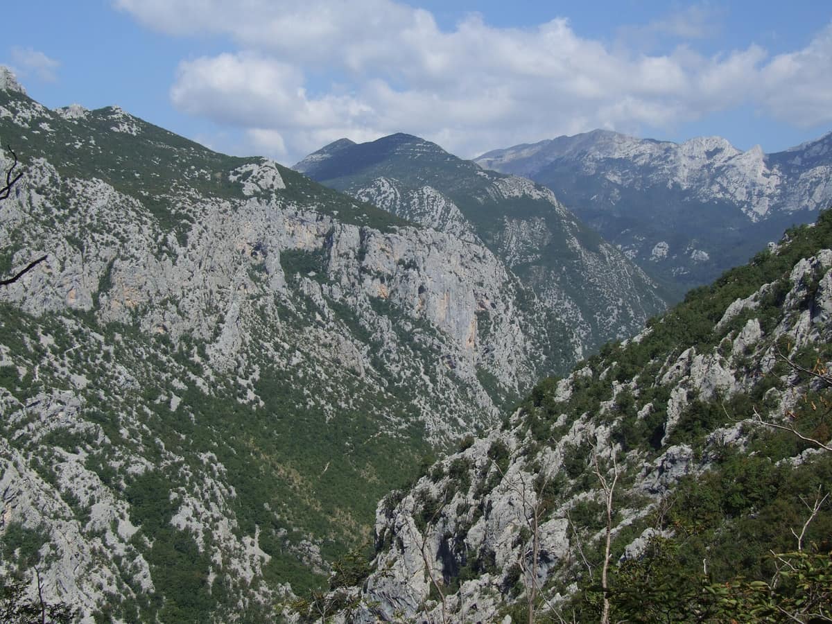
Paklenica National Park - Velebit Plateau
Nacionalni park Paklenica - Altiplano Velebit
Zadar County (Starigrad-Paklenica) · Croatia
Photo: Pudelek (Marcin Szala) · CC BY-SA 3.0 · Wikimedia Commons
Vertical incised canyons (Velika and Mala Paklenica) plunging straight towards the Adriatic Sea from the crests of Velebit.
Picture two sheer canyons dropping vertically from the crags of Velebit straight towards the sea. In Mala Paklenica, towering cliffs soar to 300 metres, narrowing to barely 10 metres wide at the tightest defile; in Velika Paklenica, the canyon extends 14,5 km, constricting over a stretch of some 3 km between Anića Kuk and Marasovići into a slot canyon a few dozen metres across and up to 400 metres deep. Paklenica National Park protects both torrent basins and the towering crests that hem them in, spanning 95 km² that embrace the loftiest peaks of the Velebit: Vaganski Vrh and Sveto Brdo.
What makes it unique
Two vertical canyons ascending from sea level to peaks over seventeen hundred and fifty metres, harbouring black pine forests whose resin likely gave the park its name.
The place
Nature
The landscape
The rugged topography divides between the torrent gorges of Velika Paklenica and Mala Paklenica, carved vertically into the southern ramparts of Velebit. At various constriction points along Velika Paklenica, giant boulders and rockfalls partially obstruct the torrent, forming turbulent rapids and churning cascades.
Climbing higher, the vegetation shifts dramatically with altitude. The park harbours eight distinct forest communities across an elevation gradient spanning from 20 to 1757 m. Near the summits prostrate mountain pine (mugo) forms the largest and most contiguous expanse of krummholz in Croatia. Below, the European black pine forms rare endemic stands on arid, skeletal soils between 700 and 1200 m; this conifer gave the park its name, as Paklenica likely derives from "paklina", the fragrant black pine resin harvested by locals for medicinal salves, lighting, and sealing wooden boats. Beneath these pine woods, winter heath bursts into vivid bloom in March, making early spring and late winter a scenic time to explore.
Deep underground lies Manita Peć at 570 m, the most renowned of 115 known caverns in the park and the sole show cave accessible with a guide, featuring colossal dripstone chambers opened to visitors since 1937.
Wildlife and seasons
Ornithologists have documented 260 bird species, with 165 breeding within the park or its immediate buffer. On the canyon rock faces nest 24 avian species, led by Eurasian nuthatch and blue rock thrush. Rare raptors include the golden eagle, peregrine falcon, short-toed snake eagle, and northern goshawk, while the Eurasian eagle-owl, Europe’s largest owl, nests regularly across both Paklenica gorges. The griffon vulture maintained three breeding pairs until late 1999 before vanishing due to pastoral decline and poisoned predator baits targeted at wolves.
Mammal diversity reaches 53 species, encompassing roe deer, red deer, chamois, and wild boar, alongside Europe’s three apex carnivores: brown bear, wolf, and Eurasian lynx.
Herpetofauna comprises 31 amphibian and reptile species, including 11 snakes; the only venomous serpents are the nose-horned viper and the scarce Orsinis viper. Over 100 species of diurnal butterflies flutter through the valleys, with the giant peacock moth, Croatia’s largest lepidopteran, frequently observed.
Species
With a page in the atlas
Being mentioned in a source doesn't guarantee sightings: check with the people who manage the area.
Memory and protection
History and conservation
Roughly eight thousand years ago, Neolithic pastoralists and farmers first arrived in the Velebit foothills, tending primitive wheat, goats, and sheep. Paklenica was declared a national park on 19 October 1949 to safeguard Dalmatia’s most extensive and pristine forest complex. Today it holds UNESCO Biosphere Reserve status (designated in 1978), joined the Natura 2000 ecological network in 2014, and in 2017 achieved World Heritage recognition: in 2017 the park’s ancient beechwoods were inscribed into the transnational UNESCO site "Ancient and Primeval Beech Forests of the Carpathians and Other Regions of Europe".
The flora counts over 1.000 plant species and subspecies, including 79 endemics.
Before you set off
Visiting
How to visit
Hiking is the premier way to experience Paklenica: between 150 and 200 km of waymarked paths traverse the terrain, ranging from leisurely valley rambles connecting Velika Paklenica to Manita Peć cave, Lugarnica forest lodge, and the mountain hut, to demanding alpine climbs reaching Velebit’s crest. All trails feature standard red-and-white trail markers and directional signposts at intersections.
For summit ascents, three primary goals stand out. Vaganski Vrh, at 1757 m, is the roof of Velebit, featuring a broad grassy crest; on clear days views carry across 150 km to Risnjak. Sveto Brdo, at 1753 m, represents Velebit’s second highest peak and can be reached in about five hours of hiking from the mountain hut. Liburnija, rising to 1709 m, offers one of the finest marine panoramas over the Adriatic archipelago; the trail ascends steeply from the mountain hut (480 m) and is recommended only for seasoned alpine hikers.
Manita Peć is reached in an hour and a half from the main Velika Paklenica car park. Guided cave visits operate from May to October, with extended daily tours in July, August, and September. The underground tour lasts roughly 30 minutes, maintaining an interior temperature of around 9 °C year-round.
The "Underground Secrets of Paklenica" visitor centre is housed inside historic bunkers excavated by the Yugoslav army between 1950 and 1953 in Velika Paklenica canyon. Inaugurated in August 2016, it presents two multimedia exhibition wings: "Natural Heritage of Velebit" and "Cultural Heritage and Inhabitants of Velebit". Open from April through October.
Before you go
Straying from marked trails and picking wild flora are strictly prohibited. To protect the wild character of Mala Paklenica canyon and its endangered cliff-nesting avifauna, rock climbing is strictly banned in that defile. The most favourable trekking months are April, May, June, September, and October.
Check access, rules and visiting conditions in the official information from the managing body before you set off.
Location
Where it is and how far it reaches
Boundary of Paklenica · IUCN II · © EEA, CDDA (CC-BY) The coordinate is estimated; it isn't a verified access point.
Transparency
Sources
The research data with its sources, and the official links for this place, are in the Spanish version of this page. See the Spanish version
Around it
Rewilding Velebit Plains lies 9 km away.
If you like this place, elsewhere in Europe
Distant places with uncommon wildlife and habitats in common. The most widespread species don't count. Sharing species doesn't imply a corridor or guaranteed presence.
- Retezat National Park
Hunedoara County (Hațeg)
In common: Circaetus gallicus · Eurasian eagle-owl · Peregrine falcon — high mountain, old-growth forest
The realm of the granitic and glacial Retezat, with over 80 crystal tarns and the Gemenele scientific reserve.
JFMAMJJASONDJune – October · Crowding low
- Domogled - Cerna Valley National Park
Caraș-Severin, Mehedinți, and Gorj Counties
In common: Circaetus gallicus · Eurasian eagle-owl · Chamois — gorge and canyon, karst and caves, high mountain
Deep tectonic canyon flanked by Banat black pine and catchments with virgin montane beech woods.
JFMAMJJASONDMay – October · Crowding very low
- Els Ports Natural Park
Catalonia / Aragon / Valencian Community (Tarragona / Teruel / Castellón / Roquetes / Tortosa)
In common: Circaetus gallicus · Griffon vulture · Eurasian eagle-owl — gorge and canyon, karst and caves, high mountain, old-growth forest
A rugged karst massif between Catalonia, Aragon, and the Valencian Community featuring limestone cliffs, southern beech groves, and the Iberian ibex.
JFMAMJJASONDApril – June · September – November · Crowding low
Entry #301 of the original atlas.