Blidinje Nature Park - Čvrsnica Massif
Park prirode Blidinje - Čvrsnica
West Herzegovina and Herzegovina-Neretva Cantons (Posušje / Jablanica) · Bosnia and Herzegovina
Photo: Irrmam · CC BY-SA 4.0 · Wikimedia Commons
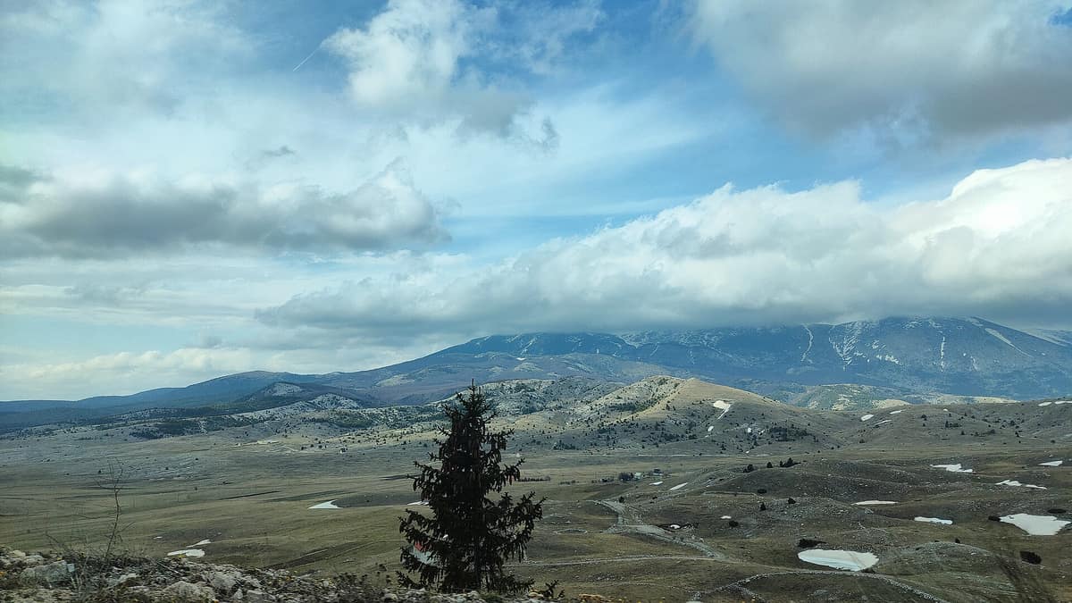
High karst mountains around the glacial Lake Blidinje featuring the iconic natural rock arch of Hajdučka Vrata.
An open portal carved into stone, a circular rock aperture five metres across to peer through, and beyond it a canyon falling away toward Prenj, Velež and Čabulja. Hajdučka vrata, protected as a natural monument since 1985, is the most celebrated landmark of Blidinje Nature Park, yet the park spans far wider than its famous stone gate. It is a high karst plateau in Herzegovina set between two mountains, Čvrsnica and Vran, with a shallow lake on the valley floor, pine woods, meadows and high crests scaled on day-long treks.
What makes it unique
A high-altitude lake surrounded by the highest peaks of the central Dinarides and home to over 200 endemic, subendemic or relict plant species.
The place
Nature
The landscape
Everything originates from ice. During the last two ice ages, glacial meltwater from Čvrsnica shaped the broad, open valley floor where the plateau rests today. At its lowest point, at 1184 m, lies Lake Blidinje, the largest natural lake in Bosnia and Herzegovina and a geomorphological natural monument that lends its name to the park. It covers between 2.5 and 6 km², with depths ranging from one to four metres. Its genesis remains debated: it may be purely glacial or partly created by shepherds who, at the close of the nineteenth century, sealed swallow-holes in the karst plain.
On one side rises Čvrsnica, the highest mountain in the central Dinarides, culminating at Pločno at 2228 m. It features another 14 peaks exceeding 2000 m. On the opposite side stands Vran, more conical with gentler contours, topping out at Veliki Vran. Between them nestles Masna Luka, a managed natural reserve harbouring the Church of Saint Elijah and a Franciscan art gallery.
The bedrock is limestone, honeycombed by several dozen mapped caves, chasms and sinkholes, though only seven have been speleologically explored. Within the Čvrsnica massif, the Diva Grabovica geomorphological reserve stands out with sheer cliffs dropping between 100 and 200 m into a deep river canyon.
Two-thirds of the park is covered in woodland, the remainder divided among pastures, meadows and alpine tundra. Foremost among the trees is the Bosnian pine (Pinus heldreichii, local munika), a relict endemic reaching its western Balkan range limit on the south-eastern flanks of Vran. At Masna Luka it has its dedicated sanctuary, Masna Luka – Borićevac, holding the largest stand of this pine in Europe. Higher up, above 2100 m along the ridge of Čvrsnica, grow lichens and high-altitude specialists including Androsace lactea and Papaver kerneri. Vascular flora exceeds 1500 species; Čvrsnica and Vran, alongside Prenj and Čabulja, form an endemic hotspot unique on a European scale. The Herzegovinian bellflower (Campanula hercegovina) clings to rock clefts on Čvrsnica.
Wildlife and seasons
Prominent mammals highlighted by the park include the Balkan snow vole, the brown bear and the Balkan chamois. Along the precipitous crags of Veliki kuk, chamois are regularly observed. Other residents comprise roe deer, pine marten, wildcat, lynx, wolf, red fox, badger, weasel, red squirrel, brown hare and wild boar.
The waters shelter rare aquatic life: the alpine newt in Masna Luka, and endangered endemic fish in the lake such as Aulopyge hügeli and Leucaspius delineatus. The only reptile recorded in scientific literature here is the meadow viper. Across Čvrsnica, Čabulja and Prenj, 109 species of diurnal butterflies have been documented.
The seasons govern your itinerary. The area sits on the boundary between Mediterranean and continental climates, prone to abrupt weather shifts, heavy autumn rains and deep winter snow.
Species
With a page in the atlas
Being mentioned in a source doesn't guarantee sightings: check with the people who manage the area.
Memory and protection
History and conservation
The area is first recorded in writing in 1408 in a royal charter by King Ostoja of Bosnia, though settled far earlier: Illyrian tumuli and Roman roads attest to at least 2500 years of human presence. For centuries, transhumant shepherds from southern Herzegovina spent the summer months here. Across 19 distinct localities, around 160 stone pastoral huts have been documented, 85 of which remain well preserved.
From the medieval era survive the stećci, monolithic carved gravestones. The park hosts five national monument necropolises at Risovac, Dugo polje, Ponor, Barzonja and Donje Bare.
On the conservation front, native newt populations declined sharply in waters where brown trout were introduced for angling, as the fish prey heavily on their larvae.
Before you set off
Visiting
How to visit
The park provides hiking itineraries suited to all abilities.
For a gentle start, the walk around Masna Luka spans some 6.5 km, taking two and a half hours with about 200 m of ascent, passing wetlands and the Jasle spring. A loop of Lake Blidinje covers around 10 km in three hours with barely 30 m of elevation change. The climb to Borova glava, a summit in the centre of the park, requires half an hour. The hills of Barzonja, Glavica and Grad lack waymarked tracks but are easily roamed on foot.
For a full-day excursion, Hajdučka vrata from Vitlenica takes about 16.5 km round trip, seven hours and some 700 m of climbing along a well-signposted medium-grade trail. The opening hour winds through the Muvarnica forest of ancient pines and firs with scattered beeches where woodland birds call, before reaching Zaglavlje at 1560 m, a deserted pastoral settlement.
For experienced mountaineers, Veliki kuk (around 17 km, nine hours, 800 m of ascent) and Pločno from Masna Luka (some 17 km, nine hours, 1200 m of ascent, with no water on the trail). In clear weather, Pločno offers panoramas across distant Bosnian and Montenegrin ranges, the Adriatic Sea and even Durmitor. The Barzonja–Jelinak trail, covering around 6 km and 600 m of elevation gain, ascends along a scenic crest overlooking the lake.
Before you go
Expect snow in winter and copious rain in autumn, with sudden weather changes. The route to Pločno has no springs along the ascent, so carry all the water you need.
Check access, rules and visiting conditions in the official information from the managing body before you set off.
Location
Where it is and how far it reaches
Boundary of Blidinje · IUCN III · © EEA, CDDA (CC-BY) The coordinate is estimated; it isn't a verified access point.
Transparency
Sources
The research data with its sources, and the official links for this place, are in the Spanish version of this page. See the Spanish version
Around it
Contiguous to the massif are Planina Čabulja and Planina Prenj; some 25 km away rise the Kamešnica Mountains.
What else to explore nearby
Approximate straight-line distance between the edges of each area. It doesn't indicate access, routes or driving times.
- Prenj Mountains
Herzegovina-Neretva Canton (Konjic / Jablanica)
Borders this area
The 'Bosnian Himalayas', an ultra-rugged alpine massif of white limestone ridges and glacial cirques.
JFMAMJJASONDJune – October · Crowding very low
If you like this place, elsewhere in Europe
Distant places with uncommon wildlife and habitats in common. The most widespread species don't count. Sharing species doesn't imply a corridor or guaranteed presence.
- Dinara Nature Park
Šibenik-Knin and Split-Dalmatia Counties (Knin / Sinj)
In common: Orsinis viper · European wildcat · Eurasian lynx — high mountain, karst and caves
The massif that gives its name to the entire Dinaric Alps and hosts Croatia’s highest peak (Dinara 1,831 m).
JFMAMJJASONDMay – October · Crowding very low
- Monti Sibillini National Park
Marche / Umbria (Visso / Norcia / Castelluccio di Norcia)
In common: Orsinis viper · European wildcat · Brown bear — high mountain, karst and caves, lake
The legendary Apennine range of Monte Vettore (2.476 m), the Infernaccio Gorge, and the highland plateaus of Castelluccio.
JFMAMJJASONDMay – October · Crowding moderate
Entry #307 of the original atlas.