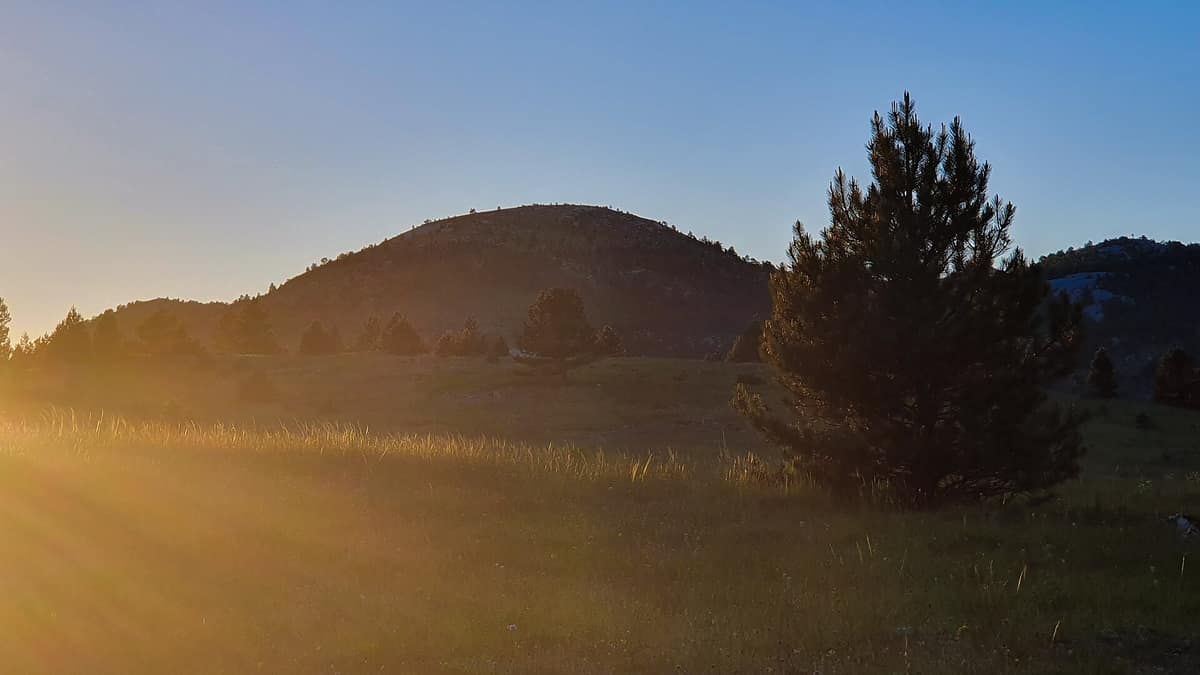
Dinara Nature Park
Park prirode Dinara
Šibenik-Knin and Split-Dalmatia Counties (Knin / Sinj) · Croatia / Bosnia and Herzegovina
Photo: Ivan Vid · CC BY-SA 4.0 · Wikimedia Commons
The massif that gives its name to the entire Dinaric Alps and hosts Croatia’s highest peak (Dinara 1,831 m).
This is the mountain that lends its name to an entire alpine mountain chain. The Dinaric Alps take their title from Dinara, and at its summit, Sinjal, at 1831 m, a geodetic pillar marks the roof of Croatia with a simple inscription: «peak of Croatia». Dinara Nature Park, Croatia’s newest nature park established in February 2021, safeguards 63,052 hectares spanning the Dinara, Troglav and Kamešnica massifs, the upper reaches and headwaters of the Cetina river, the source of the Krka, and the karst poljes of Hrvace, Paško and Vrlika along the border with Bosnia and Herzegovina. After Velebit, it is Croatia’s second-largest nature park.
What makes it unique
A wild mountain massif without a single village, with centuries-old summer pastures sustaining up to 95% of Croatia’s meadow viper population.
The place
Nature
The landscape
The defining feature of Dinara is its sheer limestone walls with pronounced horizontal bedding planes. Built from Jurassic and Cretaceous karst limestones, the mountain displays classic sinkholes, uvalas, plateaus and caves, leaving the high ridges almost devoid of surface running water. Rain sinks into a subterranean hydrological network primarily draining toward the Cetina basin and partly toward the Krka, re-emerging at powerful karst springs at the foot of the mountain. Seasonal floods inundate low-lying poljes, creating rich wet meadow habitats.
Contrasting topography defines the landscape: harsh waterless upland karst, formidable cliffs and vast summer pastures on one side; the fertile Cetina valley on the other. Near Vrlika lie the three principal karst springs of the Cetina, while the Rumin brook constitutes its second-largest tributary. Along the Krčić river, spanning some 10.5 km, three waterfalls tumble in succession, the final drop framed by a 22 metre travertine barrier. In the upper Krka valley, canyons, tuff barriers and cascades shape the scene. Average annual summit temperatures hover between 2 and 4 °C, making it one of the coldest regions in Croatia.
Wildlife and seasons
The scree slopes beneath the precipices support specialized plant communities rich in endemic taxa. Dinara harbours roughly 750 plant species, with over 110 strictly protected and 55 endemics. This floral diversity reflects its role as a glacial refuge for European species, mirrored in the rich subterranean fauna.
The flagship resident is the Karst meadow viper, an endemic viper of the Dinaric ranges. Local mammals include the brown bear, wolf, Eurasian lynx and wildcat, alongside an endemic rodent, the Balkan snow vole. Birds of prey feature the golden eagle and short-toed snake eagle, while open pastures provide scarce nesting grounds for the greater short-toed lark and ortolan bunting. Herpetofauna includes the smooth snake, nose-horned viper, fire salamander, slow worm and alpine newt.
The pastoral cycle spans May to October. In summer, shepherds drive livestock up to the high plateau, remaining until autumn frosts and early snow: an ancient transhumance tradition that has sculpted these expansive grasslands.
Species
With a page in the atlas
Being mentioned in a source doesn't guarantee sightings: check with the people who manage the area.
Memory and protection
History and conservation
The name likely derives from the ancient Illyrian Dindari tribe, who pastured their flocks across these heights. The Illyrians held the mountain sacred, naming it Troura or Triget. Along its base the early Croatian state took shape: Knin served as the medieval royal capital and Biskupija as the episcopal seat. Near the Cetina spring stands the pre-Romanesque Church of Holy Salvation from the ninth century, and the Cetina valley concentrates around 800 archaeological sites spanning Neolithic, Roman and early Christian periods.
The highland pastures are an anthropogenic landscape maintained by continuous grazing. Of the park’s eight priority habitat types, three are semi-natural grasslands that degrade and lose botanical diversity if abandoned. Near the summits, subalpine grasslands evolved from the historical retreat of mountain pine scrub and high woodlands.
Before you set off
Visiting
How to visit
Dinara is fundamentally a hiker’s mountain. Sinjal, at 1831 m, is comparatively accessible relative to other European high summits, supported by a network of waymarked trails and mountain huts. On the crest, the historic survey marker reads « 1831, peak of Croatia ».
The valleys offer rewarding explorations: the turquoise karst springs of the Cetina, the Rumin and Krčić riverbeds, and the upper Krka. Along the Grab river, an ancient stone bridge and traditional watermills are preserved as cultural heritage, with three still operating today.
Before you go
There are no permanent villages on the mountain: human shelter is limited to scattered shepherds’ bothies and mountaineering huts, so plan your expedition thoroughly and carry all necessary provisions. Dinara encompasses eleven Natura 2000 designated sites: two for bird protection and nine for habitat and species conservation.
Check access, rules and visiting conditions in the official information from the managing body before you set off.
Location
Where it is and how far it reaches
Boundary of Dinara · © EEA, CDDA (CC-BY) The coordinate is estimated; it isn't a verified access point.
Transparency
Sources
The research data with its sources, and the official links for this place, are in the Spanish version of this page. See the Spanish version
Around it
About twenty-five kilometres away lies Una National Park - Upper Reaches and Waterfalls. Farther afield, other dramatic karst massifs sharing the meadow viper and large carnivores include Monti Sibillini National Park and Vikos-Aoös National Park.
What else to explore nearby
Approximate straight-line distance between the edges of each area. It doesn't indicate access, routes or driving times.
- Una National Park - Upper Reach and Waterfalls
Una-Sana Canton (Martin Brod / Štrbački buk)
About 25 km away
Breathtaking tufa waterfall cascades like Štrbački buk (24 m) incised through rugged karst mountain woodlands.
JFMAMJJASONDMay – October · Crowding low
If you like this place, elsewhere in Europe
Distant places with uncommon wildlife and habitats in common. The most widespread species don't count. Sharing species doesn't imply a corridor or guaranteed presence.
- Retezat National Park
Hunedoara County (Hațeg)
In common: Gentiana lutea · Circaetus gallicus · European wildcat — high mountain
The realm of the granitic and glacial Retezat, with over 80 crystal tarns and the Gemenele scientific reserve.
JFMAMJJASONDJune – October · Crowding low
- Domogled - Cerna Valley National Park
Caraș-Severin, Mehedinți, and Gorj Counties
In common: Circaetus gallicus · European wildcat · Eurasian lynx — high mountain, karst and caves
Deep tectonic canyon flanked by Banat black pine and catchments with virgin montane beech woods.
JFMAMJJASONDMay – October · Crowding very low
- Blidinje Nature Park - Čvrsnica Massif
West Herzegovina and Herzegovina-Neretva Cantons (Posušje / Jablanica)
In common: Orsinis viper · European wildcat · Eurasian lynx — high mountain, karst and caves
High karst mountains around the glacial Lake Blidinje featuring the iconic natural rock arch of Hajdučka Vrata.
JFMAMJJASONDJune – October · Crowding very low
- Monti Sibillini National Park
Marche / Umbria (Visso / Norcia / Castelluccio di Norcia)
In common: Orsinis viper · European wildcat · Golden eagle — high mountain, karst and caves
The legendary Apennine range of Monte Vettore (2.476 m), the Infernaccio Gorge, and the highland plateaus of Castelluccio.
JFMAMJJASONDMay – October · Crowding moderate
Entry #303 of the original atlas.