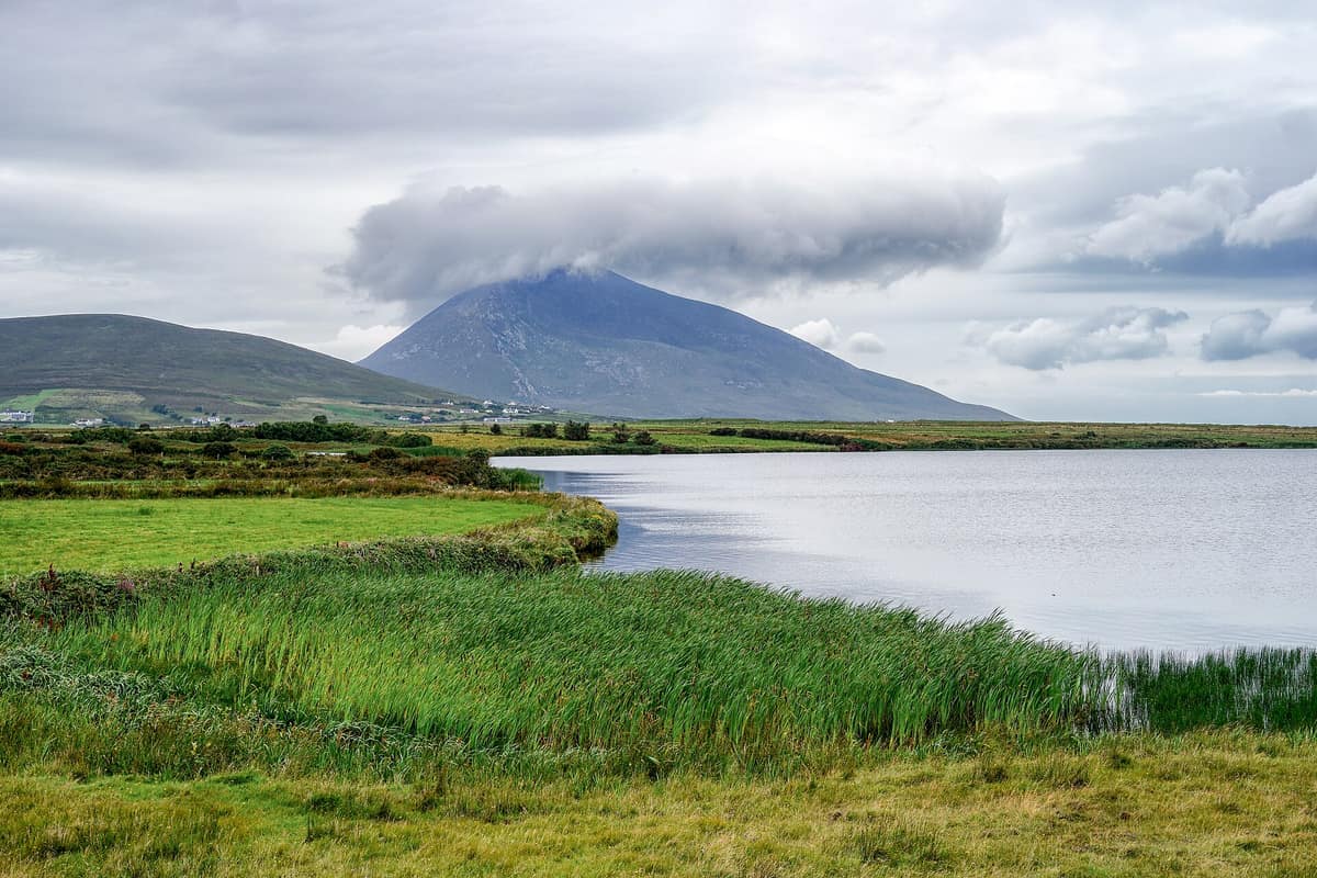
Achill Island and Croaghaun Cliffs
Achill Island
Ireland (County Mayo / Keel / Keem) · Ireland
Photo: MickReynolds · CC BY-SA 4.0 · Wikimedia Commons
Ireland's largest island (connected by bridge), home to spectacular Keem Bay and Croaghaun Cliffs (688 m, the third highest in Europe).
Beneath the peat of Achill lie ancient stone walls. They have rested there for thousands of years, climbing the flanks of Slievemore and tracing field boundaries cultivated before climatic deterioration prompted the blanket bog to swallow the terrain. That is the island in a single vignette: an elemental realm of wind, water, and bog concealing the indelible marks of past inhabitants. Achill is Ireland's largest island, encompassing roughly 148 km² off the Mayo coast, linked to the mainland by bridge since 1887. Its mountains plunge directly into the Atlantic, flanked by sandy coastal grasslands, beaches, and dramatic sea cliffs, culminating in the west at Croaghaun, the third highest sea cliffs in Europe.
What makes it unique
An island of blanket bog, mountain, and sea cliff where prehistoric stone walls emerge beneath the peat and the abandoned village of Slievemore sheltered seasonal herders until the 1940s.
The place
Nature
The landscape
Achill is overwhelmingly cloaked in blanket bog. Formed over millennia under persistent Atlantic rains, the peat mantle sweeps from mountain crests down to the shore, dominated by purple moor-grass, common heather, and sphagnum moss. The bedrock underlying the island and the adjacent Curraun Peninsula ranks among Ireland's oldest formations, dating back to the Precambrian over 600 million years ago. Its two highest massifs, Slievemore and Croaghaun, stood proud as nunataks during the last glacial maximum which ended 10,000 years ago; Lough Acorrymore provides a quintessential example of a glacial corrie with a hanging valley perched overhead.
The sheer northeast face of Croaghaun drops almost directly from its summit into the sea. On its western shoulder, Croaghaun commands the secluded cirque of Keem Bay, opposing the dramatic precipices of Benmore and the promontory of Achill Head. Croaghaun's cliffs possess no vehicular access whatsoever.
Along the shore where windblown sand meets turf lies the machair, a specialised calcareous coastal grassland found only in northwestern Ireland and northwestern Scotland, accorded priority habitat status by the European Union. Prime examples thrive at Keel, Dugort, and Valley. Come early or mid-June, they erupt with vibrant color: wild thyme, daisies, and bird's-foot trefoil.
Wildlife and seasons
May and June bring marine highlights. Dolphins and basking sharks regularly patrol the waters around Achill, with sharks entering Dooagh and Keem bays. These plankton filter-feeders are regarded as gentle giants, yet they can be startled by watercraft and thrash their powerful tails if alarmed; an official wildlife watching code of conduct governs encounters. In former decades the island was renowned for commercial basking shark fisheries, pursued for valuable liver oil.
Spring brings the flowering of Mediterranean heath (Irish heath), a botanical rarity confined to northwest Mayo, Spain, and Portugal, growing on the Curraun Peninsula and behind Croaghaun. By June the machair turns vivid with blooms. Avian life includes the red-billed chough nesting on the cliffs of Croaghaun, alongside European golden plover, dunlin, merlin, and the peregrine falcon; barnacle geese stop over on migration. Across the machair one easily encounters common snipe, the Eurasian curlew, northern lapwing, and Eurasian oystercatcher, while bogs, burns, and lochs host the grey heron. The golden eagle was extirpated locally in 1912. An island naturalist has documented no fewer than 83 bird species.
Mammals feature the Eurasian otter, Irish stoat, European badger, and pygmy shrew, alongside foraging bats. Irish hare and red fox are ubiquitous. The viviparous lizard inhabits heath and dunes, common frogs occur across almost every habitat, and elephant hawk-moths breed throughout the island.
Species
With a page in the atlas
Being mentioned in a source doesn't guarantee sightings: check with the people who manage the area.
Memory and protection
History and conservation
During the Neolithic and Early Bronze Age the climate was warmer and drier, dense pine and birch woods cloaked the landscape, and modern blanket bogs had not yet accumulated. On the lower slopes of Slievemore, prehistoric stone field enclosures predate the peat layers that engulfed them as Atlantic conditions cooled in the Late Bronze Age. Near Dugort at the mountain's foot lies the Deserted Village: between 80 and 100 drystone single-room cottages. Village descendants used them for seasonal booleying (summer transhumance) into the 1940s; Achill was the last recognized redoubt in Ireland or Britain where this ancient grazing custom endured.
At Moytoge Head stands a British naval observation post erected in the First World War to intercept German arms shipments. Roughly half the island forms part of the Gaeltacht, where the Irish language is living heritage. Petalwort, a rare machair liverwort, is protected under Annexes II and IV of the EU Habitats Directive.
Before you set off
Visiting
How to visit
This is walking country, where commonage land arrangements keep wide areas accessible to hikers. The straightforward Dooagh circular walk measures 4.40 km, climbs 60 m, and takes an hour; it skirts a storm-shifting beach and traverses burns, sand, and open bog. The Valley Walk explores around 8 km around The Valley in the northeast.
For sweeping panoramas, Minaun (466 meters) affords the celebrated vantage over Keel strand and Lough Namucka, reachable via a service road close to the summit. Over on the Curraun Peninsula, the basin between Polranny Hill and Curraun Hill hides quiet tarns, a substantial forest, and untamed footpaths free of crowds. Mountain terrain demands proper preparation: check local safety advice and uphold the seven Leave No Trace principles.
Cyclists benefit from three loops in the Achill Cycle Hub and the western terminus of the Great Western Greenway, a 42 km trail following the disused railway between Achill and Westport, opened in 2010 and 2011.
Before you go
The most rewarding period to visit runs from May to October. Crowds remain moderate around Keem Bay on fine summer days. If you hope to watch basking sharks, review the marine wildlife code of conduct beforehand.
Check access, rules and visiting conditions in the official information from the managing body before you set off.
Location
Where it is and how far it reaches
Boundary of Achill Island - Acaill · © OpenStreetMap contributors (ODbL) The coordinate is estimated; it isn't a verified access point.
Transparency
Sources
The research data with its sources, and the official links for this place, are in the Spanish version of this page. See the Spanish version
Around it
At 10 km lies Wild Nephin National Park. Farther afield, species found on Achill are shared with Parque Natural da Ria Formosa (dunlin, Eurasian curlew, and otter), Cap Fréhel (chough and peregrine falcon), Parque Natural Hoces del Alto Ebro y Rudrón (chough, peregrine, and otter), and Parque Natural do Alvão (sundew and otter).
If you like this place, elsewhere in Europe
Distant places with uncommon wildlife and habitats in common. The most widespread species don't count. Sharing species doesn't imply a corridor or guaranteed presence.
- Ria Formosa Natural Park
Algarve (Faro / Olhão / Tavira / Vila Real de Santo António)
In common: Calidris alpina · Eurasian curlew · Eurasian otter — wild coast, marine
A 60 km coastal lagoon protected by 5 sandy barrier islands (Barreta, Culatra, Armona, Tavira, and Cacela), harbouring Portugal's largest common chameleon colony.
JFMAMJJASONDApril – June · September – November · Crowding moderate
- Killarney National Park
Kerry (Killarney / Muckross)
In common: Saxifraga spathularis · White-tailed eagle · Eurasian otter — high mountain
Ireland's first national park: moss-draped ancient Atlantic oakwoods, lakes, and the island's sole native red deer herd.
JFMAMJJASONDApril – June · September – October · Crowding moderate
- Hoces del Alto Ebro y Rudrón Natural Park
Castile and León (Burgos / Sedano / Orbaneja del Castillo / Valdelateja)
In common: Red-billed chough · Peregrine falcon · Eurasian otter
Karst gorges of 200 m carved by the Ebro and Rudrón rivers, featuring the picturesque village of Orbaneja del Castillo and Pozo Azul.
JFMAMJJASONDApril – June · September – November · Crowding low
Entry #625 of the original atlas.