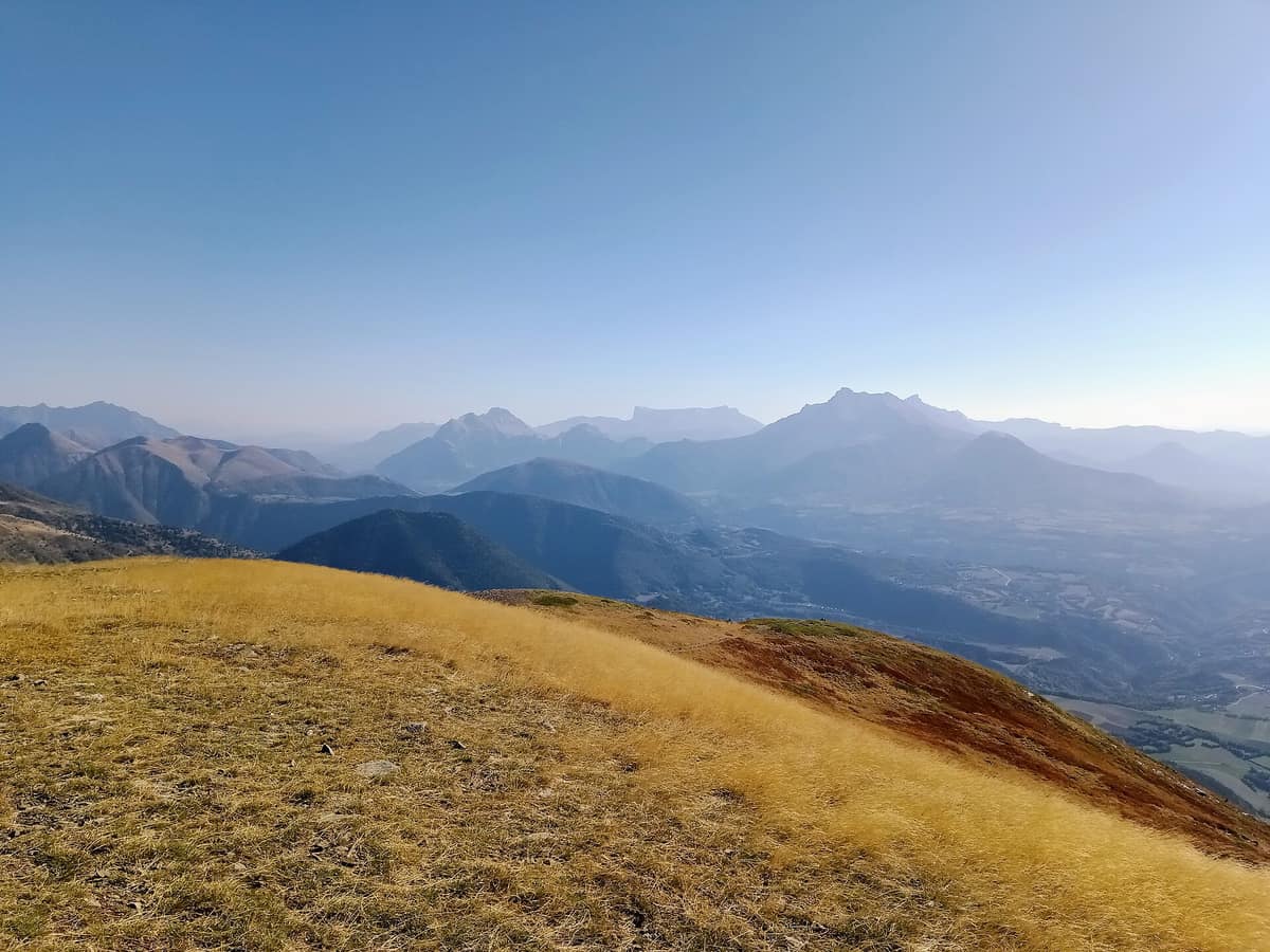
Dévoluy Massif
Massif du Dévoluy
Hautes-Alpes (Saint-Étienne-en-Dévoluy) · France
Photo: Rémih · CC BY-SA 4.0 · Wikimedia Commons
Mineral karst fortress rimmed by limestone cliffs and riddled with deep subterranean chasms (chourums).
It looks like an impenetrable stone fortress, yet inside it is entirely hollow. The Dévoluy is a subalpine limestone massif straddling the Southern and Northern French Alps, covering some 185 km² across the departments of Hautes-Alpes, Isère, and Drôme. Above rise grey ridges, summer pastures, and grazing flocks; below lie nearly six hundred cavities through which subterranean streams flow unseen. It is a land for walking across scree slopes and high pastures, discovering a landscape sculpted predominantly from the inside out.
What makes it unique
Nearly six hundred caves riddle the massif, harboring colossal chambers, limestone formations, and even subterranean ice: the most dynamic world of the Dévoluy lies right beneath your boots.
The place
Nature
The landscape
The Dévoluy is a limestone massif typical of the Prealps, intensely shaped by past glacial erosion. The glaciers have vanished entirely today: owing to its southern latitude, despite the high elevation, ice cover has melted away. They left behind sweeping valleys and immense scree slopes that give the rock its distinctive pale grey hue.
The highest peak is the Grande Couronne of the Obiou at 2.789 metres, unmistakable from neighbouring Alpine summits because it stands detached at the northern forefront of the massif. It is an outlier: the dramatic remnant of an ancient plateau dismantled around it by karst collapses and glacial action. It comprises two geological stages—Upper Jurassic below and Upper Cretaceous above—with limestone being its defining hallmark.
To the south stretches a vast limestone tableland, the Plateau de Bure, perched at 2.500 metres altitude and spanning over three kilometres in length, crowned by the Pic de Bure (2.709 metres). On that high plateau sits an astronomical observatory; from the Col des Baumes, the Pic de Bure stands as the massif’s emblem, hosting NOEMA, the most powerful radio observatory in the Northern Hemisphere, across its tundra-like plain. The floor of the Vallon des Aiguilles reveals another facet: an ancient glacial lake gave way to a meandering stream reminiscent of an alpine steppe.
And then lies the unseen realm. Cavers refer to the massif’s vertical chasms as chourums. The Rama-Aiguilles cave system, with a depth of 980 metres, is the most extensive, while the Tune des Renards drops to 890 metres below ground. In the Souloise gorge gush the Gillardes springs, the second largest karst resurgence in France after the Fontaine de Vaucluse, where subterranean waters burst back into the open air.
Wildlife and seasons
Around the Obiou, amid flocks of sheep and cattle, you can spot chamois, alpine marmots, and golden eagles. In the higher reaches, mountain hare and rock ptarmigan rank among priority protected species, while the Plateau de Bure, a high-altitude stony plateau, shelters specialized animals and plants adapted solely to harsh alpine fellfields. Local mountain guides organize wildlife-watching outings.
The hiking season spans June to October. In summer the alpine meadows are working pastures: sheep farming represents the primary agricultural pursuit, with flocks arriving from across the PACA region to graze high altitudes for the summer. With them live shepherds and livestock guardian dogs (patous). If a guardian dog approaches barking, it is not an attack: it is performing its duty to deter anyone coming near the flock.
Species
With a page in the atlas
Being mentioned in a source doesn't guarantee sightings: check with the people who manage the area.
Memory and protection
History and conservation
The name of the massif appears as Devologium in the eleventh century, carrying the connotation of an "isolated place". It remains, to a great extent, a country of pastures and grazing herds.
Much of the Tour de l’Obiou route lies within a Natura 2000 zone, where visitors are asked to respect waymarking and fragile alpine nature. The Plateau de Bure is subject to specific municipal regulations to minimize disturbance to wildlife and protect its rare high-mountain biotopes.
Before you set off
Visiting
How to visit
The definitive multi-day trek is the Tour de l’Obiou: four waymarked stages over 64 kilometres and 3.490 metres of cumulative elevation gain, designed for seasoned mountain hikers. The first stage, between Pellafol and Bachilianne, covers 11,7 kilometres with 870 metres of ascent; the second, from Bachilianne to Tréminis, spans 15,5 kilometres traversing high alpine pastures. In total, the massif boasts 200 kilometres of marked trails.
For shorter excursions, there are excellent options. From the Col du Festre, less than three kilometres bring you to the foot of the Saute-Aure waterfall. From La Joue du Loup or Superdévoluy, a yellow-marked trail climbs just over one hundred metres of ascent to the Collet du Tat, and another hundred metres lead to the Crête des Baumes, offering a 360° panorama across the massif. A gentle riverside walk from Saint-Disdier along the Souloise reaches the Puits des Bans, the most accessible abyss in the massif and the earliest cave explored here. The Gillardes springs are reached via an easy flat stroll of several hundred metres through woodlands from a car park.
Those wishing to summit the Pic de Bure must tackle over one thousand metres of elevation gain on foot. If you lack mountain experience, hire a certified guide. The Col de l’Aup, on the northern edge, offers superb vistas of the Obiou and the eastern escarpment; its pastoral hut serves shepherds in summer and acts as an unstaffed mountain hut during the rest of the year.
To venture deep underground, the show cave of the Tune, near Superdévoluy, is explored alongside a caving instructor: the underground circuit extends between 300 and 500 metres in length at a constant temperature of around 10 degrees. The Dévoluy tourist office operates three visitor centres across the valley and ski resorts.
Before you go
On the Plateau de Bure, leaving waymarked footpaths is strictly prohibited outside the winter snow season. Motor vehicles, campfires, wild camping or bivouacking, mountain biking, off-leash dogs, and launching or landing drones or paragliders are forbidden. Picking or uprooting wild plants and collecting fossils, insects, or other animals is outlawed.
Across the alpine pastures, respect shepherds’ huts, avoid startling livestock, and keep dogs on a leash. On the approach trail to the Tune underground cave, deep shafts lie near the path: do not wander off due to fall hazards. The Tour de l’Obiou is intended for experienced mountain trekkers: if unfamiliar with alpine hiking, set out with a guide.
Check access, rules and visiting conditions in the official information from the managing body before you set off.
Location
Where it is and how far it reaches
Boundary of Massif du Dévoluy · © OpenStreetMap contributors (ODbL) The coordinate is estimated; it isn't a verified access point.
Transparency
Sources
The research data with its sources, and the official links for this place, are in the Spanish version of this page. See the Spanish version
Around it
The Écrins National Park - Alpine Massif lies around 10 km away. From the high peaks of the Dévoluy, an expansive 360° panoramic vista unfolds across that national park, the Drôme, and Isère.
Further away, just over twenty kilometres distant, rises the Belledonne Mountain Range.
What else to explore nearby
Approximate straight-line distance between the edges of each area. It doesn't indicate access, routes or driving times.
- Écrins National Park - Alpine Massif
Auvergne-Rhône-Alpes / Provence-Alpes-Côte d'Azur (Isère / Hautes-Alpes)
About 10 km away
The glaciated core of the French Alps (Barre des Écrins 4.102 m), with deep glacial valleys such as Valgaudemar and Vénéon.
JFMAMJJASONDJune – October · Crowding low
- Belledonne Mountain Range
Isère / Savoie (Grenoble / Chamrousse)
About 21 km away
Imposing crystalline rocky rampart without road passes soaring directly opposite the city of Grenoble.
JFMAMJJASONDJune – October · Crowding low
Entry #331 of the original atlas.