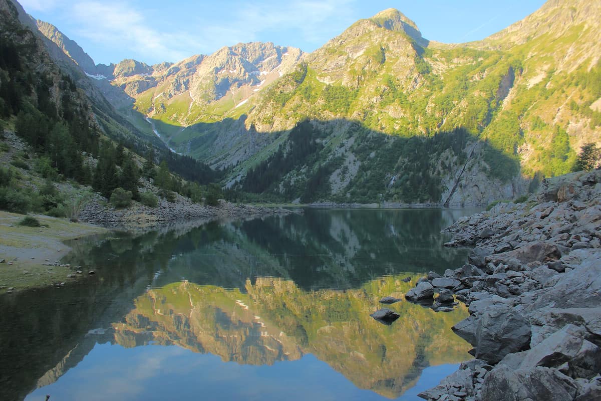
Écrins National Park - Alpine Massif
Parc National des Écrins - Massif
Auvergne-Rhône-Alpes / Provence-Alpes-Côte d'Azur (Isère / Hautes-Alpes) · France
Photo: FrDr · CC BY-SA 4.0 · Wikimedia Commons
The glaciated core of the French Alps (Barre des Écrins 4.102 m), with deep glacial valleys such as Valgaudemar and Vénéon.
In 1913 the French state acquired 4.000 hectares of high-mountain terrain above Saint-Christophe-en-Oisans, establishing the "Parc de la Bérarde." The motivation was practical rather than scenic: grazing herds were advancing up fragile slopes, triggering rampant erosion, deforestation, and unpredictable flash floods. That conservation seed took sixty years to fully mature into Écrins National Park, officially created by decree on 27 March 1973. Covering 91.800 ha between Gap, Briançon, and Grenoble, it straddles the Northern and Southern Alps, ascending from about 800 m to 4.102 m at the Barre des Écrins.
What makes it unique
A massive alpine realm with a hundred peaks above 3.000 m, some forty glaciers, and France's first strict nature reserve, Lauvitel.
The place
Nature
The landscape
The Écrins is among the coldest regions of the Alps: its extensive glaciers actively shape the regional climate. Above 2.500 to 3.000 m frigid conditions prevail year-round, and snow can fall even in midsummer. That soaring altitude is stamped into iconic topography: La Meije towers at 3.983 m above the village of La Grave, Mont Pelvoux reaches 3.946 m, and the Barre des Écrins crowns the entire massif at 4.102 m.
Amid sheer rock and ice, water pools in high glacial tarns. Lac Lauvitel is the park's largest and deepest lake, spanning 25 to 35 ha with depths between 40 and 65 m. Lac du Pavé, perched at 2.820 m, is the highest and coldest, with surface water hovering around 4 °C.
Life tiers upward with altitude. Pine and larch forests carpet lower slopes, supporting over 2.000 plant species, including alpine blue thistle, lady's slipper orchid, edelweiss, and génépi. Purple saxifrage has been recorded up to 4.070 m, making it the highest vascular plant in France.
Wildlife and seasons
Beside ice and granite dwell alpine animals. The chamois, Alpine ibex, and Alpine marmot are the most recognizable; marmots are readily seen across high alpine meadows, which is precisely why you should never feed them: human food alters their foraging habits and exposes them to predators.
Other mammals include mountain hares, stoats, red squirrels, and red foxes. Notable birds include the golden eagle (with 40 recorded breeding pairs), the black grouse, griffon vulture, bearded vulture, peregrine falcon, and Eurasian eagle-owl. The rock ptarmigan is one of ten focal avian species prioritized in the park core.
In spring, amid larch clearings, junipers, and high lawns, black grouse cocks display their striking lyre-shaped tails. In early morning and at dusk, chamois graze around Tête de la Vieille, Pic de Charance, and the Cirque de Bragousse, where binoculars allow respectful observation. In the Boscodon forest, roe deer leave tracks and stripped bark.
Species
With a page in the atlas
Being mentioned in a source doesn't guarantee sightings: check with the people who manage the area.
Memory and protection
History and conservation
The park's history had a setback: it lost its national park status in 1962 and was reborn as Écrins National Park in 1973.
Since then it has served as a conservation laboratory. In 1989 sixteen ibex from the Vanoise and Vercors parks were successfully reintroduced to the Valbonnais. In 1995 France's first strict nature reserve was created in the Lauvitel valley. In 2019 the park joined the IUCN Green List and the core zone expanded by 705 ha by incorporating two adjoining reserves. The 'Alpages Sentinelles' program has studied high-altitude alpine pastures and climate change impacts since 2010, and since 2016 the online atlas Biodiv'Écrins centralizes observations made by park wardens.
Before you set off
Visiting
How to visit
The Écrins is explored on foot. The park maintains over 700 km of trails designed for broad accessibility, and the GR 54 (Tour des Écrins) is one of the three premier long-distance alpine treks in France. Around thirty mountain refuges welcome trekkers.
A great introductory hike is the Sentier des Pyramides, a 12 km circular route taking five and a half hours and climbing 722 m. Starting and ending at the Fontaine de l'Ours car park (closed in winter), it offers vistas of Lac de Serre-Ponçon and the cirques of Bragousse and Morgon, passes two viewpoints over Embrun and the Colombier torrent with its cargneule rock towers, and skirts a rare stand of lady's slipper orchids.
Before heading into the mountains, visit one of the seven Park Houses located in Vallouise, the Briançonnais, the Embrunais, the Champsaur, the Valgaudemar, the Valbonnais, and the Oisans. They house ranger bases, permanent exhibitions, screening rooms, and relief maps. The first opened in Vallouise in 1976.
Before you go
Due to winter and spring snow, the trail network opens gradually in late spring and typically remains accessible until autumn; trails are usually practicable from mid-June to late September. Access to the highest passes and mountain huts can remain snow-covered into July, requiring crampons and an ice axe.
The park core has specific regulations. Bivouacking is permitted from 19 h to 9 h and at least one hour's walk from road access points and park boundaries. If a trail shows a degraded or hazardous section, the park asks hikers to turn back and report it. Certain routes cross pastures with livestock guardian dogs: you should stop when they approach, stay calm, and walk around the herd.
Check access, rules and visiting conditions in the official information from the managing body before you set off.
Location
Where it is and how far it reaches
Boundary of Ecrins · IUCN II · © EEA, CDDA (CC-BY) The coordinate is estimated; it isn't a verified access point.
Transparency
Sources
The research data with its sources, and the official links for this place, are in the Spanish version of this page. See the Spanish version
Around it
Nearby massifs include the Dévoluy Massif, the Queyras Regional Natural Park, and the Belledonne Range. To the north, Vanoise National Park shares ibex and glaciated alpine topography.
Farther away, Badínsky Prales Primeval Forest preserves pristine old-growth mountain woodland.
What else to explore nearby
Approximate straight-line distance between the edges of each area. It doesn't indicate access, routes or driving times.
- Dévoluy Massif
Hautes-Alpes (Saint-Étienne-en-Dévoluy)
About 10 km away
Mineral karst fortress rimmed by limestone cliffs and riddled with deep subterranean chasms (chourums).
JFMAMJJASONDJune – October · Crowding very low
- Queyras Regional Natural Park
Hautes-Alpes (Guillestre / Saint-Véran)
About 14 km away
A high alpine larch valley dominated by Mount Viso and punctuated by Saint-Véran, the highest inhabited village in Europe.
JFMAMJJASONDJune – October · Crowding low
- Belledonne Mountain Range
Isère / Savoie (Grenoble / Chamrousse)
About 15 km away
Imposing crystalline rocky rampart without road passes soaring directly opposite the city of Grenoble.
JFMAMJJASONDJune – October · Crowding low
- Vanoise National Park
Auvergne-Rhône-Alpes (Savoie)
About 30 km away
France's first national park (1963), created to save the Alpine ibex: glaciers, alpine grasslands, and one of the Alps' greatest ibex populations.
JFMAMJJASONDJune – September · Crowding moderate
If you like this place, elsewhere in Europe
Distant places with uncommon wildlife and habitats in common. The most widespread species don't count. Sharing species doesn't imply a corridor or guaranteed presence.
- Maritime Alps Natural Park
Piedmont (Cuneo / Valdieri / Entracque)
In common: Alpine ibex · Chamois · Golden eagle — high mountain, glacial landscape
United with France's Mercantour National Park, it forms a massive cross-border Alpine-Mediterranean wilderness crowned by Mount Argentera (3.297 m).
JFMAMJJASONDJune – October · Crowding low
- Schober Group - Hohe Tauern National Park
East Tyrol / Carinthia (Lienz / Debanttal)
In common: Alpine ibex · Chamois · Golden eagle — high mountain, glacial landscape
Heart of high alpine rock and silence with 30 summits above 3.000 m and no cable cars in the Eastern Alps.
JFMAMJJASONDJune – October · Crowding very low
- Hohe Tauern National Park - Umbal Valley and Isel Headwaters
East Tyrol / Carinthia / Salzburg (Matrei in Osttirol / Prägraten)
In common: Alpine ibex · Chamois · Golden eagle — high mountain, glacial landscape
The largest National Park in the Alps and Central Europe (1.800 km²), sheltering the Grossglockner (3.798 m) and the wild Isel glacial river.
JFMAMJJASONDJune – October · Crowding low
- Gran Paradiso National Park
Aosta Valley / Piedmont (Cogne / Valsavarenche / Ceresole Reale)
In common: Alpine ibex · Chamois · Golden eagle — high mountain, glacial landscape
Italy's oldest national park (1922): the last surviving Alpine ibex population held out here and repopulated the entire range.
JFMAMJJASONDJune – September · December – January · Crowding moderate
Entry #326 of the original atlas.