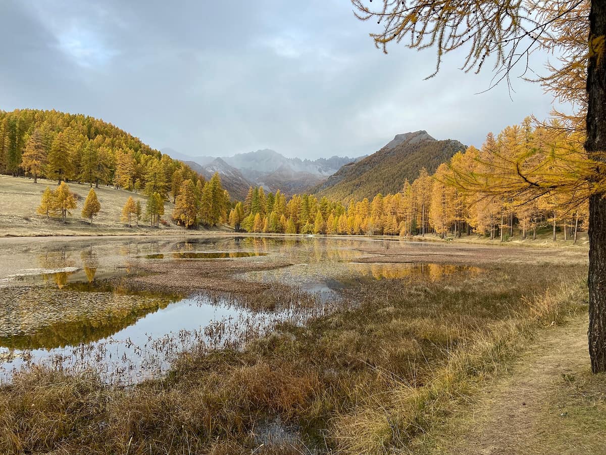
Queyras Regional Natural Park
Parc Naturel Régional du Queyras
Hautes-Alpes (Guillestre / Saint-Véran) · France
Photo: TouN · CC BY-SA 4.0 · Wikimedia Commons
A high alpine larch valley dominated by Mount Viso and punctuated by Saint-Véran, the highest inhabited village in Europe.
Ascend via the Col d'Izoard and the world turns to mineral rock. La Casse Déserte, a lunar cirque studded with fairy chimneys, appears to foreshadow a desert. Yet suddenly, just over the pass, steppe grasslands and fragrant woods unfold. This is the gateway to Queyras, a high-mountain valley in the Hautes-Alpes protected by the Queyras Regional Natural Park, with Monviso standing as its frontier guardian and the larch as its signature tree.
What makes it unique
A dry and sunny valley where a salamander unique to the Viso massif coexists with plants of African origin and the highest inhabited village in the French Alps.
The place
Nature
The landscape
Everything originated in an ancient ocean. Fossil corals within the Rochebrune massif recall a warm, shallow sea, while ammonites preserved in Guillestre marble swam in primeval shoals. Then Africa collided with Eurasia—a collision ongoing for 60 million years—buckling and folding that seabed. Foliated schists gave rise to the wide, open valleys of upper Queyras: Molines, Abriès, and Saint-Véran. Later came torrents and glaciers flowing toward the Durance, carving an enclosed mountain basin draining westward.
The climate puts the finishing touch on the scenery. Queyras receives few Atlantic weather systems, its dry air producing crystalline skies and stark thermal contrasts. A characteristic phenomenon occurs: the nebbia, mist rising from the Po basin under daytime warmth that forms a sea of clouds towards 10 h on roughly one day in three during summer, dispersing only at sundown. Above 2.400 m, winter lingers for more than nine months, leaving alpine pastures barely enough warmth to set seed.
The flora reflects diverse geographic origins: incense juniper of African ancestry, Ethiopian sage, and lavender arrived during the last major postglacial warming. Within the Ristolas–Mont Viso reserve thrive larch forests, alpine grasslands, wetlands, and screes harbouring some 800 flowering plant species, alongside local endemics of the southwestern Alps such as the Queen of the Alps, Arvet-Touvet butterwort, and mountain thistle.
Wildlife and seasons
When snows recede in late March, the alpine marmot emerges from torpor with piercing whistles. Its sheer abundance explains the high density of golden eagles patrolling the Queyras skies. The grassy slopes support some 2.500 chamois.
The alpine ibex returned through human stewardship: 26 individuals were reintroduced in 1995 and 1998, the valley being chosen as a vital biogeographical hub rich in ecological corridors. In the Ristolas–Mont Viso reserve you may also spot choughs, eagles, the bearded vulture, white-winged snowfinch, northern wheatear, and alpine accentor. In winter, mountain hares and the rock ptarmigan turn white to blend seamlessly with the snowfields.
The most secretive inhabitant is Lanza's alpine salamander: endemic to the Viso massif, it is the longest-lived amphibian—exceeding 20 years—and remains active for only about ten days each year. Like chamois and ibex, it suffers acutely from recurring human disturbances during breeding and overwintering.
Species
With a page in the atlas
Being mentioned in a source doesn't guarantee sightings: check with the people who manage the area.
Memory and protection
History and conservation
These mountain valleys have been settled since the Neolithic, evidenced by archaeological excavations at the Saint-Véran copper mine and the high pastures of Urine and Monviso. Saint-Véran, perched at 2 042 m altitude, holds fame as the highest permanently inhabited commune in the French Alps.
Conservation here tells two memorable stories. One is the ibex, successfully returned to its native heights. The other is the Spanish moon moth (Isabelle de France): collectors pushed it to the brink of local extinction in the 1970s, prompting the mayors of five communes to outlaw its capture in 1975—a full year ahead of France's inaugural nature protection law. Recovery entailed captive rearing and egg-laying on native Scots pines, its sole food plant.
Before you set off
Visiting
How to visit
Three mountain portals grant entry: the Guil gorges, the Col Agnel, and the Col d'Izoard. If you seek the untamed heart of the park, head to the Haut-Guil: the nature reserve covers 2 295 hectares between 1700 m and 3287 m in elevation, with the D947—a dead-end road linking Guillestre to Ristolas—as its sole motor route. On foot, multiple high passes cross from Italy: Vallante, Traversette, Asti, Couloir du Porc, and Pas du Sellard. The Refuge du Viso welcomes hikers throughout summer and in March and April, roughly three hours on foot from La Roche Écroulée.
In winter, ski touring is permitted across the reserve except in the Asti–Rocher Mouloun–Clos Sablé sanctuary where the rock ptarmigan winters. Mountain biking is allowed on all designated trails except along the Guil path between the Grand Belvédère and Lake Lestio.
To interpret what you encounter, three visitor centres welcome travellers: Le Soum, L'Arche des Cimes, and Le Moulin.
Before you go
In the nature reserve dogs are strictly prohibited, even on a leash. Hikers must remain on marked trails to prevent trampling high-altitude habitats; gathering edible plants is restricted to modest family quantities immediately beside paths. In communal pastures and forests outside the reserve, dogs must be leashed, and drones are banned within 200 metres of wildlife, mountain refuges, lakes, and grazing herds.
Bivouac camping in lightweight tents is tolerated at more than one hour's walk from the nearest village, for a single night per sector, pitched after 18 h and struck before 9 h. Since 2022, mountain bikes are barred in the Vallon de Bouchouse from 8 h to 15 h during July and August. To select your itinerary, the park website lists hikes by commune, duration, elevation, and theme with downloadable GPS tracks.
Check access, rules and visiting conditions in the official information from the managing body before you set off.
Location
Where it is and how far it reaches
Boundary of Queyras · IUCN V · © EEA, CDDA (CC-BY) The coordinate is estimated; it isn't a verified access point.
Transparency
Sources
The research data with its sources, and the official links for this place, are in the Spanish version of this page. See the Spanish version
Around it
The Parco naturale del Monviso lies roughly 2 km away across the border, sharing the Viso massif. Six kilometres away lies Parco naturale della Val Troncea, fourteen kilometres away stands Parc National des Écrins - Massif, and twenty kilometres away extends Parc National du Mercantour, where Lanza's salamander features in collaborative citizen-science surveys.
What else to explore nearby
Approximate straight-line distance between the edges of each area. It doesn't indicate access, routes or driving times.
- Monviso Natural Park
Piedmont — Po and Varaita Valleys (Province of Cuneo)
About 2 km away
Alpine pastures and rocky crags between the Po and Varaita valleys, harbouring the ancient stone pine forest of Alevè.
JFMAMJJASONDJuly – September · Crowding high
- Écrins National Park - Alpine Massif
Auvergne-Rhône-Alpes / Provence-Alpes-Côte d'Azur (Isère / Hautes-Alpes)
About 14 km away
The glaciated core of the French Alps (Barre des Écrins 4.102 m), with deep glacial valleys such as Valgaudemar and Vénéon.
JFMAMJJASONDJune – October · Crowding low
- Mercantour National Park
Alpes-Maritimes / Alpes-de-Haute-Provence (Saint-Martin-Vésubie / Barcelonnette)
About 20 km away
Historic site of the natural return of the wolf to France from Italy (1992), spanning from the Alps to the Mediterranean.
JFMAMJJASONDJune – October · Crowding low
If you like this place, elsewhere in Europe
Distant places with uncommon wildlife and habitats in common. The most widespread species don't count. Sharing species doesn't imply a corridor or guaranteed presence.
- Retezat National Park
Hunedoara County (Hațeg)
In common: Alpine marmot · Chamois · Grey wolf — high mountain, old-growth forest
The realm of the granitic and glacial Retezat, with over 80 crystal tarns and the Gemenele scientific reserve.
JFMAMJJASONDJune – October · Crowding low
- Dachstein Nature Reserve — Gosau, Hallstatt and Obertraun
Upper Austria — Gmunden; Gosau, Hallstatt and Obertraun
In common: Alpine marmot · Chamois — high mountain, old-growth forest
Karst topography, glaciers, alpine meadows and old-growth mountain forests above the Gosau lakes.
JFMAMJJASONDMarch – November · Crowding no data
- Rodna Mountains National Park
Bistrița-Năsăud and Maramureș Counties (Pietrosu Rodnei)
In common: Alpine marmot · Chamois — high mountain, old-growth forest
The highest glacial mountains in the Eastern Carpathians hosting the Pietrosu Rodnei scientific reserve.
JFMAMJJASONDJune – October · Crowding low
Entry #327 of the original atlas.