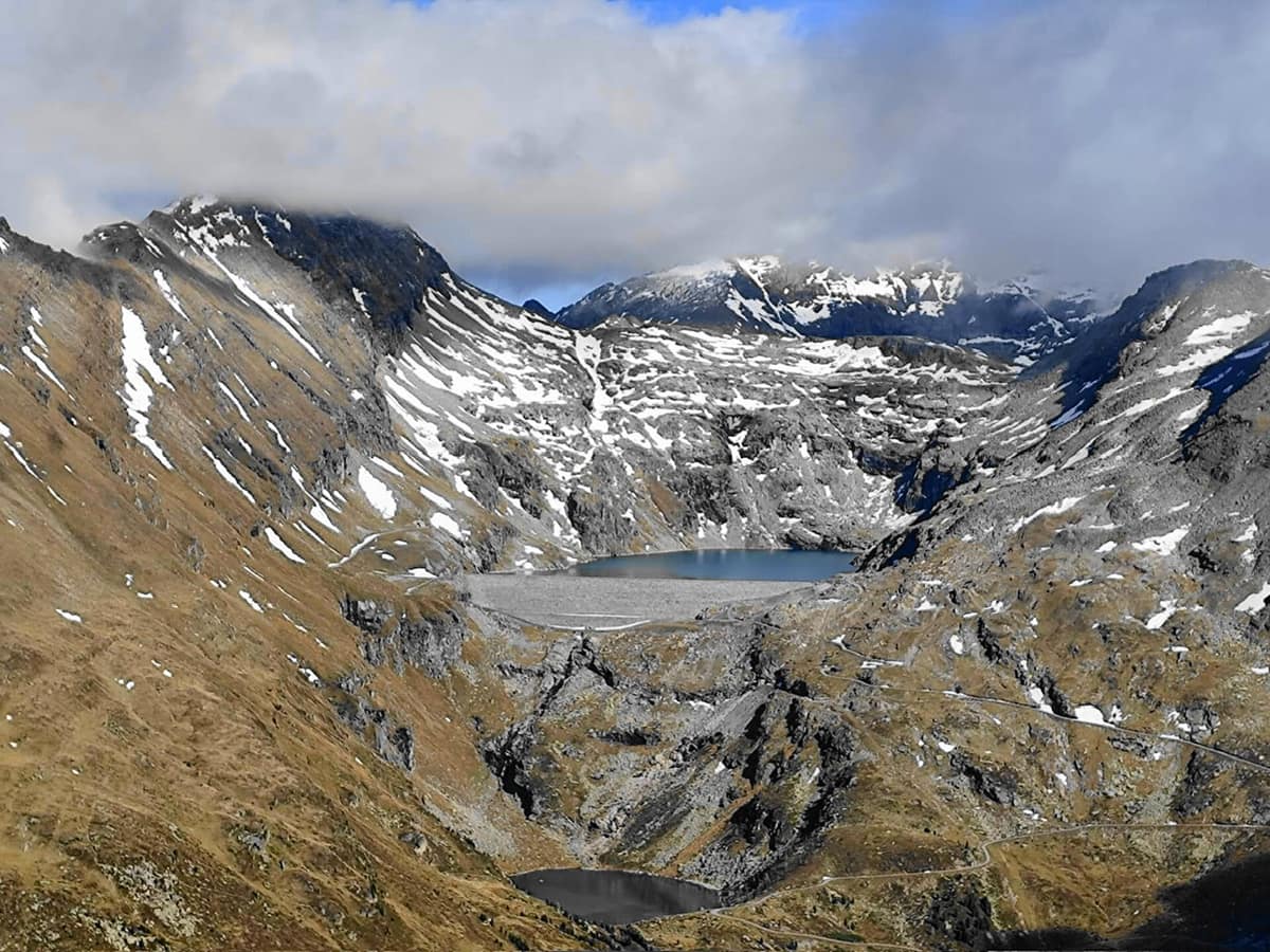
Hohe Tauern National Park - Umbal Valley and Isel Headwaters
Nationalpark Hohe Tauern - Umbaltal & Isel
East Tyrol / Carinthia / Salzburg (Matrei in Osttirol / Prägraten) · Austria
Photo: Naturpuur · CC BY 4.0 · Wikimedia Commons
The largest National Park in the Alps and Central Europe (1.800 km²), sheltering the Grossglockner (3.798 m) and the wild Isel glacial river.
In summer, as snow and ice thaw, meltwater from the Umbalkees glacier rushes down the Isel, plunging over jagged steps of rock. It is a glacial torrent in its purest state: its discharge fluctuates continuously through the day and across the seasons. The Umbal valley, at the head of the Virgental in East Tyrol, demonstrates as few places in the Hohe Tauern can how a river of ice and meltwater sculpts the landscape through cascades. It forms part of Hohe Tauern National Park, the grandest national park in the Alps, spanning 1.856 km².
What makes it unique
On a single mountain walk you can feel waterfall spray on your face and look down upon smooth green stones polished by glacial meltwaters.
The place
Nature
The landscape
The Umbalfälle resemble a roaring staircase of water. Because the cascades drop steeply, they carry glacial sediment that has polished the bedrock over millennia, carving a deep gorge. The result is revealed in the riverbed: smooth green stones pockmarked with giant’s kettles hollowed out by swirling gravel. The waterfalls illustrate the physical transition from sliding rapids into a stepped cascade staircase, plunging from basin to basin.
Beneath this landscape lies the Tauern Window, one of the Alpine realm’s greatest geological marvels: ancient rock layers that normally lie miles deep are thrust to the surface here, and the park preserves up to 200 distinct mineral varieties. Ice Age glaciers subsequently widened V-shaped valleys into vast U-shaped troughs, leaving cirques throughout the range. As glaciers retreat, newly exposed moraines create virgin pioneer land where plants and animals must colonise from scratch.
The Isel is born here and rushes through the Iseltal, which begins in Matrei in Osttirol—where Virgental and Tauerntal unite—continuing down to Lienz. The Iseltrail tracks this corridor, the longest free-flowing glacial river in the Alps, passing riverside meadows, gravel banks, gorges, rapids, and waterfalls.
Wildlife and seasons
Ascending toward subalpine pastures, the forest consists of spruce and European larch. Higher up, between 1.400 and 2.700 m, Alpine marmots live in family colonies in burrows dug across alpine meadows and boulder slopes. The Alpine ibex frequents crags and screes, numbering around 1.100 head following successful reintroductions in the sixties. The diurnal chamois is the large mammal most frequently sighted on open slopes. Park rangers know the traditional territories where bearded vultures, golden eagles, chamois, and marmots can be spotted.
Among the flora, deep dark-blue Bavarian gentian and spring gentian flower between March and August depending on elevation. The edelweiss is strictly protected wherever it grows. The trail also traverses high alpine turf and delicate wetland flushes.
The hiking season along the trail spans from spring to autumn, with summer offering peak water flow when glacier ice melts fastest.
Species
With a page in the atlas
Being mentioned in a source doesn't guarantee sightings: check with the people who manage the area.
Memory and protection
History and conservation
From the seventies onward local resistance vigorously opposed plans for a hydroelectric reservoir in the Umbal valley, leading to the creation of the water trail in 1976. The East Tyrolean sector was bitterly contested because proposed dam schemes threatened the Umbalfälle and the Kals valley; it did not join the park until 1991. On the night of 17 to 18 May 1985, a massive avalanche triggered a flash flood that swept away half of the water educational trail.
The national park originated through an inter-provincial pact: in 1971 the provincial governors of Salzburg, Carinthia, and Tyrol signed the Heiligenblut Declaration resolving to establish the park. The IUCN formally recognized it as a Category II national park in 2001 for Carinthia and in 2006 for Salzburg and Tyrol.
Before you set off
Visiting
How to visit
From the Ströden car park in Hinterbichl, a gravel path leads in half an hour on foot to Pebellalm and Islitzeralm, a journey also possible by horse carriage. There begins the water-themed educational trail, outfitted with viewing pulpits and explanatory panels: it passes the Kleinbachfall and Großbachfall before ascending toward the roaring Umbalfälle. Round trip covers around eight kilometres and roughly three hours, grading as an easy family hike. In 2014 it received the Austrian Trail Quality Seal.
For longer journeys, the Iseltrail comprises five stages, penetrating the park’s wilderness core from stage four onward, surrounded by steep ravines and cascading spray. Stage four reaches the Clarahütte, perched on the slope out of avalanche paths. Stage five tackles a steep glacial step up to 2.500 m, where the snout of the Umbalkees glacier sits opposite the Dreiherrnspitze. The first three stages can be walked from May; the full trail from June to October.
The Nationalparkhaus in Matrei prepares visitors through interactive habitat exhibitions, featuring 360-degree films across six themed rooms and virtual fly-overs through the eyes of a golden eagle.
Before you go
Trails are waymarked with yellow signs, and paths marked with black dots demand alpine experience, proper mountaineering boots, and sure-footedness. Camping and open campfires in the wild are strictly forbidden; campsites operate in surrounding valley municipalities. Stick to marked tracks out of consideration for fragile alpine flora and wildlife, avoiding unnecessary noise. From Lienz or Mittersill, take the B108 to Matrei, and continue through the Virgental to Ströden.
Check access, rules and visiting conditions in the official information from the managing body before you set off.
Location
Where it is and how far it reaches
Boundary of Hohe Tauern · IUCN II · © EEA, CDDA (CC-BY) The coordinate is estimated; it isn't a verified access point.
Transparency
Sources
The research data with its sources, and the official links for this place, are in the Spanish version of this page. See the Spanish version
Around it
Adjoining this valley within the same national park lies the Ankogel Group - Hohe Tauern, and some five kilometres away rises the Schober Group - Hohe Tauern. About twenty-three kilometres distant lie the Rofan Mountains and Brandenberg Alps. Further afield, Vanoise National Park, Gran Paradiso National Park, and Karwendel Nature Park share high-mountain ibex, golden eagle, and chamois.
What else to explore nearby
Approximate straight-line distance between the edges of each area. It doesn't indicate access, routes or driving times.
- Ankogel Group - Hohe Tauern
Carinthia / Salzburg (Mallnitz / Bad Gastein)
Borders this area
The 'Gateway to the Tauern', crystalline massif of the Ankogel (3,252 m) with retreating glaciers and pristine alpine alluvial valleys.
JFMAMJJASONDJune – October · Crowding low
- Schober Group - Hohe Tauern National Park
East Tyrol / Carinthia (Lienz / Debanttal)
About 11 km away
Heart of high alpine rock and silence with 30 summits above 3.000 m and no cable cars in the Eastern Alps.
JFMAMJJASONDJune – October · Crowding very low
- Steinernes Meer - Sea of Stone
Bavaria (DE) / Salzburg (Saalfelden / Maria Alm) (AT)
About 22 km away
The 'Sea of Stone', a vast undulating desert-like limestone plateau suspended at 2.000 m altitude straddling Germany and Austria.
JFMAMJJASONDJune – October · Crowding low
If you like this place, elsewhere in Europe
Distant places with uncommon wildlife and habitats in common. The most widespread species don't count. Sharing species doesn't imply a corridor or guaranteed presence.
- Écrins National Park - Alpine Massif
Auvergne-Rhône-Alpes / Provence-Alpes-Côte d'Azur (Isère / Hautes-Alpes)
In common: Alpine ibex · Chamois · Golden eagle — high mountain, glacial landscape
The glaciated core of the French Alps (Barre des Écrins 4.102 m), with deep glacial valleys such as Valgaudemar and Vénéon.
JFMAMJJASONDJune – October · Crowding low
- Vanoise National Park
Auvergne-Rhône-Alpes (Savoie)
In common: Alpine ibex · Chamois · Golden eagle — high mountain, glacial landscape
France's first national park (1963), created to save the Alpine ibex: glaciers, alpine grasslands, and one of the Alps' greatest ibex populations.
JFMAMJJASONDJune – September · Crowding moderate
- Maritime Alps Natural Park
Piedmont (Cuneo / Valdieri / Entracque)
In common: Alpine ibex · Chamois · Golden eagle — high mountain, glacial landscape
United with France's Mercantour National Park, it forms a massive cross-border Alpine-Mediterranean wilderness crowned by Mount Argentera (3.297 m).
JFMAMJJASONDJune – October · Crowding low
- Gran Paradiso National Park
Aosta Valley / Piedmont (Cogne / Valsavarenche / Ceresole Reale)
In common: Alpine ibex · Chamois · Golden eagle — high mountain, glacial landscape
Italy's oldest national park (1922): the last surviving Alpine ibex population held out here and repopulated the entire range.
JFMAMJJASONDJune – September · December – January · Crowding moderate
Entry #341 of the original atlas.