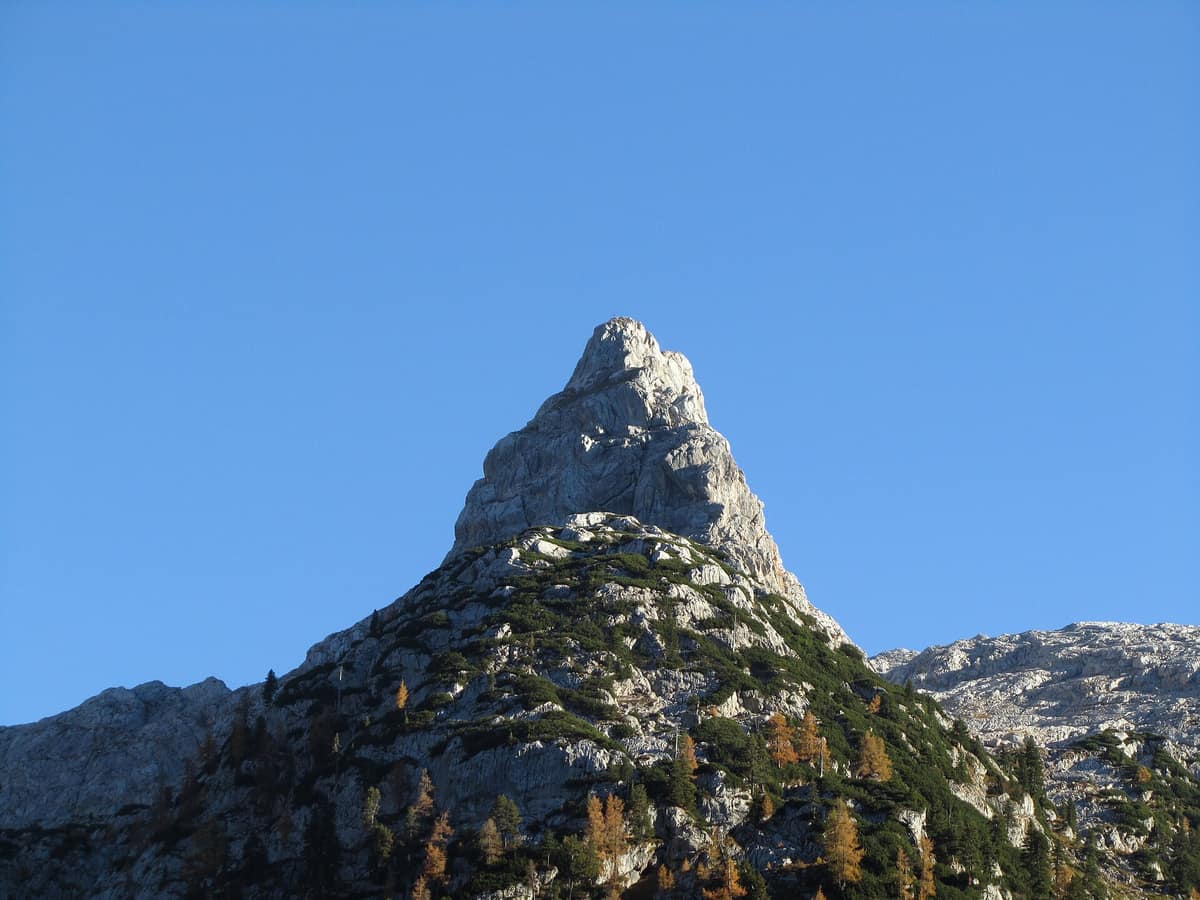
Steinernes Meer - Sea of Stone
Steinernes Meer - Karst Plateau
Bavaria (DE) / Salzburg (Saalfelden / Maria Alm) (AT) · Germany / Austria
Photo: Jörg Braukmann Milseburg · CC BY-SA 3.0 · Wikimedia Commons
The 'Sea of Stone', a vast undulating desert-like limestone plateau suspended at 2.000 m altitude straddling Germany and Austria.
Fifty summits, almost all rising between 2.000 and 2.600 meters with barely any towering markedly above the others: that is the Steinernes Meer, the Sea of Stone. It is a vast limestone massif of some 160 km², the largest plateau in the Berchtesgaden Alps, with 55 of those square kilometers lying above 2.000 meters elevation. It spans the frontier between Bavaria and Salzburg: the Bavarian sector lies within Berchtesgaden National Park, while the Austrian sector forms the Kalkhochalpen nature reserve. Seen from above, you behold not a jagged crest, but an undulating lunar plateau of pale karst bedrock, anchored by its highest ramparts, the Selbhorn (2.655 m) and Schönfeldspitze (2.653 m), along its southern precipice.
What makes it unique
A high-altitude karst plateau riddled with some 800 known caves, featuring the coldest recorded depression in Germany within one of its hollows.
The place
Nature
The landscape
Dachsteinkalk limestone and alpine karst landforms sculpt the scenery. The plateau above 2.000 meters tilts from south to north; to the south it drops precipitously into the Saalfelden basin, while beneath its sheer northern walls lies the fjord-like lake Königssee. Consequently, the Steinernes Meer presents contrasting faces depending on your approach.
Beneath this barren pavement lies a subterranean realm. Naturalists have documented some 800 caves, among which the Kolkbläser-Monsterhöhle system forms a colossal labyrinth with 44,5 km of explored passages and a depth of 723 m. The Schindlkopfhöhle lies east of Schindlkopf near the Ingolstädter Haus; daylight penetrates its ice chamber because the ceiling of a massive sinkhole collapsed. The largest cave system on the German side, the Salzgrabenhöhle, remains strictly closed to visitors by park authorities.
In a frost hollow in the heart of the plateau sits the Funtensee, renowned as Germany's pole of cold. Lower down within the national park, vegetation zones shift with elevation: above the subalpine spruce woods come dwarf mountain pines, green alder and willow thickets, dwarf shrub heaths, alpine meadows, and perennial snowfields. Along the cliffs of the Königssee grow relic yew stands, survivors of ancient yew-beech woodlands.
Wildlife and seasons
In the Bavarian sector, Berchtesgaden National Park provides a protected haven for high-alpine fauna. Chamois, roe deer, and red deer represent the primary herbivores, while the Alpine ibex is another signature species: re-established here in 1936 following regional extirpation in Germany during the early XVIII century. Across alpine pastures and boulder fields, the Alpine marmot is commonly spotted. Rocky crevices and limestone walls shelter rock ptarmigan, white-winged snowfinch, and the acrobatic wallcreeper.
Raptors are well represented across the massif. The golden eagle serves as an iconic resident throughout the national park. In the neighboring Klausbachtal, park rangers operate a winter feeding station where visitors can observe golden eagles without disturbance. Since 2021, young bearded vultures have been released annually as part of an international Alps reintroduction program.
Throughout the lower forests, western capercaillie and hazel grouse benefit from rich forest structure, while black grouse display along the subalpine timberline. Amphibians and reptiles include alpine and fire salamanders, alpine newts, common lizards, and adders. Brown bear, wolf, and Eurasian lynx disappeared during the XIX century from the Berchtesgaden Alps, though transient individuals occasionally wander through.
The premier trekking season extends from June to October. In winter the plateau becomes an extreme alpine environment inaccessible without specialized mountaineering equipment and avalanche safety expertise.
Species
With a page in the atlas
Being mentioned in a source doesn't guarantee sightings: check with the people who manage the area.
Memory and protection
History and conservation
The historic Almer Wallfahrt pilgrimage, dating back to the XVII century, crosses the limestone plateau from south to north from Maria Alm to St. Bartholomä on the Saturday following 24 August. The trail was carefully constructed with local limestone, though preservation varies across the exposed karst.
Since 1991 the national park, encompassing 20.808 hectares, forms together with its surroundings a UNESCO Biosphere Reserve; Berchtesgaden National Park itself, designated in 1978, was Germany's second national park. In winter, park authorities delineate designated wildlife quiet zones in the forests and recommend ski touring and snowshoe corridors that circumvent these sanctuaries.
Before you set off
Visiting
How to visit
The classic traverse crosses the plateau from south to north past the Riemannhaus and Kärlingerhaus, following historic pilgrimage ways. Four Alpine Club huts provide shelter across the western massif, with the Kärlingerhaus (1630 m) situated on the German side beside the Funtensee.
You can reach the Kärlingerhaus from the boat landing at Salet on the Königssee via the steep Sagerecksteig, or from St. Bartholomä up the infamous Saugasse. This latter route spans 10,0 km with 1111 m of ascent, taking roughly five hours of sustained hiking, rated as difficult. On the Austrian side, the Riemannhaus is reached from Saalfelden via the Ramseider Steig or from Maria Alm through the Sandten gorge.
Only about twenty peaks have marked trails, concentrating foot traffic on designated routes while vast limestone stretches remain completely solitary. The pyramid of the Schönfeldspitze on the southern rim is the most iconic landmark.
To understand the ecology before ascending, visit the Haus der Berge in Berchtesgaden: it features an interactive exhibition, environmental education center, and an outdoor panorama trail displaying flora and fauna of four alpine habitats: water, forest, alpine meadow, and rock. Six additional visitor information points operate free of charge within the park.
Before you go
Within the national park, open fires and unnecessary noise are strictly prohibited. Dogs must be kept on a leash, hikers must keep to established paths without taking shortcuts, and wildlife must not be disturbed. Plan according to weather, fitness, and daylight: long or demanding tours require alpine experience, sure-footedness, and freedom from vertigo.
Check access, rules and visiting conditions in the official information from the managing body before you set off.
Location
Where it is and how far it reaches
Boundary of Steinernes Meer · © OpenStreetMap contributors (ODbL) The coordinate is estimated; it isn't a verified access point.
Transparency
Sources
The research data with its sources, and the official links for this place, are in the Spanish version of this page. See the Spanish version
How it fits into the territory
Calculated from the Atlas boundaries. «Part of» is only stated with an official boundary; an estimated area only means that they overlap.
Shares territory with
- Berchtesgaden National Park - Hagengebirge Massif
Bavaria (Berchtesgaden) (DE) / Salzburg (AT)
Their official boundaries overlap
Germany's only high-alpine National Park, dominated by mount Watzmann (2.713 m) and the fjord-like Königssee.
JFMAMJJASONDJune – October · Crowding moderate
Around it
Berchtesgaden National Park - Hagengebirge Massif lies about 2 km away, forming the adjoining eastern plateau of the park. At 20 km stands the Tennengebirge, another monumental karst plateau. Farther east, the Totes Gebirge shares extensive karst barrens, chamois, and rock ptarmigan.
What else to explore nearby
Approximate straight-line distance between the edges of each area. It doesn't indicate access, routes or driving times.
- Tennengebirge Karst Plateau
Salzburg (Werfen / Abtenau)
About 11 km away
Alpine limestone plateau rimmed by precipitous escarpments housing Eisriesenwelt, the largest explored ice cave on Earth (42 km of surveyed passages).
JFMAMJJASONDJune – October · Crowding low
- Ankogel Group - Hohe Tauern
Carinthia / Salzburg (Mallnitz / Bad Gastein)
About 17 km away
The 'Gateway to the Tauern', crystalline massif of the Ankogel (3,252 m) with retreating glaciers and pristine alpine alluvial valleys.
JFMAMJJASONDJune – October · Crowding low
- Hohe Tauern National Park - Umbal Valley and Isel Headwaters
East Tyrol / Carinthia / Salzburg (Matrei in Osttirol / Prägraten)
About 22 km away
The largest National Park in the Alps and Central Europe (1.800 km²), sheltering the Grossglockner (3.798 m) and the wild Isel glacial river.
JFMAMJJASONDJune – October · Crowding low
If you like this place, elsewhere in Europe
Distant places with uncommon wildlife and habitats in common. The most widespread species don't count. Sharing species doesn't imply a corridor or guaranteed presence.
- Totes Gebirge - Karst Desert
Upper Austria / Styria (Hinterstoder / Bad Aussee)
In common: Rock ptarmigan · Chamois — karst and caves, high mountain
The 'Dead Mountains', Central Europe's largest high-alpine karst desert plateau (over 200 km² of exposed barren limestone void of surface water).
JFMAMJJASONDJune – October · Crowding low
- Vanoise National Park
Auvergne-Rhône-Alpes (Savoie)
In common: Rock ptarmigan · Chamois — high mountain
France's first national park (1963), created to save the Alpine ibex: glaciers, alpine grasslands, and one of the Alps' greatest ibex populations.
JFMAMJJASONDJune – September · Crowding moderate
- Gran Paradiso National Park
Aosta Valley / Piedmont (Cogne / Valsavarenche / Ceresole Reale)
In common: Rock ptarmigan · Chamois — high mountain
Italy's oldest national park (1922): the last surviving Alpine ibex population held out here and repopulated the entire range.
JFMAMJJASONDJune – September · December – January · Crowding moderate
Entry #353 of the original atlas.