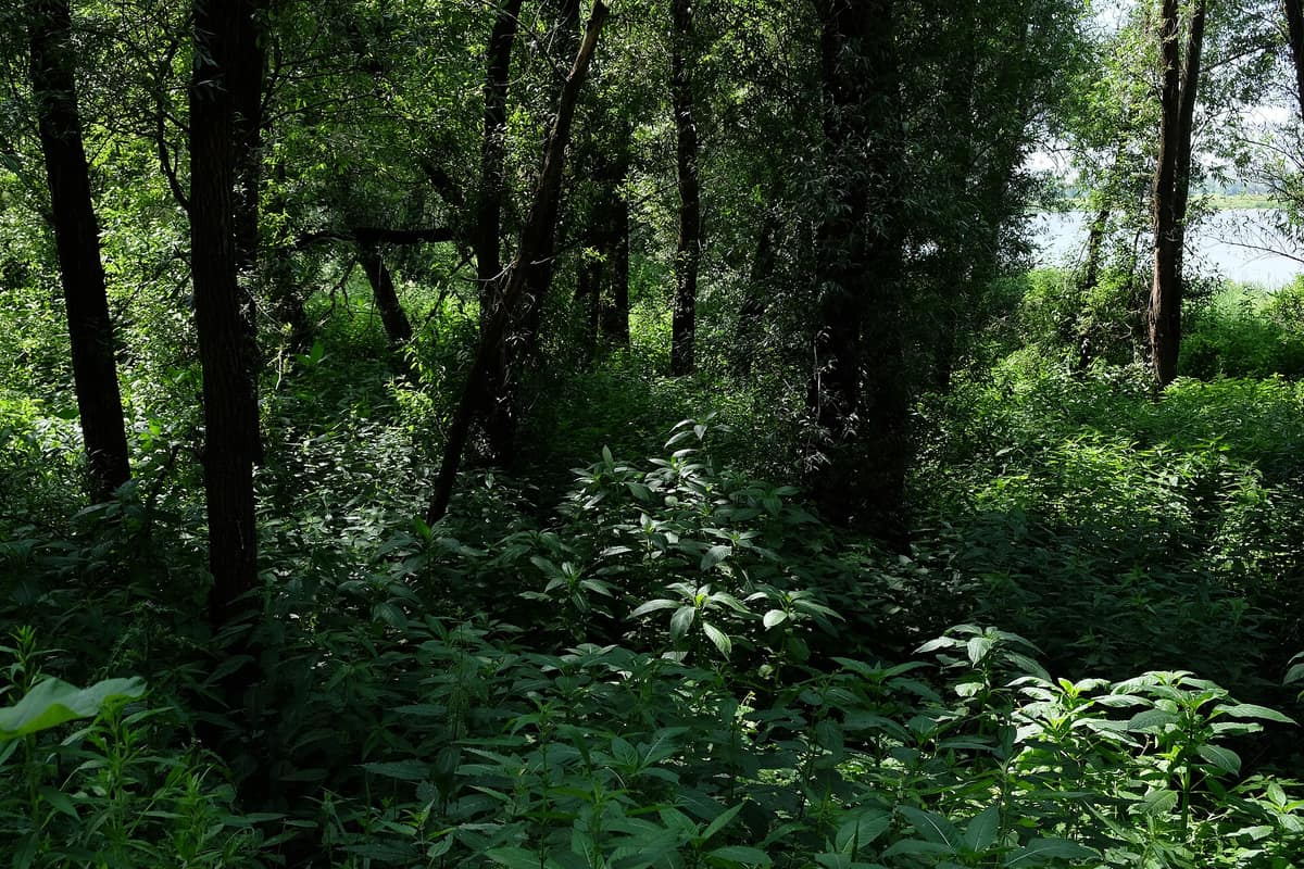
Millingerwaard Nature Reserve
Millingerwaard
Gelderland (Berg en Dal / Rhine Valley) · Netherlands
Photo: Lendskaip · CC0 · Wikimedia Commons
Iconic core of the rewilded Rhine river where beavers and free-roaming herds shape dynamic floodplain forests.
For roughly 1000 years the river was forbidden from shifting its course. Today it is free once more. The Millingerwaard, a dynamic floodplain beside Kekerdom on the southern bank of the Waal, is the birthplace of the rewilded Dutch Rhine, where waters were allowed to do as they pleased: flood, carve secondary side channels, cast up inland dunes, and let horses and cattle decide what flourishes and what yields. Staatsbosbeheer stewards the land under a straightforward ethos—allowing natural processes as much free rein as possible—yielding some 400 hectares of marsh, softwood and hardwood riparian forest, tall-herb fen meadows, backwaters, and river dunes.
What makes it unique
Here the river regained dominion over a landscape of pastures once so flat and manicured they resembled billiard tables.
The place
Nature
The landscape
To grasp the essence of the Millingerwaard, one must look slightly upstream. The Gelderse Poort, of which it forms an integral part, derives its name from the breakthrough where the Rhine cuts through an Ice Age push moraine and begins to divide: the head of the Rhine delta. The river eventually breached that ridge, separating Montferland from the Rijk van Nijmegen; subsequently winds threw up river dunes upon which historic villages like Millingen aan de Rijn took root.
One of those dunes remains active—a rare survival in the modern Netherlands. In the inner bend of the Waal sand moves freely, creating towering dunes in the midst of a flat floodplain. Around them coalesce reedswamps, tall riparian fringe vegetation, and a hardwood alluvial woodland of a type seldom encountered in north-western Europe.
The most dramatic transformations are revealed from above. Between 2013 and 2022, engineers and ecologists excavated a major side channel, a running flow channel, and a network of seepage channels. Seen from the air, they trace the outline of an open hand with thumb and outstretched fingers. As the river rises, the floodplain fills gradually from downstream, buffering high water; during extreme winter surges, the floodplain acts as a secondary bypass channel, flushing floodwaters rapidly to sea. This initiative protects four million residents living behind the river dykes while returning immense space to birds, fish, insects, and flora. Thirty years ago this was an expanse of engineered, uniform rye-grass pastures, "smooth as billiard cloth".
Maintaining the mosaic are free-roaming Konik horses and Galloway cattle, which have grazed year-round without supplemental feeding since 1992, keeping the vegetation low, open, and diverse.
Wildlife and seasons
The Millingerwaard is premier habitat for the Eurasian beaver. Dusk is the ideal time to cross paths with one, while autumn and winter reveal their freshly gnawed willows and footprints along the banks. The black poplar, nearly extinct in the wild across the Netherlands, has returned to the Gelderse Poort; its seeds only germinate on freshly deposited flood silt, depending entirely on the seasonal floods restored here.
The ecological calendar brings continuous seasonal rhythms. In summer walkers ramble over flower-carpeted river dunes. In autumn Eurasian spoonbills and great egrets congregate across mudflats. In winter the crest of the Waal dyke acts as an amphitheatre to observe tens of thousands of overwintering geese. The wider Gelderse Poort has also welcomed the black stork, white-tailed eagle, and osprey, while establishing itself as the foremost breeding stronghold in the Netherlands for the black tern. In the neighbouring Rijnstrangen reedbeds nest elusive marshland specialists including the Eurasian bittern and great reed warbler.
European tree frogs and common spadefoot toads have been reintroduced; among insects and bats, records include the lesser purple emperor butterfly and the woodland noctule bat. A more natural riverbed also restores hope for migratory fishes such as Atlantic salmon, wels catfish, and perhaps eventually Atlantic sturgeon.
Species
With a page in the atlas
Being mentioned in a source doesn't guarantee sightings: check with the people who manage the area.
Memory and protection
History and conservation
The extensive engineering works from 2013 to 2022 restored the long-lost river dynamics to the Millingerwaard. Today the river channel has room to expand, dramatically increasing flood safety for communities behind the dykes while revitalising biodiversity.
The Gelderse Poort serves as a vital ecological corridor intended to reconnect the Veluwe heathlands with the German hinterland, releasing the Veluwe red deer population from genetic isolation. The Millingerwaard is fully incorporated into the European Natura 2000 network.
Rewilding projects
Before you set off
Visiting
How to visit
The reserve is strictly accessible on foot or by bicycle, and the wandering philosophy is half the joy: within the Gelderse Poort you may roam freely almost everywhere, venturing off marked tracks. The audio walk "Het verhaal van de Millingerwaard" likewise lacks a rigid circuit: you navigate by seeking QR-code posts that trigger fourteen audio episodes recounting the tales of plants, beasts, and former human dwellers of the floodplain.
A secondary side channel threads through the reserve, crossed via one or several low-water causeways depending on river stages. During high river discharges, trails like "de drempel" and the riverside dyke submerge, and crossing is only possible when water gauges at Lobith read below 9 m above the ordnance datum. Sturdy boots are essential.
Before you go
The river’s pulse dictates access: high water temporarily submerges trails and causeways, so verify river gauge readings before setting out. Access is strictly on foot or by bicycle, and waterproof boots are never amiss.
Check access, rules and visiting conditions in the official information from the managing body before you set off.
Location
Where it is and how far it reaches
Boundary of Millingerwaard · © OpenStreetMap contributors (ODbL) The coordinate is estimated; it isn't a verified access point.
Transparency
Sources
The research data with its sources, and the official links for this place, are in the Spanish version of this page. See the Spanish version
Around it
The Millingerwaard forms part of the Gelderse Poort, an extensive mosaic of riverine nature reserves along the Rhine and Waal. Roughly twenty-eight kilometres away lies De Maashorst Nature Reserve.
If you like this place, elsewhere in Europe
Distant places with uncommon wildlife and habitats in common. The most widespread species don't count. Sharing species doesn't imply a corridor or guaranteed presence.
- Lonjsko Polje Nature Park
Sisak-Moslavina County (Sava River Basin)
In common: Feral horse · Domestic cattle — river corridor, wetland
Vast flood-retention wetland along the Sava River preserved through traditional livestock grazing.
JFMAMJJASONDApril – October · Crowding very low
- Borkener Paradies Nature Reserve
Lower Saxony (Meppen / Emsland)
In common: Feral horse · Domestic cattle — river corridor
Historical relict of wood-pasture (Hutewald) in an abandoned oxbow of the Ems River, grazed since the Middle Ages.
JFMAMJJASONDMay – October · Crowding very low
Entry #19 of the original atlas.