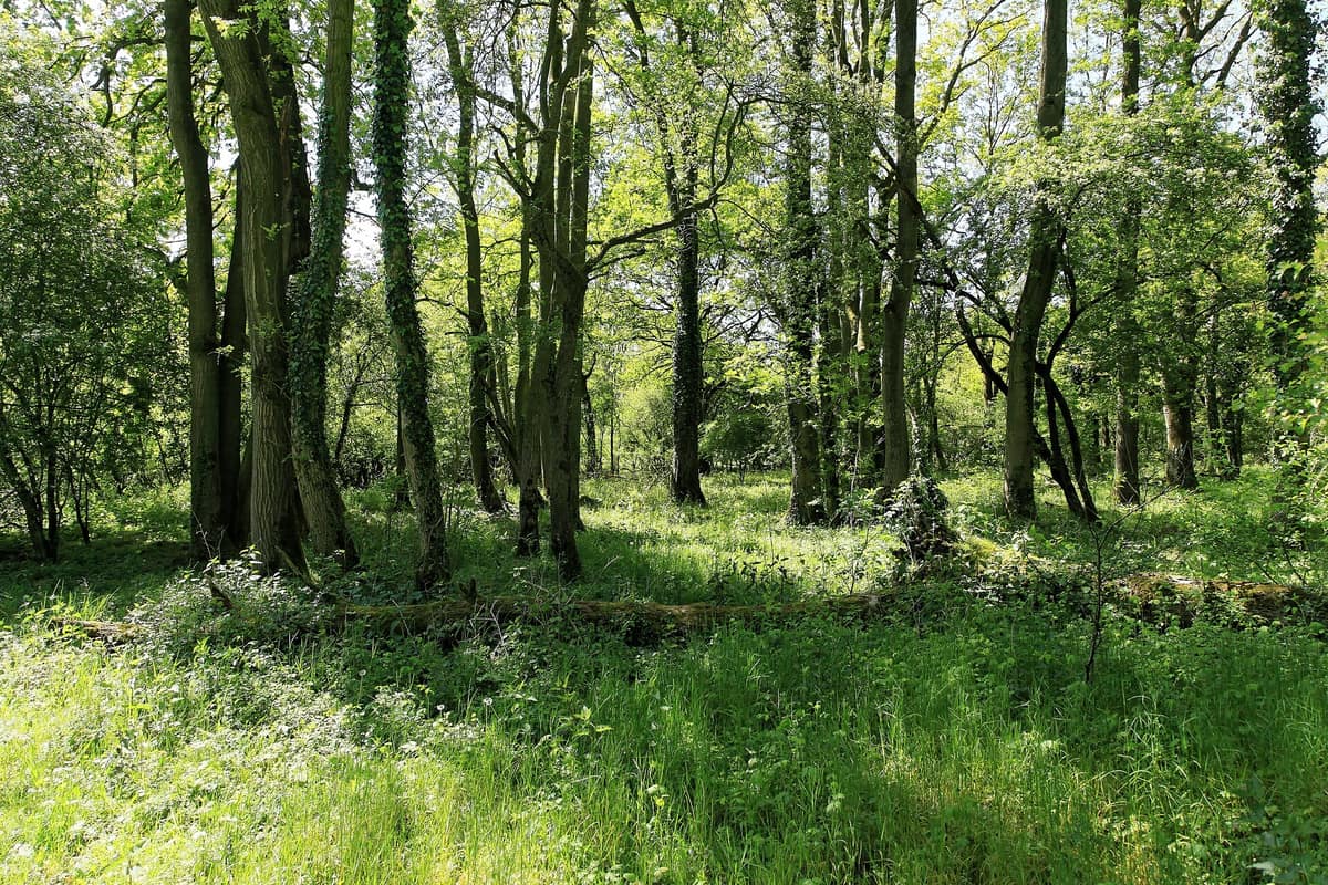
Borkener Paradies Nature Reserve
Naturschutzgebiet Borkener Paradies
Lower Saxony (Meppen / Emsland) · Germany
Photo: Frank Vincentz · CC BY-SA 3.0 · Wikimedia Commons
Historical relict of wood-pasture (Hutewald) in an abandoned oxbow of the Ems River, grazed since the Middle Ages.
Some woodlands were shaped by neglect, and others by the hunger of domestic animals. The Borkener Paradies belongs to the second kind. For centuries, cattle and horses—and earlier also pigs and goats—grazed beneath the canopy of an ancient Ems floodplain forest, sculpting an open, park-like pasture dotted with broad-crowned oaks and sandy clearings. Today, northwest of Meppen in Lower Saxony, a 30-hectare pocket encircled by an old river oxbow preserves that lost world.
What makes it unique
A textbook example of communal wood-pasture, the kind of landscape that covered vast expanses of the northwestern German Geest at the beginning of the nineteenth century.
The place
Nature
The landscape
This place was forged by human hands: centuries of woodland cattle grazing. That heritage explains a landscape that resembles neither a dense forest nor an open meadow. Historical protective regulations from 1937 assigned the reserve 33,35 ha; today official descriptions round the area to around 30. An old oxbow of the Ems wraps around it. To the west, between the reserve and the oxbow, lies a hardwood floodplain forest, while the centre of the reserve features a pond showing siltation succession.
Inside, the terrain changes in quick succession. At times the Ems inundates the floodplain woods and pastures; at other times the ground is sandy and parched, supporting nutrient-poor grassland. There are ancient pedunculate oak stands on sandy soils, preserved by managers as Hutewald (wood-pasture); there are dwarf-shrub heaths with common heather and broom over inland dunes; and there are dense blackthorn thickets. Sandy grasslands contribute rare wildflowers to this mosaic. Across the wider Ems valley, oxbows, meadows, alluvial forest remnants, heaths and wood-pastures form an intricate habitat mosaic, and the Borkener Paradies is one of its finest gems.
Wildlife and seasons
Grazing remains central to conservation. Domestic cattle (vacas) and feral horses (caballos) still graze here today to maintain the open structure of the landscape, producing wide-spreading, gnarled oaks as a direct result.
Sprawling oaks and dense blackthorn thickets represent two opposite poles of this semi-open country. Across dry grasslands of the Ems and Hase, spiked speedwell is a signature plant. Birdsfoot trefoil (Hornklee) also blooms abundantly in the reserve.
Species
With a page in the atlas
Being mentioned in a source doesn't guarantee sightings: check with the people who manage the area.
Memory and protection
History and conservation
The area has been legally protected since 31 July 1937. Protection rules prohibit leaving marked trails, making excessive noise, lighting fires and discarding rubbish. The reserve forms part of the Natura FFH 013 conservation area along the Ems, with the broad-crowned ancient oaks of the Borkener Paradies illustrating historical wood-pasture management across the northwestern Geest.
Before you set off
Visiting
How to visit
To explore the reserve and its surroundings, a waymarked circular walking trail of 7,20 km is signposted, graded as very easy with an approximate walking time of 1:47 h. It starts at point P34 in Versen; that distance corresponds to the full circuit from Versen. An observation platform stands within the reserve. The trail winds past ancient oaks, blackthorn thickets, sandy wildflower clearings and riverbanks, offering an evocative glimpse into the historical face of Central Europe.
Before you go
Follow the marked trails and do not stray from them. Dogs must be kept on a leash to prevent stress to wildlife, and lighting fires is strictly prohibited.
Check access, rules and visiting conditions in the official information from the managing body before you set off.
Location
Where it is and how far it reaches
Boundary of Borkener Paradies · © OpenStreetMap contributors (ODbL) The coordinate is estimated; it isn't a verified access point.
Transparency
Sources
The research data with its sources, and the official links for this place, are in the Spanish version of this page. See the Spanish version
Around it
About 13 km away lies the Natuurreservaat Bargerveen.
Further afield, Park prirode Lonjsko polje, De Maashorst, Gelderse Poort and Kiskunsági - Bugac Puszta share grazing cattle and horses in landscape management.
If you like this place, elsewhere in Europe
Distant places with uncommon wildlife and habitats in common. The most widespread species don't count. Sharing species doesn't imply a corridor or guaranteed presence.
- Lonjsko Polje Nature Park
Sisak-Moslavina County (Sava River Basin)
In common: Domestic cattle · Feral horse — old-growth forest, river corridor
Vast flood-retention wetland along the Sava River preserved through traditional livestock grazing.
JFMAMJJASONDApril – October · Crowding very low
- Kiskunság National Park - Bugac Puszta
Bács-Kiskun (Bugac / Kecskemét)
In common: Domestic cattle · Feral horse
The most renowned expanse of the Kiskunság puszta, preserving herds of Hungarian Grey cattle and traditional steppe horses.
JFMAMJJASONDMay – October · Crowding low
Entry #373 of the original atlas.