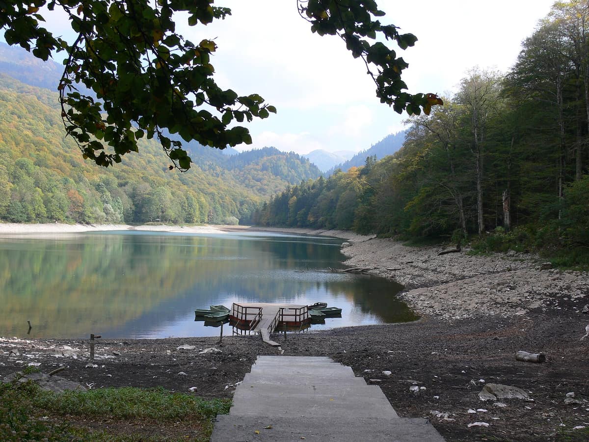
Biogradska Gora National Park - Bjelasica Massif
Nacionalni park Biogradska Gora - Masiv Bjelasice
Municipalities of Kolašin, Mojkovac, and Berane · Montenegro
Photo: Wiki surfer bcr · Public domain · Wikimedia Commons
One of the last three primeval temperate rainforests in montane Europe wrapping around a pristine glacial lake.
There is a forest in Montenegro that has enjoyed protection since 1878, when the clans of Morača and Rovca gifted a tract of primeval woodland to King Nikola I, and it has remained safeguarded ever since. This is the primeval forest of Biogradska Gora, the ecological heart of Biogradska Gora National Park on Mount Bjelasica, wedged between the Tara and Lim river basins. Enclosing this ancient woodland reserve, the national park gathers jewel-like glacial tarns, highland summer pastures, and mountain peaks rising above 2000 metres.
What makes it unique
One of the last three virgin forests in Europe, boasting trees over four centuries old, alongside a pristine glacial lake circled by a forty-minute interpretive path.
The place
Nature
The landscape
Bjelasica stands out from the rest of Montenegro. Volcanic in origin, it displays gentle, rolling, and rounded contours, contrasting sharply with the jagged limestone and karst massifs typical of the country; its range boasts ten summits exceeding 2000 m, culminated by Crna Glava at 2139 m. Bjelasica comprises four main mountain ridges crowned by three pre-eminent peaks: Crna Glava (2139 m), Zekova Glava (2117 m), and Troglava (2072 m).
Cradled between these crests lie glacial lakes. Beyond Lake Biogradsko at the core of the park, several high tarns dot the massif: Pešića Lake, Ursulovačko (Big and Little), and Šiško (Big and Little). Precipitation is exceptionally heavy, reaching up to 100 inches annually, nurturing a rare temperate rainforest. Around the main lake, European beech, sycamore maple, and European ash predominate; on the steeper slopes, beech mingles with silver fir. The strictly protected primeval forest reserve spans 1600 ha across the pristine headwaters of the Biogradska and Jezerštica rivers.
Wildlife and seasons
Spring triggers a spectacular floral display across the forest floor: blossoming wild garlic (srijemuš) carpets the beech groves bordering Lake Biogradsko. The park shelters some 2000 plant species, with 20 % representing regional Balkan endemics, alongside roughly 90 tree species. Barbarea balcana thrives beneath Zekova Glava near the source of the Biogradska river, and wild maples flourish along the river banks and lake shores.
Fauna includes approximately 200 bird species, 80 butterfly species, 350 insect taxa, and quintessential European forest mammals such as wolf, brown bear, red fox, red deer, red squirrel, and dormouse. The Greek stream frog, a Balkan endemic, inhabits Lake Biogradsko and the mouth of the Biogradska river. Three species of trout thrive within the park’s pristine waterways. The Kolašin education centre showcases park wildlife, focusing extensively on brown bear ecology, featuring live camera feeds from a remote bear feeding station.
Species
With a page in the atlas
Being mentioned in a source doesn't guarantee sightings: check with the people who manage the area.
Memory and protection
History and conservation
The area was declared a national park in 1952, and in 1977 UNESCO granted it international recognition under the Man and the Biosphere programme. Local folklore recounts that the lake originated from a grieving mother’s curse following a fatal feud between two brothers over their shared wheat field.
Before you set off
Visiting
How to visit
Nearly eighty kilometres of waymarked hiking trails, mostly of moderate grade and averaging twelve kilometres in length, lead towards panoramic summits and glacial lakes. The park features six marked mountain routes climbing to Crna Glava, Troglava, and Zekova Glava, as well as multiple tarns. A scenic section of the CT-1 national mountain transversal, spanning 120 km in total, traverses the park.
For an introductory walk, the educational nature trail encircling Lake Biogradsko measures 3,3 km, takes roughly 40 minutes, and is graded easy; it features six interactive interpretive stations exploring local flora and fauna. The circular themed trail Ljeto u katunu spans 2,5 km, is easy, and lasts about an hour. There is also a marked mountain biking route and a cross-country trail, and visitors can rent wooden rowing boats or kayaks on the lake.
Higher up, scenic lookouts grace Crna Glava, Zekova Glava, and Bendovac. Along the way hikers discover traditional pastoral architecture across Bjelasica’s seasonal settlements; in summer, shepherds reoccupy the katuns of Pešića Rupe, Vranjak, Šiška, and Vragodo, filling the slopes with the chime of livestock bells.
Before you go
Organised school and visitor groups must notify the park visitor centre at least one day prior to arrival. Verify current road and weather conditions with park management before setting out.
Check access, rules and visiting conditions in the official information from the managing body before you set off.
Location
Where it is and how far it reaches
Boundary of Nacionalni park Biogradska gora · IUCN II · © EEA, CDDA (CC-BY) The coordinate is estimated; it isn't a verified access point.
Transparency
Sources
The research data with its sources, and the official links for this place, are in the Spanish version of this page. See the Spanish version
Around it
Nine kilometres away lie Durmitor National Park - Tara River Canyon and, fourteen kilometres distant, Durmitor National Park - Mountain Massif; thirteen kilometres away stands Komovi Nature Park, and twenty-two kilometres away lies Morača River Canyon.
What else to explore nearby
Approximate straight-line distance between the edges of each area. It doesn't indicate access, routes or driving times.
- Albanian Alps National Park
Shkodër / Kukës County (Theth / Valbonë / Tropojë District)
About 21 km away
The heart of the Albanian Alps (Prokletije), featuring deep glacial canyons, isolated valleys, and the historic lock-in tower of Theth.
JFMAMJJASONDJune – October · Crowding low
- Gashi River Strict Nature Reserve
Tropojë District (Albanian Alps / Tropojë)
About 21 km away
Pristine glacial valley and undisturbed primeval beech forest designated a UNESCO World Heritage site in Albania.
JFMAMJJASONDJune – October · Crowding very low
Entry #45 of the original atlas.