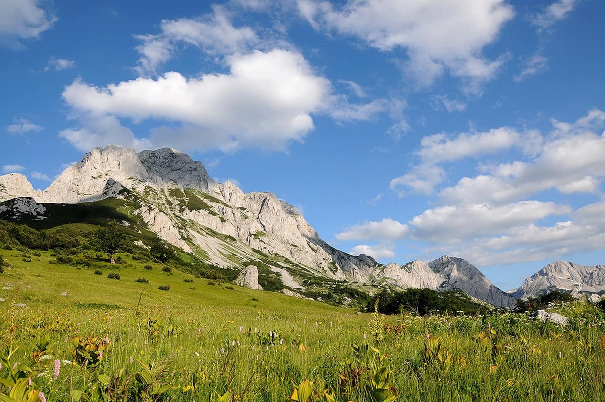
Sutjeska National Park - Maglić Massif
Nacionalni park Sutjeska - Maglić
Foča (BA) / Plužine (ME) · Bosnia and Herzegovina / Montenegro
Photo: Darko Gavric · CC BY-SA 3.0 · Wikimedia Commons
The highest summit in Bosnia and Herzegovina (Maglić 2.386 m) and the primeval forest reserve of Perućica.
The Sutjeska is not merely a mountain stream: it is a monumental incision. A canyon plunging roughly 1.200 metres deep slices the national park in two, separating the gentle plateaus of Zelengora with their emerald tarns from the jagged alpine massifs of Maglić, Volujak, and Bioč. Here rises the roof of Bosnia and Herzegovina, Mount Maglić, and at its base stretches Perućica, one of the last two primeval temperate rainforests in Europe, where ancient beech trees soar past 60 metres. It stands as the oldest and largest national park in the country.
What makes it unique
A forest where an axe has never touched a tree, standing at the foot of Bosnia’s highest mountain.
The place
Nature
The landscape
The national park was proclaimed in 1962, and 66 % of its territory is cloaked in dense forest. The Sutjeska river traverses its length, having carved the dramatic canyon and the amphitheatre valley of Tjentište. On one flank lies Zelengora with its 9 glacial tarns, known locally as the "mountain eyes", hidden amid high pastures and pine woods; on the other looms Maglić.
Maglić is a twin-peaked sentinel: Veliki Maglić, at 2.386 metres, in Bosnia, and Crnogorski Maglić, rising to 2.388 metres, just across the border in Montenegro. Its towering flanks expose Permian red sandstones, Mesozoic limestones, diabase, and melaphyre alongside glacial moraines. The north-western slopes support dense conifer and beech forests up to 1.600 metres; above extends an alpine plateau, while in other aspects the mountainsides drop steeply in barren screes. Plentiful springs bubble up, including Carev Do which never runs dry, and even in midsummer high gullies retain unmelted snow patches.
Over the crest in Montenegro, Maglić cradles the heart-shaped glacial Lake Trnovačko at 1.517 metres: 700 by 400 metres of turquoise water framed by a ring of limestone peaks.
The green jewel of the park is Perućica. It forms a strict nature reserve some 6 km long and between 1 and 3 km wide, encompassing roughly 1.400 hectares, set aside for science and conservation in 1952. Its trees have never experienced logging, with individual specimens exceeding 300 years of age and beech trunks soaring 60 metres or higher. Deep within its wilderness cascades the Skakavac waterfall, dropping roughly 75 metres through the jungle-like canopy.
Wildlife and seasons
Throughout the park, and especially in the old-growth sanctuary of Perućica, researchers frequently record brown bear, chamois, wild boar, wolf, martens, European wildcat, red fox, and feral goats. Indeed, the local Balkan chamois population historically served as a prime donor nucleus: between 1963 and 1987, wildlife authorities translocated 256 animals to 13 mountain sectors across Bosnia and Croatia. The Eurasian lynx is officially listed among the park’s faunal inventory.
Among birds, Perućica shelters the golden eagle, western capercaillie, peregrine falcon, blackbird, and rock partridge. An ornithological survey recorded 114 bird species in 2002, though current estimates are higher, including 9 woodpecker species representing 90 % of Europe’s picid diversity. Vascular flora exceeds 2.600 species with numerous rare and endemic taxa; a five-day botanical field survey recorded 403 plant species within the Sutjeska and Hrčavka river canyons in 2014.
The climate is transitional: moderate continental conditions prevail from the north with softening Mediterranean influences from the south. Peak hiking season spans June to October; the park is accessible year-round, barring high-elevation winter closures.
Species
With a page in the atlas
Being mentioned in a source doesn't guarantee sightings: check with the people who manage the area.
Memory and protection
History and conservation
Sutjeska is also hallowed historical ground. Here, between 15 May and 16 June 1943, raged the epic Battle of the Sutjeska, where Partisan forces broke through Axis encirclement despite losing one-third of their troops. The sprawling Tjentište Memorial Complex, built between 1958 and 1975, incorporates a crypt containing the remains of 3.301 fallen soldiers.
Modern ecological threats have included proposals for four small hydroelectric dams in the park’s river basins; the court in Banja Luka subsequently struck down the environmental approvals for the proposed projects in the Hrčavka canyon. Ongoing regional initiatives propose creating an adjoining national park in Montenegro to protect the remaining Maglić-Volujak-Bioč range and Lake Trnovačko as an integrated transboundary protected wilderness.
Before you set off
Visiting
How to visit
The ascent of Mount Maglić is the premier alpine challenge. Three classic routes lead to the peak: from Prijevor, from Lokve Dernečišta, and from Lake Trnovačko. Prijevor, situated at 1.668 metres, marks the trailhead for the shortest and steepest line, demanding surefootedness on exposed alpine screes and scrambling gullies. The trail from Lokve Dernečišta is longer, less technical, and more gradual. Most multi-peak hikes require two days, approaching the upper massif from the southern slopes across dwarf mugo pine and alpine turf. From the summit, panoramic views take in Volujak, Bioč, Lake Trnovačko, and the distant crests of Durmitor.
Zelengora provides a gentler alternative: highly favoured by distance hikers, it features several restored mountain chalets across its undulating slopes.
Before you go
The park is reached by road from Sarajevo at 110 km, and from Dubrovnik at 142 km. The nearest town, Foča, lies 20 km away. On the exposed Prijevor trail, park wardens urge hikers to turn back immediately at the onset of thunderstorms.
Check access, rules and visiting conditions in the official information from the managing body before you set off.
Location
Where it is and how far it reaches
Boundary of Sutjeska · © EEA, CDDA (CC-BY) The coordinate is estimated; it isn't a verified access point.
Transparency
Sources
The research data with its sources, and the official links for this place, are in the Spanish version of this page. See the Spanish version
How it fits into the territory
Calculated from the Atlas boundaries. «Part of» is only stated with an official boundary; an estimated area only means that they overlap.
Within this area · 1
- Perućica Primeval Forest - Sutjeska National Park
Republika Srpska (Foča / Maglić)
Inside its official boundary
The best-preserved beech and fir primeval forest in Southeastern Europe, with trees over 300 years old and the Skakavac waterfall.
JFMAMJJASONDJune – October · Crowding very low
Shares territory with
- Sutjeska National Park - Zelengora Mountains
Republika Srpska (Foča / Tjentište)
Their official boundaries overlap
The "Green Mountain", a range of forests and alpine meadows dotted by 8 glacial lakes of striking beauty.
JFMAMJJASONDJune – October · Crowding very low
Around it
Protected within this park are the Perućica Primeval Forest, the Bioč Massif, and the Volujak Mountains. Twenty-two kilometres away lie Durmitor National Park - Mountain Massif and Tara River Canyon; Piva Nature Park directly abuts the boundary.
Entry #311 of the original atlas.