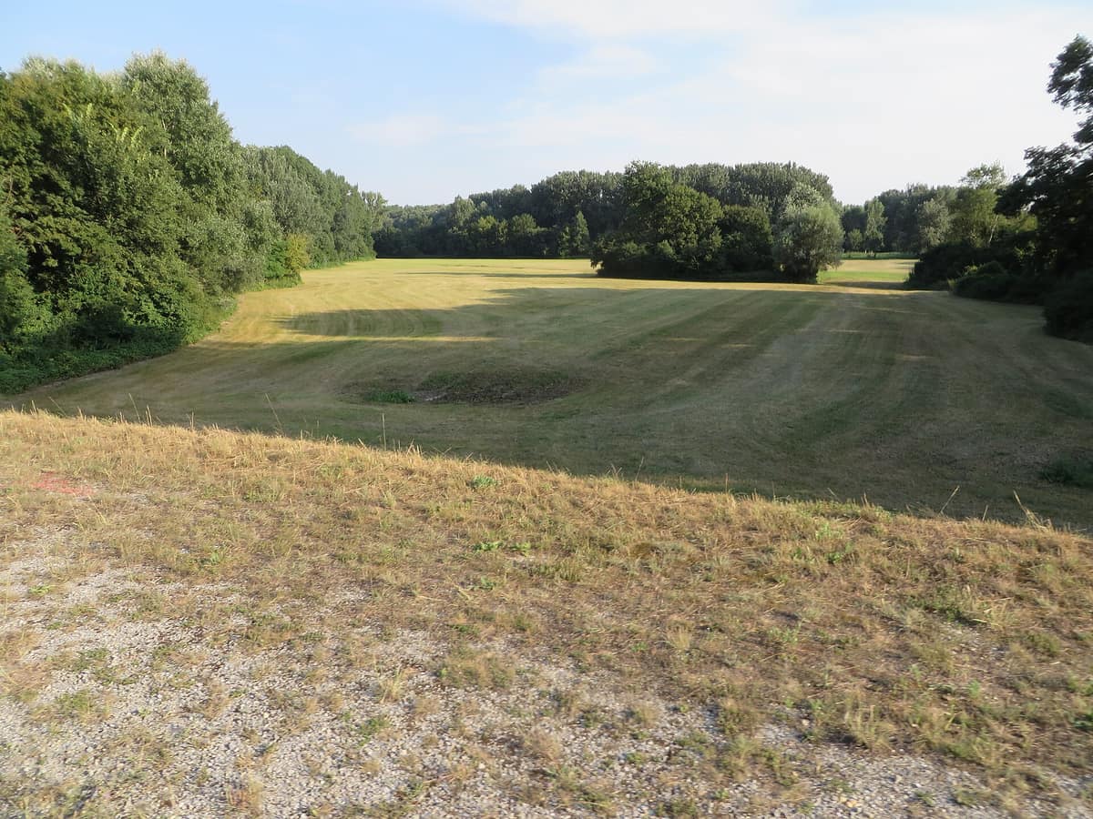
Donau-Auen National Park
Nationalpark Donau-Auen
Vienna / Lower Austria (Orth an der Donau) · Austria
Photo: Brent Hugh · CC BY-SA 4.0 · Wikimedia Commons
Central Europe's last major free-flowing lowland river landscape between Vienna and Bratislava.
In December 1984, thousands of citizens from all backgrounds occupied the riparian forests of Stopfenreuth to prevent a hydroelectric dam from severing Austria's last long, free-flowing stretch of the Danube. Police attempted evictions several times without success, and the federal government eventually halted construction. Twelve years later, on 27 October 1996, these wetlands were protected as Donau-Auen National Park. Today it safeguards more than 9.600 hectares stretching between Vienna and the mouth of the March river at the Slovak border.
What makes it unique
Here the Danube remains a wild river: fluctuating up to seven metres, remodelling the riverine landscape with every flood.
The place
Nature
The landscape
The Austrian Danube behaves like an alpine torrent: it drops around 40 cm per kilometre and rushes at 1 to 3 metres per second. Through the national park it flows for thirty-eight kilometres and, at its narrowest points, spans only some 4 km across; wetlands are confined to the immediate riparian corridor. Water levels surge with the spring snowmelt through mid-summer, then recede. That natural pulse keeps the floodplain dynamic: side-arms form, gravel bars accumulate into islands, old meanders detach, and bare sand or shingle initiates ecological succession from pioneering herbs to willow carrs and mature hardwood forest.
Prior to nineteenth-century regulation, the Danube branched into an ever-shifting braided network of main channels and backwaters. It was canalised to improve navigation and shield the arable Marchfeld plain from flooding, and from the fifties onward an almost continuous chain of hydropower dams impounded the river into reservoirs. Only the Wachau and this national park remain free.
The resulting habitat is an intricate mosaic. Approximately 65 % of the park is alluvial forest, 15 % meadowland, and nearly 20 % open water. Willows, black poplars, and alders constitute the softwood floodplain forest, inundated several times each year; higher terraces support oaks, maples, ashes, and lindens. Deep gravel terraces foster semi-arid steppe grasslands with hawthorn, buckthorn, wild orchids, and feather grass, alongside praying mantises. Hay meadows cultivated for centuries also endure.
Wildlife and seasons
Commercial logging has ceased throughout the national park: the sole lumberjack at work is the Eurasian beaver. Along the undercut banks of Schönau, late winter afternoons provide prime opportunities to spot one. Walking the Schönau trail reveals grey herons among reedbeds and, in winter, cormorants and white-tailed eagles. Having long ceased breeding in Austria, the white-tailed eagle has returned to nest in the park with up to six resident pairs.
Other notable birds include the black kite, one of Austria's rarest raptors, and the corn crake, which lurks hidden in tall, damp meadows and is betrayed by its rasping nocturnal call. The park shelters Austria's last native breeding population of the European pond turtle. The Aesculapian snake is frequently encountered along sunny woodland trail verges on south-facing slopes.
In total, 39 mammal species, 100 breeding birds, eight reptiles, thirteen amphibians, 67 fish species, and 900 vascular plant species inhabit the park. The recommended season spans from spring to autumn.
Species
With a page in the atlas
Being mentioned in a source doesn't guarantee sightings: check with the people who manage the area.
Memory and protection
History and conservation
Scientific studies following the 1984 protests confirmed that the alluvial wetlands possessed national park quality and that a hydroelectric barrage was fundamentally incompatible with them. The Danube, March, and Thaya river floodplains and the lower Lobau have been Ramsar wetlands since 1983, and the park holds IUCN Category II status. Future expansions of its protected territory are planned.
Conservation networks
Before you set off
Visiting
How to visit
You can explore the park freely on foot or by bicycle; there is no admission fee. A well-marked trail network branches from various gateway villages, and both the long-distance hiking trail 07 and the Danube Cycle Path, originating in Passau and extending to Hungary via Hainburg, pass through the park.
An excellent introductory outing is the Schönau circular trail: two kilometres, one hour, though it becomes impassable during high water. At Eckartsau you can trace historical Habsburg imperial hunting tracks through riverside glades, while Hainburg condenses diverse scenery into a compact space where the Danube constricts between the Braunsberg and Devín Castle. The Auterrasse viewpoint near Stopfenreuth offers a two-storey flood-proof observation platform overlooking the main river.
For guided exploration, park rangers lead interpretive walks that change according to season, weather, and river levels, remaining accessible as the terrain is flat. Scheduled themed excursions range from spring birdsong dawn walks to nocturnal deer-rutting outings in autumn. Boat trips in canoes, inflatable rafts, or traditional flat-bottomed wooden boats are available. Guided tours are conducted in German, English, and Slovak.
The park visitor centre is located in the castle of Orth an der Donau, 15 km from Vienna. Opened in 2005, it houses the interactive exhibition «Im Fluss», which illustrates river dynamics and habitat creation. It closes from 2 November to 20 March.
Before you go
Stick strictly to marked trails; cycling is permitted only along designated routes and boating is restricted to non-motorised craft on designated watercourses. Danube floods can alter schedules and trail access on short notice: check current water levels before setting out and avoid low-lying riparian tracts where you might become trapped. After nightfall visitors are requested to cease recreational activities and avoid noise to protect crepuscular and nocturnal wildlife. From the south bank, access is convenient via the S7 suburban railway from Vienna toward Wolfsthal.
Check access, rules and visiting conditions in the official information from the managing body before you set off.
Location
Where it is and how far it reaches
Boundary of Donau-Auen · IUCN II · © EEA, CDDA (CC-BY) The coordinate is estimated; it isn't a verified access point.
Transparency
Sources
The research data with its sources, and the official links for this place, are in the Spanish version of this page. See the Spanish version
Around it
Roughly twenty kilometres away lie the Vienna Woods Core Forests, and some twenty-five kilometres distant spreads the Neusiedler See - Seewinkel National Park.
What else to explore nearby
Approximate straight-line distance between the edges of each area. It doesn't indicate access, routes or driving times.
- Vienna Woods - Core Forest Areas
Lower Austria / Vienna
About 19 km away
Protected mature beech and oak forests across the wooded hills flanking the Austrian capital.
JFMAMJJASONDApril – October · Crowding low
- Neusiedler See - Seewinkel National Park
Burgenland (Neusiedl am See / Illmitz)
About 25 km away
Central Europe’s only endorheic steppe lake and its belt of saline shallow soda pans in Seewinkel.
JFMAMJJASONDApril – June · September – October · Crowding low
If you like this place, elsewhere in Europe
Distant places with uncommon wildlife and habitats in common. The most widespread species don't count. Sharing species doesn't imply a corridor or guaranteed presence.
- Hortobágy National Park - The Hungarian Puszta
Hajdú-Bihar / Jász-Nagykun-Szolnok
In common: Emys orbicularis · White-tailed eagle — wetland
Central Europe's largest steppe grassland (80.000 ha) featuring traditional pastoralists and massive crane migrations.
JFMAMJJASONDApril – June · September – November · Crowding low
Entry #201 of the original atlas.