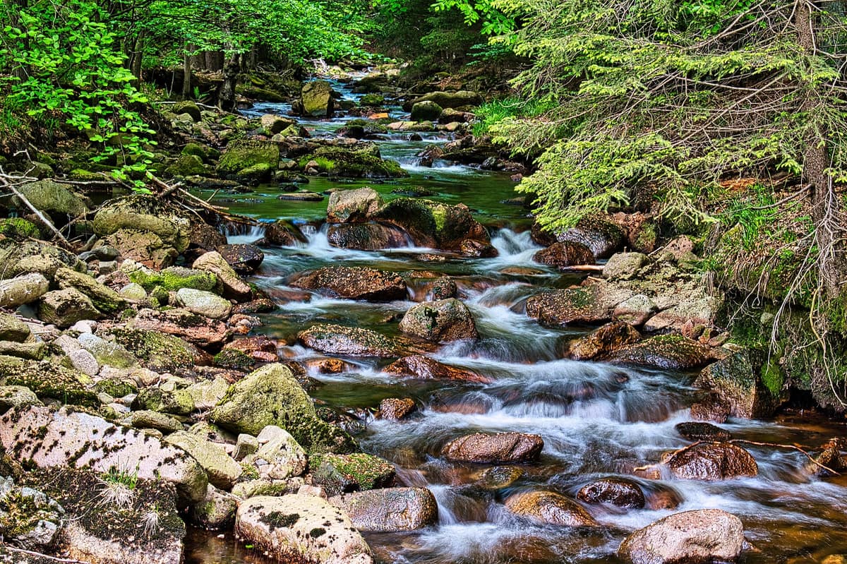
Harz National Park
Nationalpark Harz
Lower Saxony / Saxony-Anhalt (Wernigerode / Bad Harzburg) · Germany
Photo: Matthias Trusheim · CC BY-SA 4.0 · Wikimedia Commons
Germany's northernmost mountain range, culminating in the legendary mist-shrouded summit of the Brocken.
For decades, the border dividing Germany severed the Harz, leaving vast sectors of the range strictly off-limits to the public. Access was severely restricted, and from August 1961 nobody was even permitted atop the Brocken. Portions of that closed landscape were ultimately protected as a national park: originally two sister parks on either side of the former divide, which merged in 2006 into a single entity, becoming Germany's first cross-state national park.
Today Harz National Park encompasses some 24.700 hectares—roughly a tenth of the entire mountain massif—spanning from Wernigerode and Ilsenburg in the north to Herzberg and Bad Lauterberg in the south.
What makes it unique
Here you find mountain forests reclaiming their natural dynamics and the celebrated conservation saga of the lynx's return.
The place
Nature
The landscape
The Harz rises in marked topographic steps. Around the perimeter the terrain begins around 240 m in the north and 270 m in the south, climbing up to the 1.141 m peak of the Brocken, the highest point in northern Germany, with each elevation tier supporting distinct woodland types. Below roughly 600 m deciduous hardwoods prevail, yielding to Norway spruce higher up. In the harsh subalpine zone gnarled spruces aged over 250 years endure wind and frost, interspersed with open raised peat bogs of international conservation significance.
The historical dominance of spruce reflects centuries of human industry. Local silver and copper mining and smelters consumed vast amounts of timber, depleting native mixed forests. Beginning in the eighteenth century, reforestation heavily prioritized fast-growing spruce, creating uniform stands. On the highest windswept summits, however, original natural spruce taiga accompanied by rowan trees naturally persisted.
Water also carries historical resonance. Numerous mountain streams rise within the park, and the historic Oderteich reservoir, completed in 1722, collected the headwaters of the Oder to drive waterwheels for the mines of Sankt Andreasberg.
Wildlife and seasons
The creature that defines the park is the Eurasian lynx. The last indigenous lynx of the Harz was killed in a hunt; in 1999 authorities launched a reintroduction programme, releasing 19 zoo-bred cats between 2000 and 2004. Wild litters have been born regularly since 2002. Spotting a lynx in the vast woods requires immense luck, which is why an observation enclosure operates at Rabenklippe near Bad Harzburg, allowing you to watch lynx basking on rocky ledges or patrolling their wooded run. Public feeding demonstrations on Wednesday and Saturday afternoons are very popular.
Not every reintroduction succeeded. For the western capercaillie, once extinct across the Harz, around one thousand captive-bred birds were released, yet the population failed to establish self-sustaining numbers and the effort ended. A capercaillie aviary remains accessible near Lonau.
Other wildlife abounds. The Harz represents one of Germany's premier strongholds for the European wildcat, while red deer and roe deer are prominent large herbivores. Rare native fauna includes the white-throated dipper, black stork, and peregrine falcon. Among flora, the endemic Brocken anemone grows in Germany exclusively across the high plateau; the Brockengarten alpine botanical garden on the summit is dedicated to preserving rare plants and restoring the peak.
To reach the lynx enclosure you can hike up from Bad Harzburg; check the seasonal schedule for bus line 875 beforehand. In autumn rangers and foresters conduct guided rutting and ecology walks. In winter, interpretive stations along the WaldWandelWeg are temporarily dismantled.
Species
With a page in the atlas
Being mentioned in a source doesn't guarantee sightings: check with the people who manage the area.
Memory and protection
History and conservation
The eastern national park in Saxony-Anhalt was gazetted on 1 October 1990, just two days prior to German reunification; the western sector in Lower Saxony was established in 1994, spanning 15.800 ha. Decades of Iron Curtain border closure shielded core wilderness habitats from development, despite military perimeter fencing.
Today over 10.000 species of animals, plants, and fungi inhabit the park, though woodlands face severe stress. Climate-driven drought and native bark beetle outbreaks have left extensive stands of gray spruce deadwood. While challenging for spruce monocultures, this process facilitates an organic rebirth into resilient mixed natural forest.
Before you set off
Visiting
How to visit
Begin at one of the visitor centres, each focusing on a distinct theme. The Brockenhaus atop the peak houses a barrier-free exhibition over three storeys exploring mountain history, climate, and wildlife, preserving the Cold War radar dome and an open-air observation deck. At TorfHaus, a barrier-free exhibition showcases the European Green Belt, featuring an interactive cinema where you can simulate hikes or encounters with wildlife. The Sankt Andreasberg centre explains mountain geology and mining history, while the HarzWaldHaus in Bad Harzburg presents woodland ecology, featuring Germany’s largest indoor observation anthill.
Over 600 kilometres of waymarked paths crisscross the terrain. An easy introductory stroll is the WaldWandelWeg, spanning 180 metres and ten minutes mostly on wooden boardwalks, which demonstrates forest change: bark beetle dynamics, standing deadwood, and pioneering rowans and birches. It is reached via a 1,5-kilometre walk from TorfHaus. For ascending the Brocken, the rocky Eckerloch trail from Schierke measures 10 km round trip, requires four to five hours, and tackles some 500 metres of stony climb. For wildlife watching, two public hides are located beside Molkenhaus near Bad Harzburg and in the Oder valley between Oderhaus and Rinderstall (barrier-free). Patience is essential.
The Harzer Wandernadel hiking network maintains roughly 30 stamp checkpoints distributed throughout the park for collecting the coveted WildnisEntdecker badge.
Before you go
A strict rule to remain on marked trails applies throughout the park. Each year over one thousand sacks of discarded litter are collected, posing grave threats to wildlife: please carry out all trash. Check trail closure advisories before setting out and respect seasonal diversions. High-elevation conditions are notoriously harsh and unpredictable; wear sturdy footwear and pack weatherproof layers.
Check access, rules and visiting conditions in the official information from the managing body before you set off.
Location
Where it is and how far it reaches
Boundary of Harz · IUCN II · © EEA, CDDA (CC-BY) The coordinate is estimated; it isn't a verified access point.
Transparency
Sources
The research data with its sources, and the official links for this place, are in the Spanish version of this page. See the Spanish version
If you like this place, elsewhere in Europe
Distant places with uncommon wildlife and habitats in common. The most widespread species don't count. Sharing species doesn't imply a corridor or guaranteed presence.
- Vindelfjällen Nature Reserve
Västerbotten (Ammarnäs / Tärnaby)
In common: Picea abies · Eurasian lynx — high mountain, old-growth forest, wetland
One of the largest nature reserves in Europe: high-alpine massifs, birch valleys, and the free-flowing Vindel River running wild to the Baltic.
JFMAMJJASONDMarch – April · June – September · Crowding very low
- Lom Primeval Forest Strict Nature Reserve
Republika Srpska (Petrovac / Klekovača)
In common: Picea abies · Eurasian lynx — high mountain, primary forest
Beech and fir reserve set upon the deep karstic terrain of Mount Klekovača.
JFMAMJJASONDJune – October · Crowding very low
- Hajdučki and Rožanski Kukovi Strict Reserve
Lika-Senj County (Sjeverni Velebit)
In common: Picea abies · Eurasian lynx — high mountain, primary forest
Dantesque labyrinth of limestone monoliths and abyssal karst pits such as Lukina Jama (1,431 m deep).
JFMAMJJASONDJune – October · Crowding very low
Entry #361 of the original atlas.