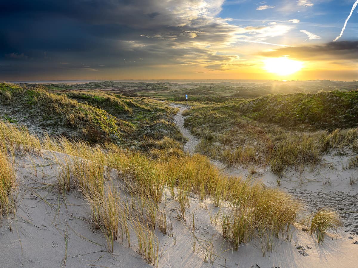
Lower Saxony Wadden Sea National Park
Nationalpark Niedersächsisches Wattenmeer
Lower Saxony (East Frisian Islands / Cuxhaven / Wilhelmshaven) · Germany
Photo: Stephan Sprinz · CC BY 4.0 · Wikimedia Commons
Barrier islands, salt marshes and intertidal mudflats between the Ems and the Elbe, part of the Wadden Sea World Heritage site.
The sea retreats, and a vast plain appears. For thousands of years the tide has shaped the southern North Sea coast, and the result is a dynamic landscape that changes with every wave. The mudflats here formed around 8.000 years ago, following the last ice age, when the rising sea began depositing sand and silt along the low-lying shore.
Lower Saxony declared this shoreline a national park in 1986. It stretches from the Dutch border in the Dollart to Cuxhaven, framed by the East Frisian Islands as a natural seaward barrier. The result is Germany's second-largest national park, encompassing some 3.450 km². The coast forms an intricate mosaic of intertidal mudflats, salt marshes, sandy beaches, dunes and dynamic estuaries.
What makes it unique
A tidal landscape of international scale where 10 to 12 million migratory birds refuel every year along barrier dunes and mudflats.
The place
Nature
The landscape
Picture the seabed laid bare before your eyes. Depending on wave exposure and currents, different sediments settle, creating sand flats, mixed flats or mudflats criss-crossed by deep tidal gullies. The East Frisian Islands arose from migrating sandbanks; by contrast, the North Frisian Islands and Halligen once formed part of the mainland. On the seaward side facing the open ocean lie wide sandy beaches and white dunes, while salt marshes dominate the sheltered Wadden side. Marram grass rules the dunes, binding them with extensive root systems; in summer, sea holly and sea lavender burst into bloom across the salt marshes.
Zone 1, by far the largest sector of the park, may only be entered on designated, authorized paths.
Wildlife and seasons
Across the wider Wadden Sea, in spring and autumn up to 12 million migratory birds representing over 40 internationally significant species make stopovers between northern breeding territories and southern wintering quarters; the red knot alone reaches 350.000 individuals here. In summer, more than 30 breeding species remain across marshes, dunes and beaches: Eurasian oystercatchers muster up to 40.000 pairs across the entire Wadden Sea, accompanied by gull and tern colonies numbering thousands of pairs. The salt marshes serve as vital nesting grounds for pied avocets and terns.
From July to September the great moult takes place: across the whole Wadden Sea, roughly 180.000 common shelducks from northwestern Europe and some 200.000 common eiders spend these flightless weeks here. In total, more than 400 bird species have been recorded, including black-headed gull, common tern, hen harrier and northern wheatear.
Beneath the surface, the intertidal mud is an extraordinarily rich pantry. The mud amphipod Schlickkrebs reaches densities of up to 100.000 individuals per m². Common seals and grey seals rely on exposed sandbanks to rest and pup, while the harbour porpoise, the region's only native cetacean, patrols deeper offshore waters. Researchers have documented over 10.000 plant and animal species, making the East Frisian coast a premier biodiversity hotspot.
Species
With a page in the atlas
Being mentioned in a source doesn't guarantee sightings: check with the people who manage the area.
Memory and protection
History and conservation
The Lower Saxon sector of the Wadden Sea was designated a Wetland of International Importance under the Ramsar Convention in 1976; the national park was established in 1986, later becoming a UNESCO biosphere reserve and part of the Wadden Sea World Heritage site. UNESCO inscribed it on 26 June 2009, and since June 2014 the entire North Sea Wadden Sea has shared this status. It forms the world's largest unbroken expanse of intertidal sand and mud flats. In 2001, a controversial legal reform reduced protection across certain peripheral zones to accommodate tourism.
Before you set off
Visiting
How to visit
An extensive network of trails caters to walkers, cyclists and equestrians, marked by colour-coded wooden posts: green for hiking and red for bridleways. To understand this dynamic world, begin at a visitor centre: there are three large Wadden Sea visitor centres, fourteen Nationalpark-Häuser and an experiential discovery station along the coastline and islands. Their interactive displays illuminate the national park concept, World Heritage values and marine habitats; ideally, complement this with a guided mudflat excursion.
Explore the tidal flats with certified guides who read the weather and tides, knowing when to suspend a walk if conditions deteriorate rapidly. For route planning, the Federal Maritime and Hydrographic Agency (BSH) publishes official tidal predictions and water temperatures.
Before you go
In Zone 2 you may step off trails, except within breeding bird colonies on salt marshes during nesting season from April to July. Rapid weather shifts are frequent, so dress in layers: base layer, warm jumper and wind- and waterproof jacket. The tides dictate every activity: the BSH provides live schedules for high and low water alongside water temperatures.
Check access, rules and visiting conditions in the official information from the managing body before you set off.
Location
Where it is and how far it reaches
Boundary of Niedersächsisches Wattenmeer · © EEA, CDDA (CC-BY) The coordinate is estimated; it isn't a verified access point.
Transparency
Sources
The research data with its sources, and the official links for this place, are in the Spanish version of this page. See the Spanish version
Around it
In the Dutch sector of the same coastal system lie the Wadden Sea Salt Marshes (Dutch Sector), and another German sector is the Schleswig-Holstein Wadden Sea National Park.
Further away, Słowiński National Park shares the red knot, common shelduck and grey seal; Wadden Sea National Park (Denmark) shares the red knot and grey seal; and Rusanda Nature Park shares the pied avocet and common shelduck.
What else to explore nearby
Approximate straight-line distance between the edges of each area. It doesn't indicate access, routes or driving times.
- Wadden Sea Salt Marshes (Dutch Sector)
Provinces of Friesland and Groningen (Islands of Texel, Vlieland, Terschelling, Ameland, Schiermonnikoog, and mainland coast)
About 4 km away
Vast intertidal system of mudflats and salt marshes, a vital lifeline for millions of migratory birds along the Atlantic flyway.
JFMAMJJASONDMay – June · September – October · Crowding low
- Schleswig-Holstein Wadden Sea National Park
Schleswig-Holstein (Sylt / Halligen / Husum / Tönning)
About 8 km away
Central Europe's largest national park: intertidal mudflats, dyked islets (Halligen) and millions of migratory waders on passage.
JFMAMJJASONDApril – May · August – October · Crowding moderate
If you like this place, elsewhere in Europe
Distant places with uncommon wildlife and habitats in common. The most widespread species don't count. Sharing species doesn't imply a corridor or guaranteed presence.
- Wadden Sea National Park (Denmark)
South Jutland (Esbjerg / Fanø / Rømø / Ribe)
In common: Red knot · Grey seal — wild coast, marine, wetland
The world's largest unbroken system of intertidal sand and mud flats (UNESCO World Heritage), renowned for massive starling murmurations (Sort Sol).
JFMAMJJASONDApril – May · September – October · Crowding low
Entry #1013 of the original atlas.