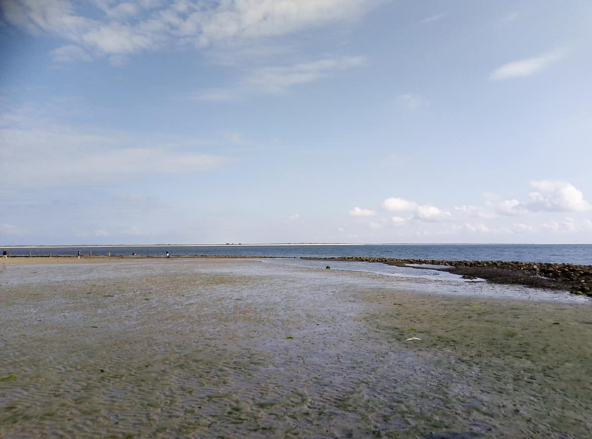
Schleswig-Holstein Wadden Sea National Park
Nationalpark Schleswig-Holsteinisches Wattenmeer
Schleswig-Holstein (Sylt / Halligen / Husum / Tönning) · Germany
Photo: Wilhelm II. Hohenzollern · CC BY-SA 4.0 · Wikimedia Commons
Central Europe's largest national park: intertidal mudflats, dyked islets (Halligen) and millions of migratory waders on passage.
Here the map redraws itself twice a day. When the sea recedes, the coastline of Schleswig-Holstein turns into an expanse of mud and sand that floods anew with every high tide. The Schleswig-Holstein Wadden Sea National Park is Germany's largest, and the largest between the North Cape and Sicily: 4.380 km² of North Sea coast, stretching from the mouth of the Elbe to the Danish border. It was founded on 1 October 1985 by the national parks act of 22 July 1985, and in North Frisia the tidal mudflats reach widths of up to 40 km in places.
What makes it unique
Dynamic mudflats and undyked Halligen where the North Sea reclaims and redraws the land with every single tide.
The place
Nature
The landscape
It all began with the ice. The Wadden Sea formed after the last ice age, 10.000 years ago: as glaciers melted, sea levels rose and organic and inorganic sediments settled along the shallow coast, shaping fine mudflats and coarser sand flats. More than two-thirds of the park remain permanently submerged beneath water, while roughly 30% consists of tidal flats exposed at low tide. The tide rises and falls between 1,5 m and 3,7 m, and that tidal range increases from north to south.
Within this sea lies land. The North Frisian Islands were formed primarily from fragments of the mainland severed by storm surges. Sylt, Amrum, Föhr, Pellworm and the five largest Halligen lie outside the park boundary, as do sea dykes; within the park lie uninhabited islands and islets such as Trischen and Blauort. Even so, people reside within the park: one family lives on Hallig Süderoog year-round, another stays in summer on Hallig Südfall, and a bird warden watches over Trischen island.
Wildlife and seasons
The Wadden Sea is Central Europe's most bird-rich area and a vital staging post along the East Atlantic Flyway. Across the transboundary Wadden Sea system, an average of 10 to 12 million birds pass through each year; Schleswig-Holstein is one of their prime resting and breeding sectors. Small passerines, such as the northern wheatear, also find crucial habitat here. Among ducks, the common shelduck stands out prominently.
In the water, common seals and grey seals rely on sandbanks to rest and pup, while the harbour porpoise is the only native cetacean. West of Sylt lies a designated whale and seabird sanctuary, a critical breeding area for the harbour porpoise, whose population plummeted by around 90% in the North Sea during the twentieth century. Dense seagrass meadows also thrive across the park.
Across the park's habitats live some 3.200 animal species, and about 250 reside exclusively in salt marshes. Across the World Heritage salt marshes as a whole, some 1.800 species of spiders and insects occur, including habitat specialists. Scientists have recorded 63 fish species, and the Wadden Sea functions as a vital nursery for North Sea plaice, herring and sole.
Species
With a page in the atlas
Being mentioned in a source doesn't guarantee sightings: check with the people who manage the area.
Memory and protection
History and conservation
The Schleswig-Holstein state parliament founded the park in 1985; a reformed statute was passed in 1999 and took effect in January 2000. It has been a UNESCO biosphere reserve since 1990, including the North Frisian Halligen, and since 2009 a World Heritage site alongside other German and Dutch Wadden sectors; since June 2014, the entire North Sea Wadden Sea has shared that inscription. Zone 1 is dedicated to the undisturbed natural evolution of nature and cannot be entered, except near the coastline and along authorized guided mudflat routes. The Nutzungsfreies Gebiet, covering 125 km² between Sylt and Föhr, remains completely untrodden.
Before you set off
Visiting
How to visit
Begin at the Multimar Wattforum in Tönning, the park's largest information centre in Schleswig-Holstein, set beside the river Eider. Its exhibition features a 17,50 m sperm whale skeleton and 37 aquariums displaying 280 North Sea species, while outside you might spot Eurasian otters with a little luck. In total there are around 20 information centres, and more than 5.000 nature excursions are conducted each year.
For walking, Schleswig-Holstein offers long strolls along dykes, salt marshes and beaches on the mainland, islands and Halligen. Permitted routes are designated for guided mudflat walks. You can also walk independently near the shore, but you must monitor tidal schedules with extreme care. For cycling, well-paved tracks run beside dykes, out to the Hamburger Hallig and toward the Westerhever lighthouse; the historic Stockenstieg at Westerhever has strictly regulated pedestrian access. Boat excursions depart from many harbours to observe marine wildlife, always operated in close coordination with park management.
Before you go
The Stockenstieg closes from October to May. When open, it must be walked strictly on foot between the lighthouse and dyke without stepping off the edges.
Park guides understand weather and tides and determine whether a walk must be cancelled due to sudden weather shifts. Weather can change swiftly: bring a sun hat and sunscreen and carry drinking water, as brisk sea breezes mask the strength of the sun.
Check access, rules and visiting conditions in the official information from the managing body before you set off.
Location
Where it is and how far it reaches
Boundary of Schleswig-Holsteinisches Wattenmeer · © EEA, CDDA (CC-BY) The coordinate is estimated; it isn't a verified access point.
Transparency
Sources
The research data with its sources, and the official links for this place, are in the Spanish version of this page. See the Spanish version
Around it
To the north, the same coastal system continues into Wadden Sea National Park (Denmark), while another German sector is the Lower Saxony Wadden Sea National Park.
Further away, the Wadden Sea Salt Marshes (Dutch Sector) share the common seal, harbour porpoise and red knot; Słowiński National Park shares the harbour porpoise, red knot and common shelduck; and Great Blasket Island / An Blascaod Mór shares the harbour porpoise and grey seal.
What else to explore nearby
Approximate straight-line distance between the edges of each area. It doesn't indicate access, routes or driving times.
- Wadden Sea National Park (Denmark)
South Jutland (Esbjerg / Fanø / Rømø / Ribe)
About 2 km away
The world's largest unbroken system of intertidal sand and mud flats (UNESCO World Heritage), renowned for massive starling murmurations (Sort Sol).
JFMAMJJASONDApril – May · September – October · Crowding low
- Lower Saxony Wadden Sea National Park
Lower Saxony (East Frisian Islands / Cuxhaven / Wilhelmshaven)
About 8 km away
Barrier islands, salt marshes and intertidal mudflats between the Ems and the Elbe, part of the Wadden Sea World Heritage site.
JFMAMJJASONDApril – May · August – October · Crowding moderate
If you like this place, elsewhere in Europe
Distant places with uncommon wildlife and habitats in common. The most widespread species don't count. Sharing species doesn't imply a corridor or guaranteed presence.
- Wadden Sea Salt Marshes (Dutch Sector)
Provinces of Friesland and Groningen (Islands of Texel, Vlieland, Terschelling, Ameland, Schiermonnikoog, and mainland coast)
In common: Common seal · Common porpoise · Red knot — wild coast, wetland
Vast intertidal system of mudflats and salt marshes, a vital lifeline for millions of migratory birds along the Atlantic flyway.
JFMAMJJASONDMay – June · September – October · Crowding low
- Great Blasket Island / An Blascaod Mór
Ireland (County Kerry / Dingle Peninsula / Dunquin)
In common: Common porpoise · Grey seal — wild coast, marine
The largest of the Blasket archipelago islands (evacuated in 1953), famed for rich Gaelic literature, wild sea cliffs, and beaches with hundreds of grey seals.
JFMAMJJASONDMay – September · Crowding low
Entry #1012 of the original atlas.