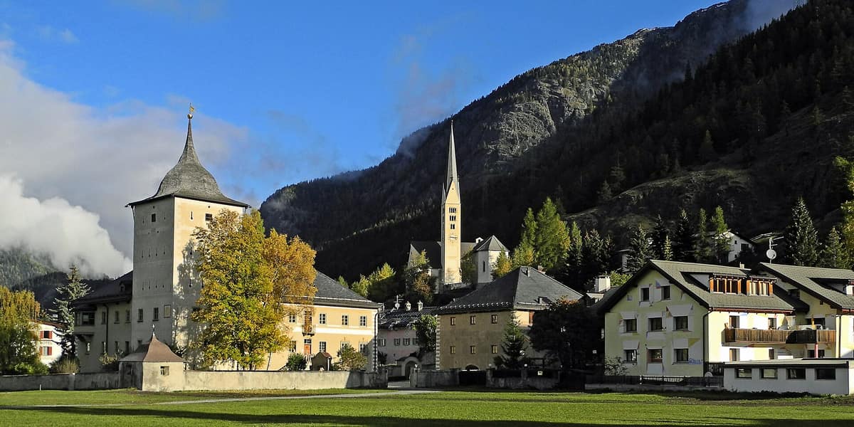
Swiss National Park - Core Zone
Parc Naissunal Svizzer - Hinterland
Grisons (Zernez / Engadin) · Switzerland
Photo: WillYs Fotowerkstatt · CC BY-SA 3.0 · Wikimedia Commons
The oldest National Park in the Alps (founded in 1914), a Strict Nature Reserve where all human intervention is forbidden.
In the Swiss National Park, natural processes are not managed: they are protected. A fallen tree stays exactly where it drops, and whatever follows is the forest's business. That was the core philosophy when it opened on 1 August 1914, and today it remains the oldest national park in the Alps and an IUCN Category Ia strict nature reserve, the most rigorous conservation status. It spans the Engadin within the quadrilateral outlined by Zernez, S-chanf, the Ofenpass, and Scuol, and you explore it strictly as a guest: on signposted paths, without dogs, and without stepping off the trail.
What makes it unique
Here the mountains have been left in complete peace since 1914, and it shows on every slope.
The place
Nature
The landscape
The bedrock has ancient origins. The dolomite forming the crags originated as marine sediments accumulating on the margins of an ocean more than 200 million years ago; the Verrucano sandstones arose from the weathering of Central Europe's Variscan massifs; and the gneiss represents granite transformed under intense heat and tectonic pressure. Three rocks, three geological epochs, all visible during a single day's hike.
Elevations underline the dramatic vertical relief: from 1400 m along the Clemgia gorge near Scuol up to 3174 m on Piz Pisoc. Between the two, the park divides almost equally into three distinct realms. Forests occupy 32% of the territory, alpine meadows cover 20%, and screes and rocky crags claim fully 47%. In other words, almost half the park is bare stone.
The climate is continental and demanding, characterized by intense solar radiation and low atmospheric humidity, and the woods reflect these constraints. Swiss stone pine seeks cool northern aspects, mountain pines bloom in June, and Norway spruce features prominently in the canopy. In forest clearings, browsing wild ungulates can suppress young tree saplings. Higher up, between 2000 and 3000 m, an alpine floral spectacle unfolds: most species bloom in late July, with park botanists recording treasures such as lady's slipper orchid and alpine clematis.
Wildlife and seasons
Almost any hour yields wildlife sightings, but each creature keeps to its own habitat.
Alpine marmot colonies inhabit virtually every subalpine pasture, such as Alp Grimmels, Alp Stabelchod, or the Val Mela rest area in Val Trupchun; it is best to avoid the hottest midday hours. Chamois can be spotted throughout the entire season, at any hour, on Murtaröl, in Val Cluozza, and around Margunet above the tree line. Red deer emerge during daylight into open meadows between and above the tree line: Val Trupchun, Val Mingèr, and Il Fuorn are their classic arenas from June through mid-October. The Alpine ibex rounds out the ungulate cast alongside red foxes and the golden eagle, and retreats high to avoid midday heat.
For large raptors, scan the skies from midday onwards. The bearded vulture and golden eagle ride powerful thermals that build during sunny afternoons. Small wildlife thrives equally well close to the ground: park researchers have documented 35 species of ants across the territory.
The seasonal calendar dictates your visit. The trekking season runs from June to October; by late July even the highest alpine passes become easily practicable provided you carry suitable mountain gear, while October bathes the valleys in the golden needles of turning larches.
Species
With a page in the atlas
Being mentioned in a source doesn't guarantee sightings: check with the people who manage the area.
Memory and protection
History and conservation
The wild landscape you see today endured a turbulent past: intensive nineteenth-century timber harvesting heavily altered the forests before park creation. Since 1914 the policy has been the absolute opposite: leaving woodland and wildlife entirely to their natural succession. Park scientists are already tracking the local impacts of ongoing climate change.
The surrounding cultural landscape is equally precious. The Engiadina Val Müstair Biosphere Reserve, which encompasses the national park, preserves one of the last bastions of the Romansh language.
Rewilding projects
Before you set off
Visiting
How to visit
Begin your journey in Zernez. The Nationalparkzentrum centres its permanent exhibition on genuine wilderness, offering a multimedia guide in five languages (German, French, Italian, Romansh, and English) alongside binocular rentals. The visitor centre is fully barrier-free. If arriving by postbus, alight at the Zernez, Center dal Parc Naziunal stop.
The trail network encompasses 100 km of paths and 21 official hiking itineraries designed for wildlife observation. To hike with local experts, the park offers regular guided tours. The classic Val Trupchun day hike covers 10 km with 450 m of ascent and descent, while the Margunet trail spans 7 km with 500 m of climbing: two day-walks that lead straight into prime deer and chamois territory. For peak-baggers, Piz Quattervals at 3165 m represents the highest accessible summit in the park, reserved exclusively for sure-footed alpine hikers.
From early July through mid-October, seasonal mobile information points operate at Il Fuorn or within Val Trupchun. In S-charl, the historic administrative building of the former lead and silver mines houses the Museum Schmelzra, exploring local mining history and Alpine brown bears.
Before you go
The national park closes completely during winter, and entry is strictly illegal. Dogs are prohibited under all circumstances, even on a leash. Check park regulations and current trail status before setting out: authorities require all visitors to respect these strict rules. You can reach trailheads by public transport or private car, though the park strongly advocates train and postbus travel to minimize ecological impact.
Check access, rules and visiting conditions in the official information from the managing body before you set off.
Location
Where it is and how far it reaches
Boundary of Nationalpark · © EEA, CDDA (CC-BY) The coordinate is estimated; it isn't a verified access point.
Transparency
Sources
The research data with its sources, and the official links for this place, are in the Spanish version of this page. See the Spanish version
Around it
Parque Nacional del Stelvio is the immediate neighbor in the atlas, at 0 km,.
What else to explore nearby
Approximate straight-line distance between the edges of each area. It doesn't indicate access, routes or driving times.
- Val Müstair Biosphere Reserve
Graubünden (Santa Maria Val Müstair)
Borders this area
Pristine alpine valley bordering the Swiss National Park preserved from heavy transit routes.
JFMAMJJASONDJune – October · Crowding very low
- Stelvio National Park
Lombardy / Trentino-Alto Adige (Bormio / Ortler / Sulden / Val Martello)
Borders this area
One of Europe's oldest and most majestic Alpine national parks (Ortles 3,905 m), featuring vast valley glaciers and massive herds of red deer and chamois.
JFMAMJJASONDJune – October · Crowding moderate
Entry #334 of the original atlas.