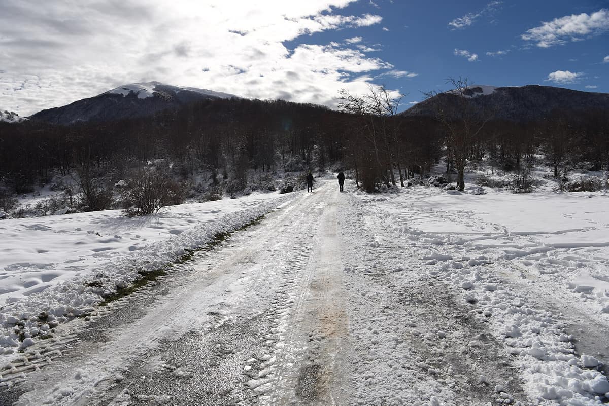
Pollino National Park
Parco Nazionale del Pollino
Calabria / Basilicata (Castrovillari / Rotonda / Morano Calabro) · Italy
Photo: Diana Cimino Cocco · CC BY-SA 4.0 · Wikimedia Commons
Italy's largest national park (192.000 ha), exclusive sanctuary of the Bosnian pine (Pinus heldreichii) and a UNESCO Global Geopark.
High on a windswept ridge of the Pollino stands a pine whose age researchers radiocarbon-dated to 1.230 years, christening it Italus after the mythical hero who gave Italy its name. It is a Bosnian pine, the proud emblem of this park, a resilient conifer that thrives where even beech cannot take root. Straddling Basilicata and Calabria, the Pollino National Park is the largest in Italy: encompassing 192.565 hectares, with 88.650 on the Lucanian side and 103.915 on the Calabrian side.
What makes it unique
Here the Bosnian pine clings to the most hostile rocky crags beneath snow-capped peaks that offer panoramic views spanning both the Tyrrhenian and Ionian coasts.
The place
Nature
The landscape
The summits of the Pollino rank among the highest in southern Italy: Serra Dolcedorme (2.267 m), Monte Pollino (2.248 m), Serra del Prete (2.181 m), Serra delle Ciavole (2.127 m), and Serra di Crispo (2.054 m). Snow blankets them for many months each year, and from their crests hikers can behold both the Tyrrhenian and Ionian seas with the naked eye.
Ancient glaciers sculpted this alpine profile. Their most striking imprint marks the north-western flank of Serra Dolcedorme, within the glacial hollow known as Fossa del Lupo. In retreating, glaciers deposited moraines as well as immense erratic boulders, isolated far from parent crags, readily observed across Piani di Pollino and Piani di Acquafredda between 1.800 and 2.000 m. On Monte Pollino, at 2.225 m, a perennial snowfield persists even in late August.
All of this forms part of the geopark: in November 2015, the area joined the UNESCO Global Geoparks Network. The Pollino Geopark features 69 designated geosites, including glacial cirques, moraines, permanent snowbeds, rudist fossils, and dramatic limestone gorges such as Raganello, Lao, Rosa, and Garavina.
Wildlife and seasons
The Bosnian pine reigns over the highest crags and steepest limestone precipices as the floral symbol of the park, also occurring across the Balkan ranges and Greece. Below it grow silver fir, beech, all seven native maple species, European black pine, and yew. In the ancient old-growth beechwood of Cozzo Ferriero—the southernmost primeval beech forest in Europe—stands the ancient Italus. In spring, wild orchids, violets, gentians, and bellflowers bloom, followed in summer by the rare orange lily.
Mammals include the Apennine grey wolf, European wildcat, red fox, wild boar, the native Orsomarso roe deer, Eurasian otter, European badger, and southern black squirrel. Red deer (2002-03) and the griffon vulture (2002) were reintroduced in recent decades. The rich avifauna features the golden eagle, Egyptian vulture, peregrine falcon, red kite, Eurasian eagle-owl, black woodpecker, and rock partridge. Reptiles and amphibians include grass snake, asp viper, painted frog, fire salamander, and the rare alpine beetle, Rosalia longicorn.
Species
With a page in the atlas
Being mentioned in a source doesn't guarantee sightings: check with the people who manage the area.
Memory and protection
History and conservation
The national park was established in 1988, with provisional boundaries drawn in 1990. It encompasses 56 municipalities—24 in Basilicata and 32 in Calabria—and protects four state nature reserves: Valle del Lao, Gole del Raganello, Valle del Argentino, and Rubbio.
Between 1470 and 1540 Arbëreshë (Albanian) communities settled here, founding San Paolo Albanese and San Costantino Albanese in Basilicata, and San Basile, Lungro, Plataci, Frascineto, and Civita in Calabria. The highest village is Alessandria del Carretto at 999 m, known for preserving ancient musical rituals, while at 1.537 m in San Severino Lucano sits the Sanctuary of the Madonna del Pollino, the focal point of deep local veneration.
Before you set off
Visiting
How to visit
The park maintains an extensive hiking network divided between its Lucanian and Calabrian sectors, catering to leisurely nature walks, moderate day hikes, and challenging mountaineering traverses. Along Fosso Jannace, trails trace the mountain torrent beneath towering silver firs, maples, and beeches; the route continuing up to Serra di Crispo crosses the legendary Giardino degli Dei, an awe-inspiring sanctuary of ancient Bosnian pines dominating the ridge.
The trail from Colle Impiso ascends Monte Pollino via Piani di Vacquarro, Spezzavummula spring, and Colle Gaudolino; another path from Colle Impiso toward Serra Dolcedorme is especially recommended in spring for its wild blooms, while the Calabrian approach to Serra Dolcedorme reaches the 2267-metre summit, where mountaineering experience or local alpine guides are recommended. Other itineraries include the ascent from Rifugio Bosco Favino to Monte Alpi for seasoned hikers, and the gentle trail from Valsinni to Monte Coppolo. In Rotonda, the park's eco-museum showcases the region's natural heritage and mountain traditions.
Before you go
Snow blankets high ridges for many months; check meteorological conditions before ascending. High summit routes, such as the climb to Serra Dolcedorme, require experienced mountain navigation or a certified guide.
Check access, rules and visiting conditions in the official information from the managing body before you set off.
Location
Where it is and how far it reaches
Boundary of Parco nazionale del Pollino · IUCN II · © EEA, CDDA (CC-BY) The coordinate is estimated; it isn't a verified access point.
Transparency
Sources
The research data with its sources, and the official links for this place, are in the Spanish version of this page. See the Spanish version
Around it
The Parco Nazionale del Cilento, Vallo di Diano e Alburni lies twenty-eight kilometres away.
What else to explore nearby
Approximate straight-line distance between the edges of each area. It doesn't indicate access, routes or driving times.
- Cilento, Vallo di Diano and Alburni National Park
Campania (Salerno / Vallo della Lucania / Palinuro / Castellabate)
About 28 km away
UNESCO Biosphere Reserve and Global Geopark uniting the karst gorges of the Calore River with the dramatic sea cliffs of Cape Palinuro.
JFMAMJJASONDApril – June · September – November · Crowding low
If you like this place, elsewhere in Europe
Distant places with uncommon wildlife and habitats in common. The most widespread species don't count. Sharing species doesn't imply a corridor or guaranteed presence.
- Mount Olympus National Park
Pieria / Larissa (Litochoro)
In common: Bosnian pine · Golden eagle · Grey wolf — high mountain, old-growth forest, gorge and canyon
Greece's inaugural national park (1938): the country's highest peak, incised by the Enipeas Gorge and renowned for endemic flora.
JFMAMJJASONDJune – October · Crowding moderate
Entry #530 of the original atlas.