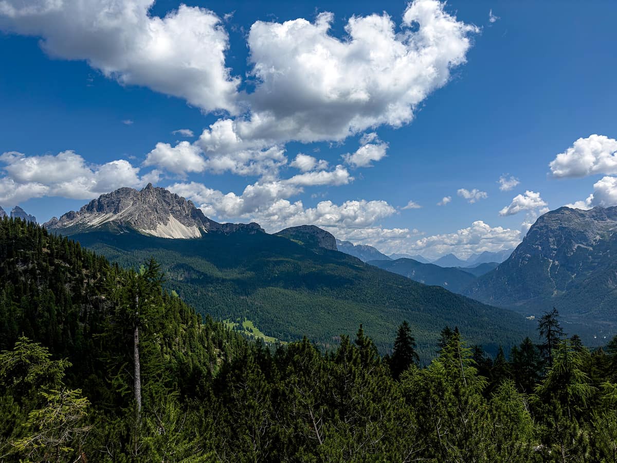
Belluno Dolomites National Park
Parco Nazionale delle Dolomiti Bellunesi
Veneto (Belluno / Feltre / Agordo) · Italy
Photo: Turcito11 · CC BY-SA 4.0 · Wikimedia Commons
The wildest and southernmost sector of the Dolomites (UNESCO World Heritage), carved by deep karst ravines such as the Cadini del Brenton.
There are Dolomites famous for iconic summits, and Dolomites ruled by water. The Belluno Dolomites belong firmly to the second: steep valleys shielded from mass tourism, torrents racing through deep limestone gorges, reservoir lakes, and trails tracing wild mountain streams. The Belluno Dolomites National Park covers 31.512 hectares in the province of Belluno, between the Cismon River to the west and the Piave to the east, forming the southernmost bastion of the mountains inscribed as a UNESCO World Heritage Site in 2009.
What makes it unique
A quiet realm of the Dolomites where rushing waters, karst phenomena, and secluded valleys take precedence over postcard peaks.
The place
Nature
The landscape
The park unites several distinct mountain massifs: the Feltrine Alps (Vette di Feltre, Cimonega, Pizzocco, Brendol, Agnelezze), the Monti del Sole, the Schiara, the Talvéna, the Prampèr, and Piz di Mezzodì. High-altitude karst plateau surfaces, sheer limestone walls, and scree slopes surround an aquatic heartland: gushing springs, peat bogs, and torrents including the Cordevole, Mis, Caorame, Stién, Falcìna, Ardo, Vescovà, and Prampèra. Several plunge through tight chasms. In Val di Canzoi outcropping Principal Dolomite bears the marks of paleorivers, Quaternary glaciers, and karst erosion, while Val Falcina forms a sharp V-shaped ravine carved along a tectonic fault.
The Vette Feltrine form the southernmost group of the Dolomites and the westernmost section of the park. Their highest crest is Monte Pavione, presenting a striking pyramidal silhouette when viewed from the Primiero; between Rifugio Dal Piaz and Pavione spreads a glacial cirque basin, the Busa delle Vette, traditionally grazed by sheep. The Monti del Sole, in contrast, feature steep, untracked, and rarely visited valleys, with summits around 2000 metres. Monte Talvéna rises to 2542 metres and the Schiara to 2565.
Wildlife and seasons
The rich flora displays alpenrose, alpine thistles, and edelweiss, nestled among broadleaved woods, coniferous forests, subalpine pastures, and mountain meadows. In Val di Canzoi botanists seek out rare endemics such as Veselsky's catchfly, Dolomite spleenwort, and orange lily.
Mammals include alpine marmot, stoat, pine marten, edible dormouse, red squirrel, roe deer, chamois, red deer, mouflon, alpine ibex, wild boar, grey wolf, and Eurasian lynx. In spring, roe deer and mouflon graze quietly in the meadows of Val di Canzoi. The diverse birdlife features the black woodpecker, wallcreeper, northern goshawk, golden eagle, boreal owl, Eurasian eagle-owl, western capercaillie, black grouse, and rock ptarmigan, alongside hazel grouse; riparian stretches along Lake della Stua and the Caorame stream host grey wagtail and white-throated dipper. Bats number five species, and amphibians include alpine newt, alpine salamander, and yellow-bellied toad.
Species
With a page in the atlas
Being mentioned in a source doesn't guarantee sightings: check with the people who manage the area.
Memory and protection
History and conservation
The Valle del Mis tells a poignant tale of depopulation. The construction of the Mis reservoir between 1957 and 1962 inundated hamlet dwellings and fertile bottomland; the catastrophic flood of 1966 accelerated abandonment, leaving the valley uninhabited by 1972. At Gena Bassa only the small chapel of San Remedio was reconstructed, now resting by the lakeshore. Vallalta was once a bustling mining town with mercury mines ranking among the sixth largest globally, reduced today to overgrown ruins.
The national park was conceived in 1988 through local environmentalist campaigns and officially designated in 1990. Following boundary refinements, its borders align with natural topographic lines: sharp crests, rivers, and roads. Its statutory mission prioritizes scientific research and environmental education.
Before you set off
Visiting
How to visit
Two primary gateways open into the park: Val Canzoi and Valle del Mis. Val Canzoi stretches for about 7,5 km, terminating at Lake della Stua, an artificial reservoir formed by a dam built in 1952-1953 through which flows the Caorame torrent. Along the road sits the park's «La Santina» environmental education centre, the starting point for an accessible circular walk of about two kilometres with elevated boardwalks through the forest. From the lake, a historic mule track climbs to Piani Eterni in the heart of the wilderness. The valley is also renowned for its calchère, historic quicklime kilns scattered along the valley floor.
The Val di Canzoi nature trail is an 8,4 km circuit around Lake della Stua taking about four hours, recommended from March to October and guided by ten interpretive panels on geology, botany, and fauna. Shorter is the Val Falcina loop: four kilometres, taking about two hours round-trip from Pian della Falcina; to reach it, follow highway SS 203 to Mas and follow signs for Valle del Mis.
For refuge hikes, Rifugio Dal Piaz is roughly two hours from Passo Croce d'Aune along an easy military mule track with 900 to 1000 metres of elevation gain; Rifugio Bruno Boz lies 2,5 to 3 hours from Val Canzoi via Passo Alvis. Across the Vette Feltrine runs the concluding stage of the Alta Via no. 2 delle Leggende from Bressanone to Feltre.
Before you go
Check trail conditions and opening schedules for «La Santina» visitor centre before your trip. Detailed itineraries for Val di Canzoi and Val Falcina are available on the official park website.
Check access, rules and visiting conditions in the official information from the managing body before you set off.
Location
Where it is and how far it reaches
Boundary of Parco Nazionale delle Dolomiti Bellunesi · IUCN II · © EEA, CDDA (CC-BY) The coordinate is estimated; it isn't a verified access point.
Transparency
Sources
The research data with its sources, and the official links for this place, are in the Spanish version of this page. See the Spanish version
Around it
Just 5 km away lies Parque Natural Paneveggio - Pale di San Martino, and less than thirty kilometres away sits Parque Natural Fanes-Sennes-Braies.
What else to explore nearby
Approximate straight-line distance between the edges of each area. It doesn't indicate access, routes or driving times.
- Paneveggio - Pale di San Martino Natural Park
Trentino (San Martino di Castrozza / Predazzo / Tonadico)
About 5 km away
The 'Forest of the Violins' (resonance spruce harvested by Stradivarius) beneath the spectacular dolomitic spires of the Pale di San Martino.
JFMAMJJASONDJune – October · Crowding low
- Fanes-Sennes-Braies Natural Park
South Tyrol / Alto Adige (San Vigilio di Marebbe / Val Badia / Lago di Braies)
About 28 km away
The idyllic turquoise waters of Lago di Braies and the desolate karst plateaus of Fanes and Sennes encircled by dolomitic amphitheatres.
JFMAMJJASONDJune – October · Crowding moderate
Entry #546 of the original atlas.